
March 21, 2015
Inyo and Keynot are two iconic peaks on the southern side of the Inyo Mountains. They are known for their not-so-good terrain quality but very good views of the Sierra Nevada to the west. I had first done both peaks in February 2014 via Forgotten Ridge. I joined up with Craig this time to do the peaks from the standard Union Wash route (with our slight deviation at the start).
| Peak | Elevation | Topographic Prominence | Summit Coordinates (lat/lon) |
|---|---|---|---|
| Keynot Peak | 11,101 ft | 3,050 ft | 36.707586, -117.962623 |
| Mt. Inyo | 10,975 ft | 955 ft | 36.735229, -117.985686 |
Getting to the trailhead: From the North end of Lone Pine, go north on 395 1/2 mile and head east on Lone Pine Narrow Gauge Rd (also abbreviated NPLG Rd on some of the signs.) Head east for approx 3 miles staying on the paved road until you get to a "Y" intersection where you will head north for 5 miles. At this point, look for a notch incut into the dirt berm on the east side of the road. Word has it that there used to be some tires piles up here to mark the correct turn. They were not in place when we did this trip. You should now be able to see the 4WD road heading up Union Wash; this is your objective. A 2WD vehicle will be able to get much of the way up; 4WD will get you another 1/2 mile or so depending on the current conditions and how badly you want to drive rather than walk. (directions from Summitpost)
4WD trailhead coordinates (lat/lon): 36.709082, -118.014412
where we parked (lat/lon): 36.695569, -118.051345
We were only able to get the car about a tenth of a mile up the road heading up Union Wash, so we parked there (3,710 ft) and walked to the 4WD trailhead (5,480 ft), adding roughly 4.7 miles and 1,770 ft of gain to the hike.
The two of us began hiking up the road at around 6:50am, just in time to see the sunrise on the Sierra a short moment after we started.


The 4WD road ends at the toe of an obvious ridge heading east towards the Inyo Crest. From there, the standard route heads up the northern branch of Union Wash to a point where forward progress is blocked by a dry waterfall. A large cairn marks the start of a use-trail heading south up towards the aforementioned ridge.
We deviated from the standard route by ascending the ridge directly from the 4WD trailhead. This provided us with scree, good views, and burning calves. The going became much faster once we intersected the use-trail of the standard route and followed it up the ridge.
ascending the ridge


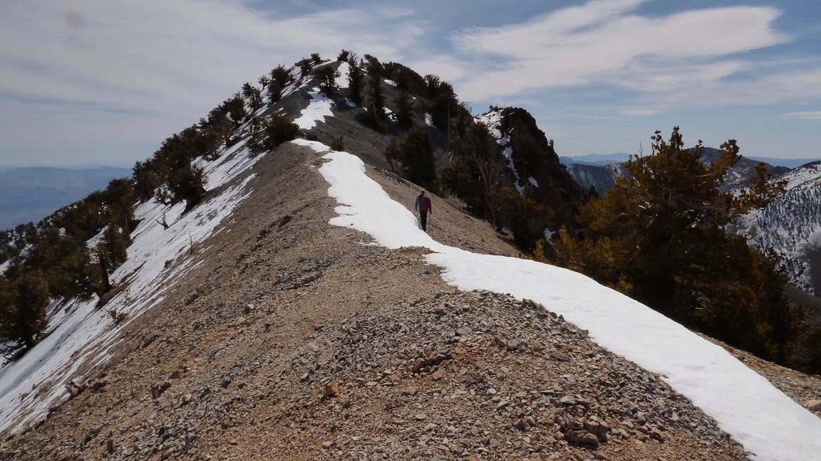
The use-trail was made up of primarily scree, but it was easy to follow. Once the trail came upon the saddle east of Point 9155 (see topo map), it contoured along the north side of the ridge, dropping into a gully leading up to Bedspring Saddle (10,100 ft). Since we planned to climb Keynot first, we did not head up to Bedspring Saddle, but angled southeast to intersect the Inyo Crest south of the saddle. From there, we followed the crest to the summit of Keynot. The first three quarters of the crest was straightforward class 1 walking with periodic use-trails here and there. For the last quarter, the trail supposedly contoured along the eastern (left) side of the ridge. Upon reaching that point, we could see that the east side was covered with about a foot of soft snow, so we continued ascending directly on the crest. This involved a series of ups and downs on cruddy class 3 crumbles. When the crest itself became too spicy or cruddy, we would drop a short distance down the west side into screeish gullies. We reached the summit shortly after, finding hoards of ladybugs among the rocks.
views from the Inyo Crest


initial easy section on Keynot

terrain gets cruddy


ladybugs on summit

on the summit: "We own you Keynot Peak!"

On the way down Keynot, we were able to avoid the cruddy class 3 stuff by dropping ~100 ft down one of several chutes on the west side of the ridge, and contouring northwards until we had bypassed the crud.
Now it was time for Mt. Inyo. The routefinding was very simple: just head north along the crest until we hit Inyo. There were a total of two false summits before we hit the real one.
heading over to Mt. Inyo


the true summit of Mt. Inyo (photo taken on February 14, 2014)

view southwest from Mt. Inyo

southeast

After Inyo, we descended back to Bedspring Saddle and headed down the eastern gully to meet back up with the use-trail.
view of Union Wash from a spot near Bedspring Saddle

afternoon Lenticular clouds

We took the use-trail back to the saddle east of Point 9155 (see map). Now came the fun part. We left the trail and walked over to Point 9155, continued southwest down a loose but short cliff band, and bombed down over 1,000 ft of scree. Shortly after intersecting the trail again, we found another cascading scree field and skied down it to the northwest, intersecting the start of the standard route in Union Wash. Once we had reached Union Wash, we followed the wash out to the 4WD trailhead, and followed the dirt road back to the car, reaching it just after dark.
looking down the first scree ski below Point 9155 (photo taken on February 14, 2014)

second scree ski


intersecting the standard route

Final Stats
15.4 miles
9,470 ft gain/loss

Weather Forecasts
Trailhead
7,180 ft
Keynot and Inyo
Peakbagger Pages
Forgotten Point
Keynot Peak
Mt. Inyo
Summitpost Pages
Keynot Peak
Mt. Inyo
Other
Inyo Mountains Wilderness
Nice write-up and beautiful photos! I did approximately the same route a few weeks ago (minus Inyo Peak). I also dropped into Union Wash before 9155 on the descent. Huge mistake given the dozen or so crumbling waterfalls that I had to climb down or circumnavigate. Amazing place though, and totally worth it.
ReplyDelete