
December 6-7, 2014
The Salt Creek Ridge is located in the Southwestern Sierra approximately 28 miles east of Visalia. Even though it only rises to an elevation of around 9,000 ft, it dominates its surroundings and is prominently visible from Visalia on a clear day. The highpoint of Salt Creek Ridge is Cahoon Rock, a mostly flat and insignificant feature on the ridge's eastern side. Homer's Nose, the second highest point on the ridge, is a dominant peak which stands out from afar. Apart from a few ocassional peakbaggers and rock climbers, Homer's nose is rarely visited due to its difficult access. The shortest route to its summit involves a direct ascent from the south involving copious amounts of bushwhacking and a lot of poison oak. Our chosen approach (see map) involved taking a 14.7 mile trail on the first day from the South Fork [Kaweah River] Trailhead (3,640 ft) to Cahoon Rock (9,278 ft) and camping on the large summit plateau of Cahoon Rock. The second day, we would get up at the crack of dawn and traverse west along Salt Creek Ridge to Homer's Nose. Along the way we would climb up and over three additional peaks which lay along the ridge.
| Peak | Elevation | Topographic Prominence | Summit Coordinates (lat/lon) |
|---|---|---|---|
| "Homers Zit" | 8,351 ft | 100 ft | 36.373975, -118.707983 |
| "Eden Peak" | 8,837 ft | 337 ft | 36.385619, -118.720579 |
| Homers Brow | 8,942 ft | 402 ft | 36.384202, -118.729484 |
| Homers Nose | 9,023 ft | 963 ft | 36.385043, -118.737775 |
| Cahoon Rock | 9,278 ft | 698 ft | 36.378761, -118.690152 |
Getting to the trailhead
Trailhead coordinates (lat/lon): 36.350017, -118.766068
It was just after noon as Mason and I pulled into South Fork Trailhead, meeting up with Chris, Gary, and Michael who had spent the previous night at the trailhead. The trailhead was located about 100 ft before the parking area and was well marked with two signs which read "South Fork Trailhead" and "Garfield/Hockett Trail."
We began heading up at around 1pm, finding the trail to be in surprisingly nice condition. It ascended very gradually, contouring along the northern slopes of Dennison Mountain and in the shade of large groves of giant sequoias.
South Fork Trailhead

first view of Homers Nose and Homers Brow

afternoon views


Cahoon Rock seen from ~7 miles in

The only slight hiccup in the trail came at the crossing of the South Fork of the Kaweah River (~9.1 miles, 8,240 ft). We crossed the river itself with no trouble. Due to the dry year, the water level was much lower than usual and we did not need to take our shoes off in order to cross (as Mason had done during his previous visit). After crossing, the trail seemed to disappear. We walked around for a few moments searching for it, and managed to relocate it heading southeast for a short distance to a junction. From the junction, we took a left and began switchbacking upwards to the northeast. Note that this junction is drawn on the WEST side of the Kaweah River on the USGS 7.5' topo map. It should be on the EAST side.
After the switchbacks, the trail became covered in icy snow and some of us regretted not bringing the microspikes. Out came the headlamps as the sun set at around 4:40pm. We passed two more junctions before reaching Hockett Meadows, taking a left at each of the junctions. Immediately after the first Whitman Creek crossing on a footbridge at Hockett Meadows, the trail split into a stock trail (left) and hiker trail (right). Mason mentioned that the stock trail was a shortcut which would bypass the Hockett Ranger Station, so we ended up taking it, intersecting the trail to Cahoon Rock shortly after. From there, Cahoon Rock was only 2.7 miles away. The five of us slipped and slid through the darkness, crossing Whitman Creek a total three more times, eventually reaching the large summit plateau of Cahoon Rock sometime around 8pm. The summit blocks of Cahoon Rock itself stood less than a minute away to the northwest. To the west, the Salt Creek Ridge dropped off into the darkness. We could vaguely make out the dark shape of Homers Nose Silhouetted against the lights of Visalia. After setting up camp and eating a relaxing dinner, we drifted off to sleep with a planned wake up time the next day at 5:30am.
At around 6:15 the next morning, the five of us set off west along the Salt Creek Ridge. The initial descent to the first major saddle along the ridge involved dropping more than 1,000 ft of elevation.
Alta Peak in predawn light

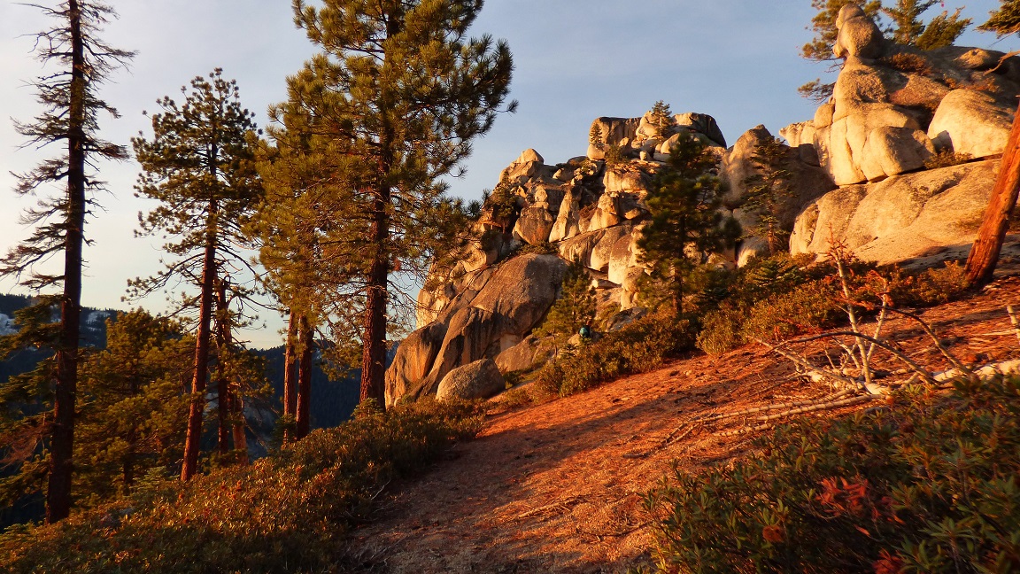
Just west of the first major saddle rose a large pile of rocks. Even thought this rockpile was not very significant, it looked fun and we decided to climb it. There were numerous ways to climb it from the east side, all of which contained a few moves of easy class 3. The summit contained a spectacular view north towards the Tablelands and west towards Homers Brow. Michael dubbed this peak "Homers Zit."
Homers Zit from the east

looking north

view north from summit

closeup of Copper Mine Peak


unnamed peak somewhere in the Tablelands

Michael heading up to the summit

looking west along Salt Creek Ridge


Next up on the ridge was Eden Peak. As we began ascending towards it, the terrain started out nice and mellow. Starting at around 0.6 miles before Eden Peak, the brush increased, consisting mostly of chinquapin with a few scattered patches of buckthorn. There were only a few bad sections of shoulder-high chinquapin. Otherwise the brush only came up to our knees at most.

leaaaannnn...

one of the brushier sections

last rise to Eden Peak


Eden's summit block turned out to be a fun little feature. We ascended it by walking across a narrow ledge on the block's eastern side, then preforming a mantle move to get to the highpoint.

Shortly after getting past Eden Peak, the bushwhacking vanished and the going was smooth. We seemed to reach Homers Brow in no time. Homers Brow contained northern and southern highpoints. It was difficult to tell which one was higher by looking at them, so we visited both. According to the topo map, the northern point was higher. The southern point contained a register and a far better view. There was more than one entry in the register insisting that this peak was the real Homers Nose.
views from Homers Brow


There were several potholes on the summit which had filled up with rainwater from recent storms. We happily lapped it up.

various register entries

view west to Homers Nose

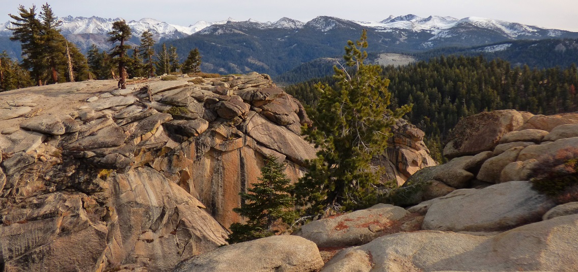
The jaunt over to Homers Nose was very straightforward on pleasant terrain. The summit itself contained spectacular views in three directions.
views from Homers Nose


Apparently "Homers Nose" was too long to fit onto the benchmark. But come on, not even a "nose?"


After our long break on the summit, everyone except Mason and I began heading back east along the ridge towards camp. Mason and I continued west towards a small peak known as "Salt Creek Peak" located half a mile away. The descent from Homers Nose was steep with some light to moderate bushwhacking. Salt Creek Peak itself only contained around 50 ft of prominence, making it barely a bump compared to the 840 ft descent we had done from Homers Nose. As we neared the highpoint, we were dismayed to see the large mossy 15 ft summit block. The easiest way up looked to be on its northwest side (class 5.6). I climbed more than halfway up, then backed down since the rock was mossy and wet and I was not roped up. I stared at it luridly thinking about this failed attempt less than 5 ft from the summit. Mason didn't seem to mind as much. Oh well. It was better to come back another day than take a 30 ft unroped fall.
Salt Creek Peak summit block


We turned around and trudged back up the ridge towards camp, enjoying the burning in our legs. As we reached camp, I remembered that I had not yet stood on the true highpoint of Cahoon Rock, and spent a minute or two tagging it.
views on the way back


drab views from Cahoon Rock

breaking camp

The hike back out went without a hitch. Darkness came shortly after we passed Sand Meadows. As we descended the Garfield/Hockett Trail, the sight of trees whizzing by in the light of our headlamps was very soothing. We reached the trailhead at around 8:45pm to the sound of the South Rock of the Kaweah River roaring to the north. It was hard to believe that this was the same river which was only a small creek where we had crossed it at 8,240 ft.
Final Stats (not including detour to Salt Creek Peak)
36.8 miles
11,180 ft gain/loss
Final Stats (including detour to Salt Creek Peak)
37.9 miles
12,020 ft gain/loss

Weather Forecasts
South Fork Trailhead
6,500 ft along Garfield/Hockett Trail
Hockett Meadows
all peaks
Peakbagger Pages
Homers Zit
Eden Peak
Homers Brow
Homers Nose
Cahoon Rock
Summitpost Pages
Homers Nose
Other
High Sierra Topix message board
Sequoia National Park
Thanks for the amazing post and great details.
ReplyDelete