
December 20, 2014
Between Snow Canyon and Chino Canyon on the north side of the San Jacinto Mountains are a series of ridges branching out from a main spur ridge connecting to the the upper plateau of Mt. San Jacinto. The longest of these ridges is Windy Point Ridge, which starts from Hwy 111 just northeast of Windy Point (see topo map). This ridge had been mentioned several times in local forums, but no one had yet come out with a route description of it, which made it exciting. So on a random Saturday morning, Sung, Dagmar, and I found ourselves standing in a dusty lot on the side of the road in the wee hours of the morning, gazing up towards the start of the ridge.
| Peak | Elevation | Topographic Prominence | Summit Coordinates (lat/lon) |
|---|---|---|---|
| Windy Point | 1,564 ft | 203 ft | 33.896548, -116.62631 |
| Pass Benchmark | 2,258 ft | 30 ft | 33.891098, -116.636438 |
| "Addition Peak" | 2,871 ft | 294 ft | 33.88513, -116.639507 |
| San Jacinto Peak | 10,834 ft | 8,319 ft | 33.814785, -116.679477 |
Getting to the trailhead: Take I-10 east, 6 miles past Cabazon, and turn right onto CA 111. Travel 3.5 miles on CA 111. Take note of the base of Windy Point Ridge which will be to the right (south). 0.2 miles after passing the ridge, a small parking lot for an ATV rental facility will appear to the right. This is the trailhead.
Trailhead coordinates (lat/lon): 33.897427, -116.620837

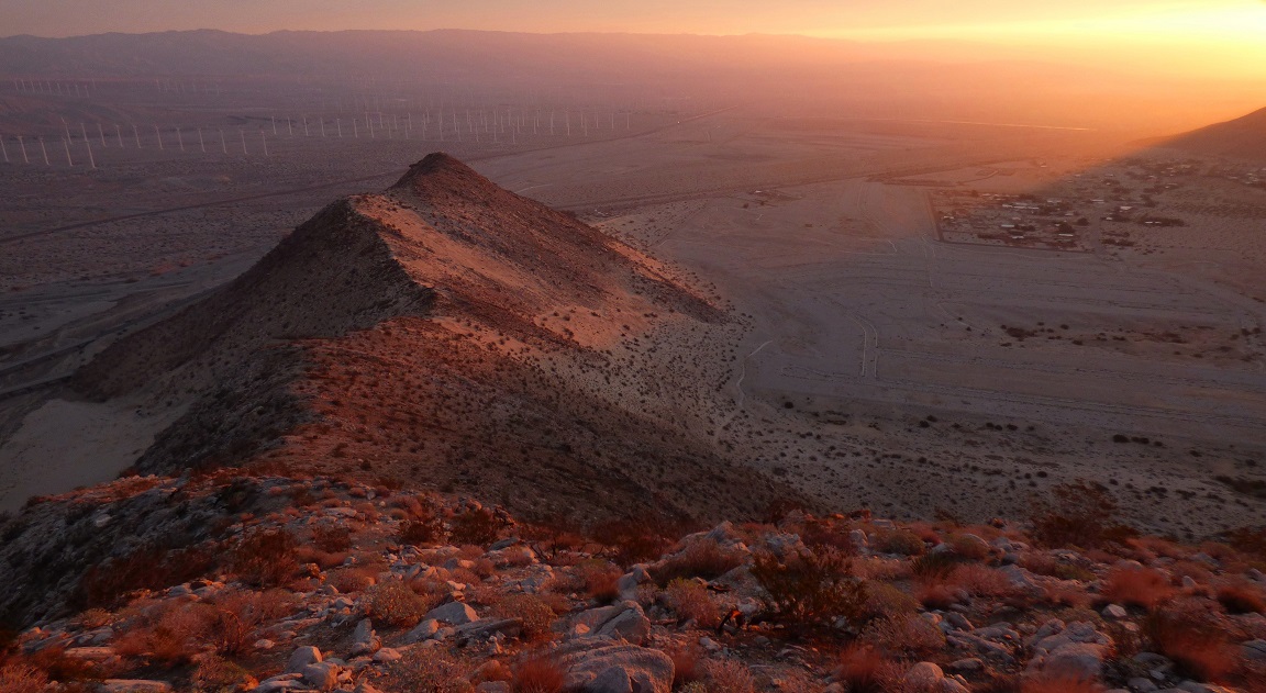
The three of us left the trailhead (1,020 ft) at around 6:40am and began ascending the ridge, finding it surprisingly sandy to begin with. This was mostly class 2 with some short sections of fun class 3 directly on the ridge itself. Shortly after, we had reached Windy Point (1,564 ft) as the sun had began to rise and we paused for a few moments taking photos before continuing on. The summit block of Windy Point was a semi-rounded boulder which required a mantle move to surmount.
view southwest from Windy Point

sunrise


the destination in view


San Gorgonio

Windy Point again
At ~2,200 ft the ridge flattened out and became strewn with globs of survey wire and cairns. We were getting close to Pass Benchmark. I managed to locate one of the three benchmarks and considered it a success (the other two looked to be ripped out).
a rock ring located about 20 ft northwest of the benchmark
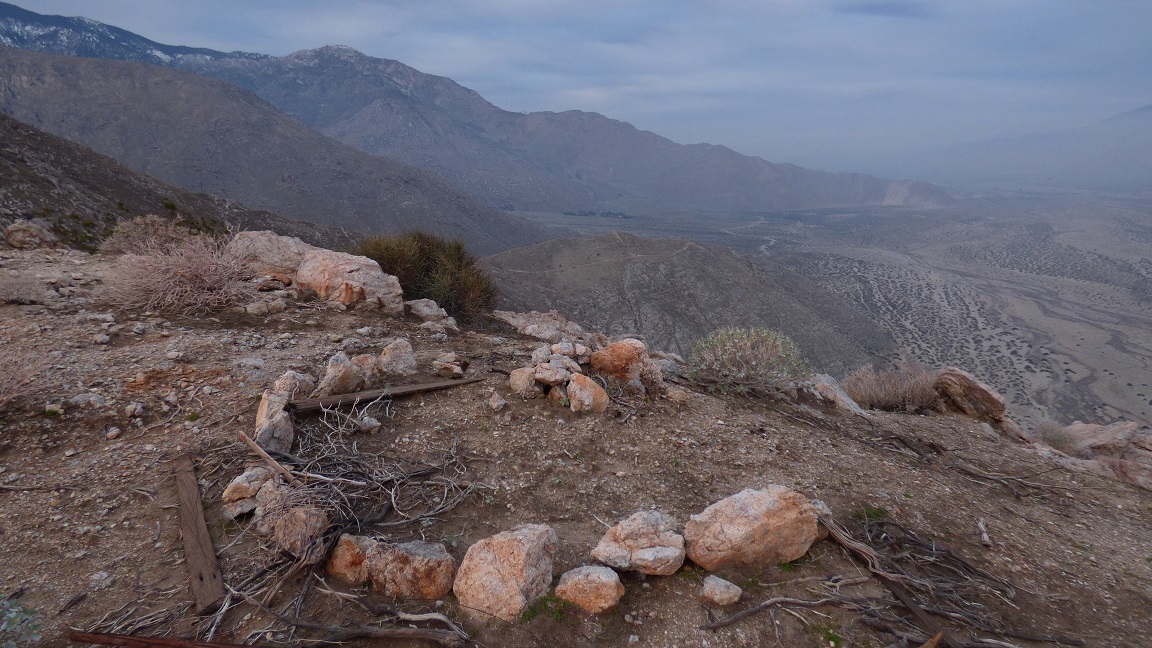
Pass BM

At 2,871 ft we came upon which would be our biggest bump on the ridge. Since it bore almost 300 ft of prominence, I considered it at "peak" status and decided to dub it "Addition Peak" since it sat on the center of a series of ridges which resembled a "+" sign on the topo map.
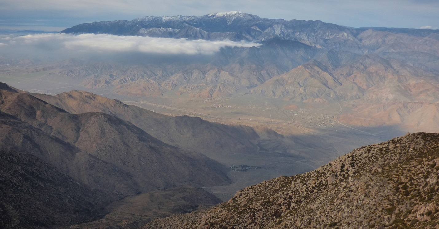
San Jacinto Peak seen from just below Addition Peak

looking up the ridge from Addition Peak

Up and up went the ridge. The terrain itself was very pleasant, consisting of semi-hard dirt with little to no bushwhacking (this would change). It felt like we were climbing a giant staircase, as the terrain would steeply rise a few hundred feet of elevation, flatten out for a quarter mile or so, then repeat itself. The routefinding was no problem as all we had to do was stay on the obvious ridge.
snow on Mt. San Gorgonio


ascending the staircase


At 3.3 miles and ~4,100 ft of elevation, we came upon the first of two major plateaus. I dubbed this one "Blaisdell Flats" after nearby Blaisdell Canyon. Up and over the next rise was a bigger plateau which I dubbed "Upper Flats."

view of Folly Ridge from Blaisdell Flats

At Upper Flats, the brush began gradually increasing, but not enough to hinder our progress. The real bushwhacking was soon to come.


The brush increased dramatically as we ascended the next rise above Upper Flats. As the ridge narrowed (starting at 4.5 mi, 5,400 ft) and began heading south towards Point 7446, the bushwhacking came with a vengeance. For a period of a little over an hour our net speed was probably about a mile an hour. It was almost impossible to stay directly on the ridge as the brush was usually the worst there. Soon we reached the snow line and began crawling through a jumble of rocks, brush, and slush. We mostly stayed just below the east side of the ridge for the most favorable conditions, making a few class 3 moves on generally solid rock in order to avoid the worst of the brush.


At around 5.8 miles and 7,000 ft, the brush began thinning out to our great relief.


Shortly before Point 7446 the brush vanished and was replaced by broad slopes of grass. We basked in the glory of being able to walk freely without getting poked all over our bodies. I was very glad to have reached Point 7446. This point marked the intersection of all the sub ridges branching out from the main north spur ridge. Some notable branches include Leatherneck Ridge, Blaisdell Ridge, and Desert Angel Ridge. The terrain up ahead would be all familiar to Dagmar and I, having done Leatherneck Ridge (via upper shortcut route) in 2013.
grand view of San Jacinto Peak from Point 7446

We continued south along the ridge, encountering several ups and downs, light bushwhacking, and gradually increasing snow cover. Like the last time I was here, it was much easier to go up and over each of the bumps than to side-hill around them. The ridge eventually ends at a flat area at 8,630 ft known as Shangri-La. From there, one could choose to descend south for a short distance before hitting the trail which leads to the upper station of the Palm Springs Aerial Tramway, or head west towards San Jacinto Peak. Dagmar and Sung decided that they would not go to the peak, and I did, so I went ahead along the ridge, climbing at a pace which was faster than usual. There was roughly 3 hours of daylight left and still a lot of ridge to cover.
looking south from Point 7446


Finger Rock

still more ridge

The sun broke through the clouds for a period of about 20 minutes, and of course I spent a lot of that time taking pictures.


The snow greatly increased as I climbed up the last steep rise to Shangri-La. It seemed to take forever, and I rejoiced upon seeing the mountain above give way to sky. After dragging myself up to Shangri-La, I ate a quick snack, put on another layer, and began postholing southwest, aiming for a saddle between Harvard Peak and Yale Peak which is known by the name...You guessed it!- Harvard-Yale Saddle. It took a while to reach the saddle due to knee deep postholing, and I was relieved when I finally got to it, knowing that the Sid Davis Route to the south would be broken out nicely.
...Except that it wasnt, to my astonishment upon seeing not one footprint whatsoever in Tamarack Valley. I grit my teeth and resumed trudging SSW up the Sid Davis Drainage, thinking of the nice pair of snowshoes sitting in the Jeep back at the base of Windy Point Ridge which I had neglected to bring. After what seemed like an eternity of postholing (at some points waist deep), I intersected the San Jacinto Peak Trail east of Marion Mountain and was very relieved to see it broken in very well.
view upon intersecting the San Jacinto Peak Trail

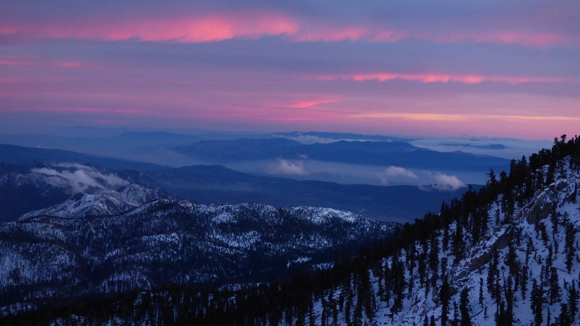
The clouds grew red as I trudged up the "great switchback" not far below San Jacinto Peak. It was an amazing sight. About a tenth of a mile before the summit, I put on all my layers and left the pack there, preparing for the arctic blast.
views from the Great Switchback

My last few bits of energy were spent crawling up the last pile of icy rocks to the windy summit, where 40-50mph gusts screamed from the west. It was about 30 minutes after sunset, with just enough light for me to capture a few grainy photos. I spent a total of around 5 minutes at the summit before heading back down.
summit shot. woohoo!

Back at my pack, I forced down an energy bar before heaving the pack onto my back and ordering my legs to move. Not wanting to posthole again, I would take the 5.4-mile San Jacinto Peak Trail to the tram instead of the usual Sid Davis Route, arriving at the tram sometime after 8pm. It had been another memorable adventure in the eastern San Jacinto Mountains.
Final Stats
16.2 miles
11,340 ft/4,040 ft gain/loss

Weather Forecasts
Trailhead
3,600 ft along Windy Point Ridge
5,600 ft along Windy Point Ridge
7,800 ft along Windy Point Ridge
Shangri-La
San Jacinto Peak
Peakbagger Pages
Windy Point
Pass Benchmark
Addition Peak
Mt. San Jacinto
Summitpost Pages
Mt. San Jacinto
Other
Mt. San Jacinto message board
Webcam at 8,000 ft elevation near upper tram station
Palm springs Aerial tramway website
No comments:
Post a Comment