
home page
October 19, 2014
Sometime around 6:15 am the eastern horizon began to light up, and we crawled out of our tents and began hastily packing. It had been a mild night with temperatures in the low 30s. A thin film of frost covered all the gear we had left outside. Within 15 minutes we were all packed up and heading up the class 2 south ridge of Annie Peak. Almost immediately this ridge presented itself with a series of rock outcroppings and several thick pockets of whitebark pines.
Annie Peak

Thankfully this section of bushwhacking was short and we were standing on the summit by 7am. The ridge connecting Alice to Rutherford Point looked like a straightforward class 1-2 boulder hop.
view south from Alice Peak

northeast

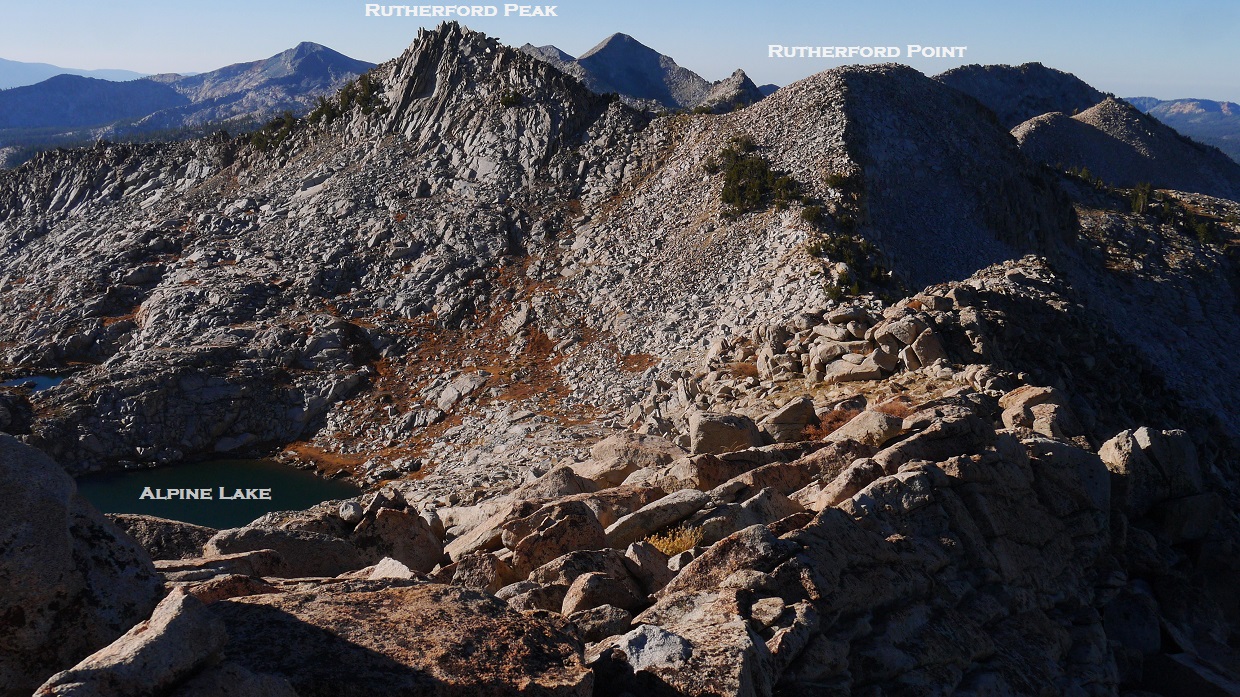
At the lowpoint between Alice and Rutherford Point, we stumbled upon a benchmark which marked the boundary of Yosemite National Park.

The sun finally rose by the time we hit the slopes below Rutherford Point, lighting up the southern half of the traverse.


After summiting Rutherford Point, we descended to the saddle between Rutherford Point and Peak and stashed our heavy packs since Rutherford Peak would be a slight detour from the main ridge. The climb up to this peak was pretty short with some very fun blocky class 3 moves near the top.

view east from Rutherford Peak

south

southwest

north

descending Rutherford Peak


From the saddle between Rutherford Point and Slagg Peak, we descended east for a short distance to refill on water at Alpine Lake and take a 30 minute break, snacking on crackers.
Alpine Lake

After our nice long rest by the lake, we faced the inevitable and dragged ourselves back onto the ridge and continued towards Slagg Peak. Slagg's south ridge was an easy boulder hop which went surprisingly quickly.
view south while ascending Slagg
view north from Slagg Peak summit

At the summit we located an old Andy Smatko register buried under a cairn. We searched around but could not find a writing utensil. While fumbling around, I managed to drop the lid of the register down a crack in the rocks and no matter how much we tried, we couldn't locate it. In the end, I reasoned that a register without a pencil and lid would not last long up here, and decided to take it down, restore it, and bring it back up at a later date.

From the summit of Slagg we looked north along the ridge and saw another highpoint ~0.2 miles away which could potentially be higher. Upon closer inspection, it turned out to be another one of those optical illusions.
Slagg Peak seen from the northern highpoint

After passing over the northern highpoint, the ridge steepened for some loose class 3 downclimbing to the next saddle.


looking back at the class 3 section


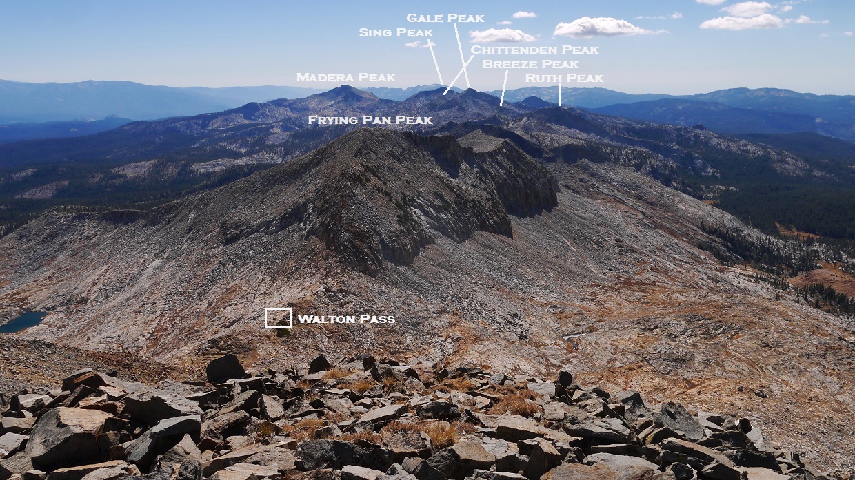
The south ridge of Frying Pan Peak was mostly pretty tame class 1 but it seemed to take a while, and we were glad to be finally standing on its summit about 45 minutes later.
last few hundred feet to Frying Pan Peak

view southeast from Frying Pan Peak

north

The north ridge of Frying Pan Peak contained short class 3 sections near the top, and got easier the lower we went. We ditched our heavy packs at the saddle between Frying Pan Peak and Triple Divide Peak (which I dubbed "Walton Saddle" after nearby Walton Lakes) and headed up Triple Divide's south ridge, contouring just below the cruddy looking pinnacles near the top of the ridge.
Frying Pan's north ridge

Triple Divide seen from Walton Saddle

heading up Triple Divide

At around 1pm we reached the summit of Triple Divide Peak, completing the traverse. The mighty peaks of the Clark Range and Cathedral Range were spread out all around us. They were part of another traverse I was looking to do in the future, and I studied them intently.
view north from Triple Divide Peak

northeast

east


southeast

south
northwest

closeup of Clark

benchmark and register scrap

After descending back to Walton Pass, we headed southeast down some slabs, heading around the west side of Frying Pan Lake. After Frying Pan Lake was another series of downhill slabs which led to Slab Lakes.
looking southeast from Walton Pass

Walton Lake


Slab Lakes


We headed over to the outlet of the largest Slab Lake, and crossed to its eastern side where the map had indicated a trail. Finding no trail but a bunch of cairns, we paralleled the drainage, hoping that the trail would become more defined lower down. We passed by two sets of small tarns which appeared to our right (west). After passing the second set, the trail suddenly became visible and increasingly well defined, and we followed it 1.5 miles to a junction. From that junction, we took a series of trails (see map) totaling 8.7 miles back to the trailhead.
back to Fernandez Traverse
No comments:
Post a Comment