
June 26, 2017
Mt. Muir is the second most prominent highpoint on the Whitney Massif, constantly overshadowed by the much more popular Mt. Whitney just a mile north. Gavin and I had originally planned to climb Fishhook Arete on Mt. Russell this day but could not get across the North Fork of Lone Pine Creek, so we decided to climb Muir's East Buttress on a whim with very little beta after seeing that it was nearby and looked kind of interesting. Due to the lack of prior research, we ended up getting off route into the southeast couloir, but it all worked out nicely and turned out to be a very adventurous climb. (see map)
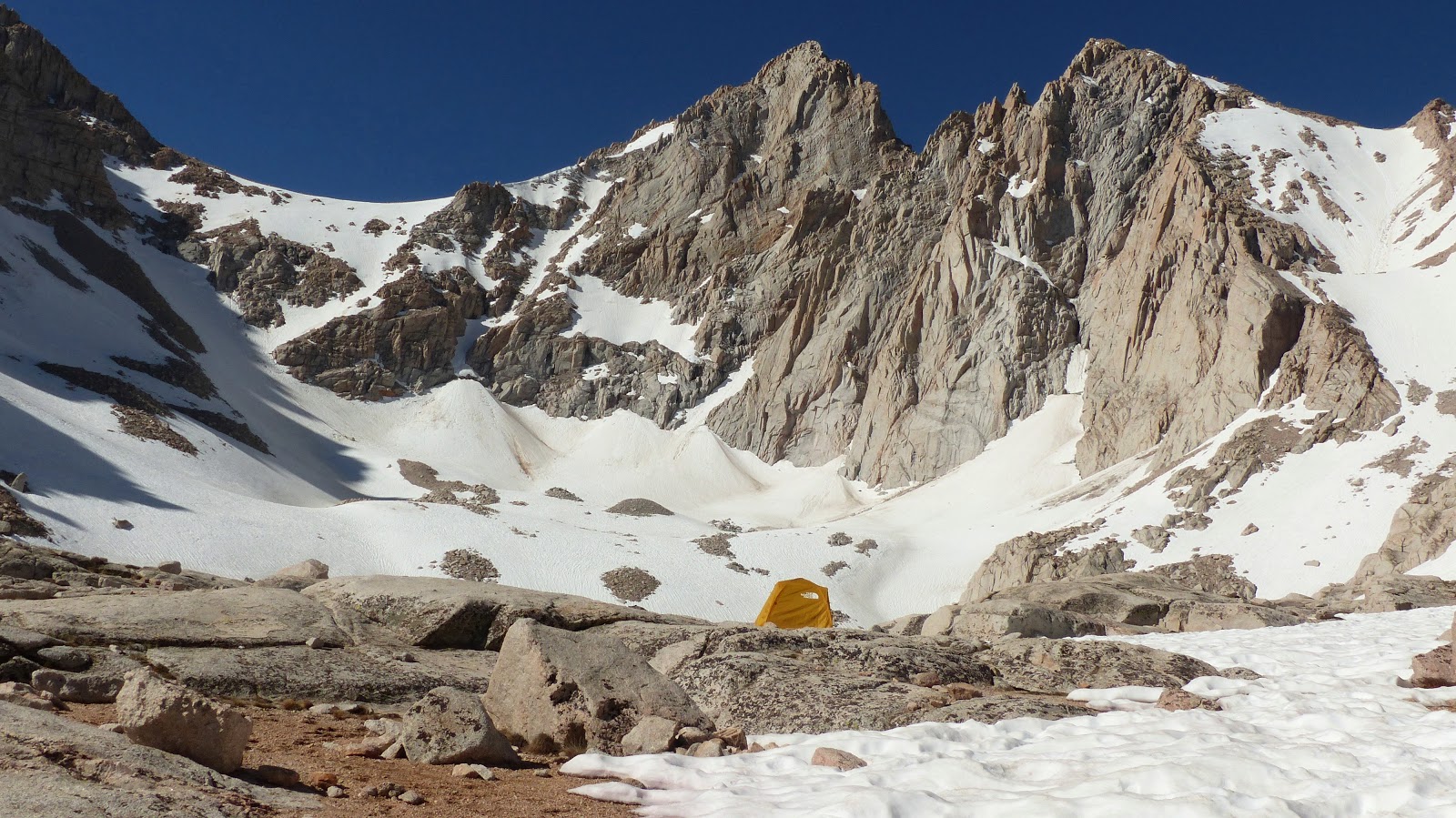
our route seen from Trail Camp along the main Whitney Trail

| Peak | Elevation | Topographic Prominence | Summit Coordinates (lat/lon) |
|---|---|---|---|
| Mt. Muir | 14,012 ft | 298 ft | 36.5647, 118.2913 |
Getting to the trailhead: From Lone Pine off of Hwy 395, head west on Whitney Portal Rd for 13 miles to the obvious parking area and trailhead.
Trailhead coordinates (lat/lon): 36.586907, -118.240020
Getting to the base of Muir's east buttress involved hiking 6 miles up the Mt. Whitney Trail to Trail Camp (12,040 ft) and then aiming for the obvious toe of the buttress to the west. Due to the high snow year, many parts of the trail were flooded and we had to take our shoes off a few times to cross various overflowing creeks.
heading up the Whitney Trail


just above Consultation Lake, with Arc Pass above

For the first few hundred feet, we remained just right of the buttress, then eventually got onto the arete itself (exposed class 3-4) as snow forced us up. Here was where we began deviating from the classic route, as the classic route remained on the right side of the buttress.


Eventually the the buttress became spicy, and we rappelled 45 ft into a gully to the left.


The gully averaged about a 65 degree angle and contained two 100 ft long snow patches. We were above to bypass the first snow patch by climbing some 4th-easy 5th generally solid rock to the left. The hardest move was perhaps 5.4.


The second snow patch was unavoidable without some major climbing, so we got into belay mode and roped up a short section of 65 degree snow to a giant ledge at the base of an obvious chimney.


looking back down from the ledge

The chimney started out solid and mellow, but eventually because rotten near the top. This was the crux of the route involving a few 5.6 moves. The whole thing was doable in one pitch, using up about 45m of rope.

The top of the chimney ended at the first of two stages of the southeast couloir. Both stages were approximately 500-600 ft long. The first stage was angled at 60 degrees and the second at 45 degrees. The stages were separated by a loose rocky rib which required a short section of class 4 climbing. We divided up the first stage into 3 pitches, belaying off our anchored ice axes, but put away the rope for the second stage.
first stage viewed from the top of the 5.6 chimney

looking over at Whitney hikers going up and down The Chute, which was to be our descent route later that day

ascending the first stage


climbing over the class 4 rib

second stage seen from rib

The second stage ended at a loose class 3 notch where we popped onto the Sierra Crest, where we were suddenly hit with bright sun and a strong breeze.

After the notch, it was a simple short class 3 scramble up the standard west face route to the summit of Muir.

views from Muir


We didn't remain on the summit for very long, hoping to get down in time to glissade The Chute before it froze. After descending to the Whitney Trail, it took no time at all the hike less than 1 mile to Trail Crest, where we saw that The Chute had already been in shade for quite a few hours.

Not to our surprise, The Chute had already frozen, and we reluctantly side stepped back down 30 degree slopes to Trail Camp, reaching it about 15 minutes before sunset.
Gavin at the base of The Chute

We headed back down the trail at a methodical pace, not bothering to take off our shoes anymore at various creek crossings. The temperature quickly warmed up as we descended, rising back up into the mid 60s at the trailhead which we reached just before 9pm.
Final Stats
14.6 miles
6,600 ft gain/loss

Weather Forecasts
Trailhead (8,630 ft)
Outpost Camp (10,360 ft)
Trail Camp (12,040 ft)
summit (14,012 ft)
Peakbagger Pages
Mt. Muir
Summitpost Pages
Mt. Muir
No comments:
Post a Comment