
August 8, 2016
The Virginia Lake Basin is a relatively small basin surrounded by eight peaks, located roughly 9 miles southeast of Mammoth. Due to its hiking distance away from more popular areas nearby, the basin is seldom visited and mostly seen only by JMT'ers and PCT'ers passing through. I decided that the eight surrounding peaks would make a great single day traverse (see map) for day 4 of the 2016 Sierra Challenge, starting with Mt. Mendenhall on the east side of the basin and traversing clockwise.
| Peak | Elevation | Topographic Prominence | Summit Coordinates (lat/lon) |
|---|---|---|---|
| Mt. Mendenhall | 12,260 ft | 482 ft | 37.5265, -118.9027 |
| "Point Glen" | 12,146 ft | 170 ft | 37.5287, -118.9123 |
| Virginia Peak | 12,342 ft | 695 ft | 37.5232, -118.9162 |
| "Tully Peak" | 11,899 ft | 384 ft | 37.5125, -118.9178 |
| "Tully Hill" | 10,784 ft | 384 ft | 37.5047, -118.9316 |
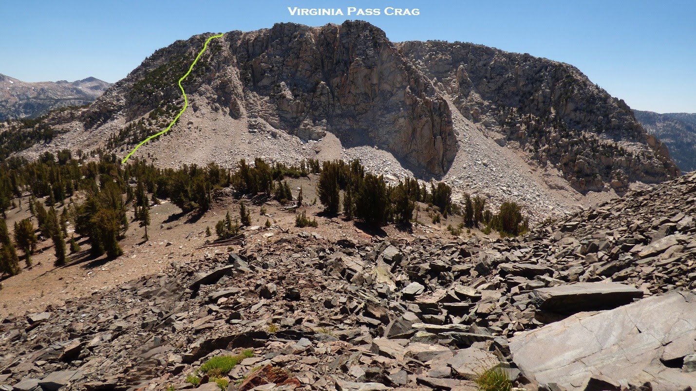
| Virginia Pass Crag | 11,164 ft | 633 ft | 37.5175, -118.9436 |
| "Purple Peak" | 11,453 ft | 462 ft | 37.5293, -118.9362 |
| "Glennette Peak" | 11,444 ft | 260 ft | 37.5322, -118.9298 |
Getting to the trailhead: From Bishop, travel 34 miles on US-395 N to a turnoff for Convict Lake (marked by a sign). Turn left and travel 2 miles to a parking lot at the lake.
Trailhead coordinates (lat/lon): 37.595085, -118.852514
There were about 15 of us (plus a handful of others who showed up late) who started out from Convict Lake (7,600 ft) on this fine Monday morning. In 7 miles, a series of trails would take us from Convict Lake to Mildred Lake (9,790 ft) to the south side of Lake Dorothy (10,290 ft). All these trails are labeled nicely on the 7.5' topo, so there is no further explanation needed for their whereabouts. As usual, the group began spreading out after the first mile. For most of the approach, I hiked with Rob, who was keeping up a similar moderate steady pace. The first few miles through Convict Canyon were quite pleasant with the canyon walls blocking out the sun. At one point, the trail crossed Convict Creek. There were concrete pillars indicating that there used to be a bridge there, but it had since washed out. We plunged through the creek with shoes on, not thinking much of it. My trail runners would dry nicely over the next hour.
sunrise on Laurel Mountain


Red Slate Mountain reflected in Mildred Lake

the enormous Lake Dorothy

As the trail neared Lake Dorothy's southern end, it became lesser defined but still very manageable. Right at Dorothy's southernmost inlet, we left the fading trail, heading briefly south into an old glacial basin east of Mt. Mendenhall. After intersecting this basin, we headed west right towards Mt. Mendenhall which was clearly visible at the head of the basin. We remained more or less on the basin's northern side, as its center and southern sides were full of moraine rubble. Near the top, we caught sight of a lowpoint north (right) of Mendenhall. This was what Secor referred to as "Pretty Pass." Our plan was to ascend to this pass, then take Mendenhall's north ridge to its summit.
above Lake Dorothy

views from the basin east of Mendenhall


Getting up to Pretty Pass was a standard sand slog that was thankfully short. Mendenhall's north ridge was quite fun, with plenty of class 3 rock to scramble all over on. Unfortunately this ridge was also short, and I soon popped out at the summit to meet up with Loren who was sitting there eating a snack.

looking northeast from Mendenhall


southeast

northwest

west

Lauren and I relaxed on the summit for about 30 minutes, watching as a tiny Bob figure scrambled up to Pretty Pass and onto the north ridge. Shortly after he arrived, I headed off west towards Point Glen and Virginia Peak. Point Glen was a straightforward walk-up. It was not at all topographically prominent, but certainly looked prominent from below.
view south from Point Glen

southwest

north

east

As I began walking the ridge between Point Glen and Virginia Peak, I noticed two tiny figures of Bob and Rob heading for Virginia as well. We would soon meet back up at the summit after rock hopping our separate ways up.
between Glen and Virginia


view southwest from Virginia Peak

south

After hanging around for a few minutes at the summit, I continued on south towards Tully Peak. I attempted to coax Bob into climbing this extra bonus peak, but he took one look at it and shook his head. Tully's north ridge could be kept at entirely class 2 boulders if one were to drop slightly below the ridge, but the ridge crest contained more fun class 3 scrambling.
views between Virginia and Tully


views from Tully Peak


I descended the first half of Tully Peak's west ridge, then moved into a prominent gully just north of the ridge. This gully was filled with loose crud, but was not too horrible. After the gully, it was a nice walk across gradual tree covered slopes, then straightforward up the northeast side of Tully Hill. From there, I gained a nice vantage on most of the traverse.
descending Tully Peak


views from Tully Hill


I stopped briefly near the outlet of Virginia Lake to eat and fill up on water. This would be the only source of reliable water on this part of the traverse.

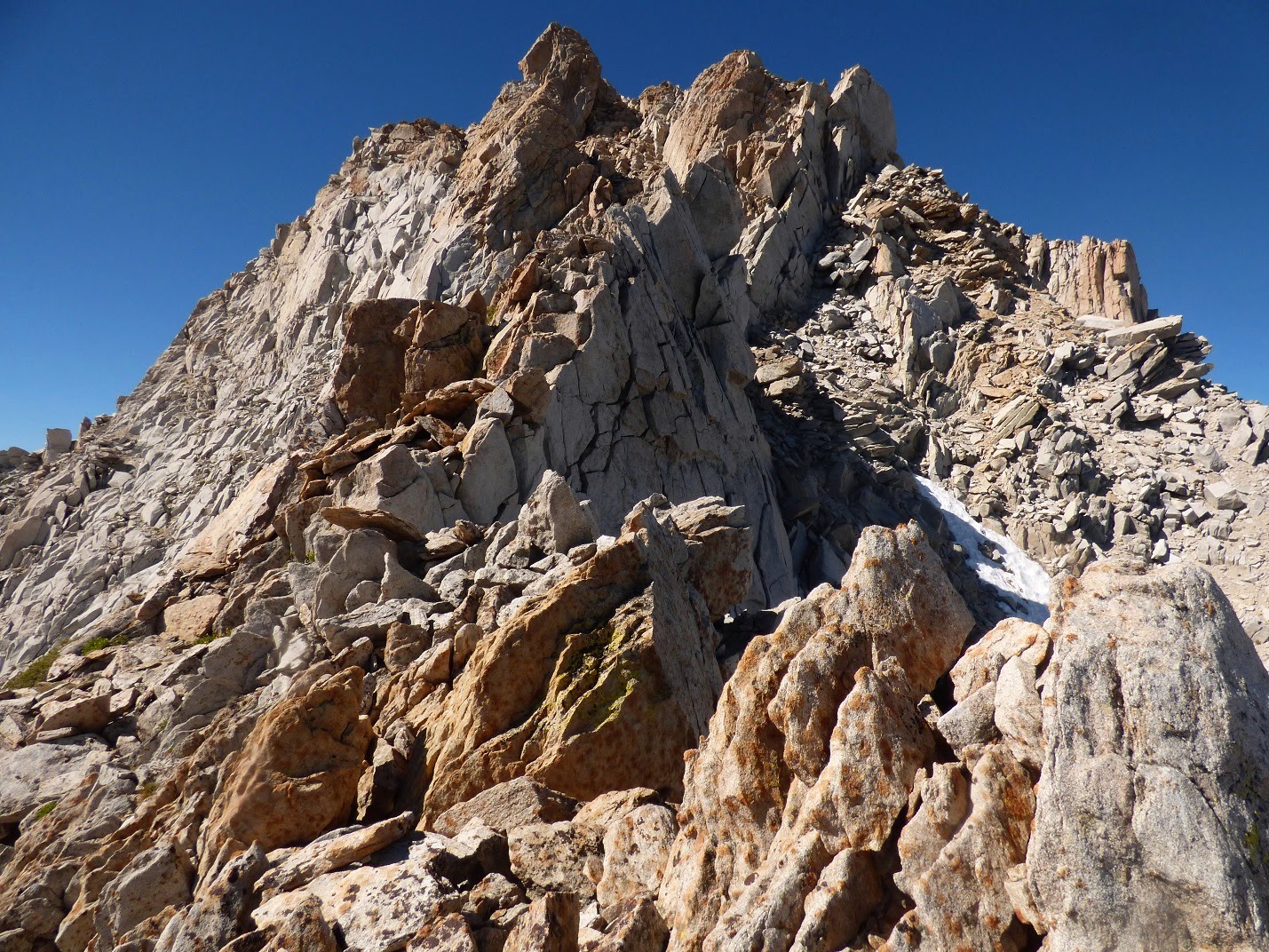
Virginia Pass Crag's southeast ridge was a straightforward walk up a steep slope of sand, granite blocks, and trees. From its summit, I caught a glimpse of Purple Peak's gradually ascending south ridge.

looking back at Lake Virginia

There were a multitude of ways to descend Virginia Pass Crag to the lowpoint between it and Purple Peak. The easiest (and recommended) way of doing it would be to descend the steeper part of the southeast ridge, then hook around north to the lowpoint. I decided to head straight for the lowpoint starting from a nondescript point a few hundred feet south of the summit. This resulted in some annoying bushwhacking down loose class 3 sand and rocks, and I was glad to be off the thing within 10 minutes.
Purple Peak's south ridge was a straightforward affair. Upon reaching its summit, I got my first good look at the class 3-4 ridge between Purple and Glennette peaks.
view southwest from Purple Peak

south

east

The class 3-4 ridge actually turned out to be fairly solid and fun. Shortly after Purple was a class 3 cracked face of black rock which was descended fairly easily. After that came a ridge composed of large granite blocks. I stayed more or less on the ridge crest, occasionally making class 4 moves. There probably was a way to keep it at class 3 if one were to do more weaving, but this was fun and comfortable.
cracked face below Purple

amongst the large granite blocks

summit of Glennette ahead

view south from Glennette

east

From Glennette, I headed ENE, crossing up and over a lower part of Point Glen's northwest ridge, eventually entering Franklin Lake Basin.
tundra east of Glennette peak


looking up Franklin Lake Basin

From Franklin Lake Basin, I had a clear view of Pretty Pass to the southeast. I decided to head around the south side of Franklin Lake, hoping to gradually ascend to the pass using a moraine. This turned out to be a mistake, as the moraine further up was spliced by a series of loose horrid drainage gullies. I descended back to the lake and headed up through the main inlet drainage. The last few hundred feet to the pass was expectedly sandy.


looking back down towards Franklin Lake Basin from Pretty Pass

I was pretty tired by the time I had reached Franklin Pass, and the sandy descent on the other side was a welcome relief. I retraced my steps back to the trail at Lake Dorothy, and enjoyed the afternoon hues on the lake as I walked along its shore. The trail down Convict Canyon went pretty quickly, with the chossy trail material clinking and clanking with every step. The plunge back across Convict Creek actually felt pretty nice and refreshing. By sunset, I had reached Convict Lake, glad to have some rest before the next day's 5am start.


Final Stats
25.2 miles
10,250 ft gain/loss

Weather Forecasts
trailhead (7,600 ft)
8,000 ft
10,700 ft
the traverse "ring"
Peakbagger Pages
Mt. Mendenhall
No comments:
Post a Comment