
January 31-February 1, 2015
The Ventana Wilderness is a large swath of undeveloped land at the northern end of the Santa Lucia Range in central California. Its ruggedness and difficulty of access makes it one of the most remote places in California west of the Sierra Nevada. At one point in time, an intricate network of trails ran through the area, providing access to some of the deepest parts of the range. As time went on, the trails began falling in disrepair. Only a few of them continued to be maintained while the others gradually became reclaimed by the thick chaparral which inhabits most of the range. Several trails disappeared entirely and were declared "officially lost." The Ventana Wilderness is now slowly returning to the wild and remote landscape that it once was. This eventually gave rise to a good amount of difficult cross country routes, one of which is the Ventana Triple Crown.
The concept of the Ventana Triple Crown was created by Bob Burd, who looked at combining the three "Ventana Cones" (South Ventana Cone (SVC), Ventana Cone (VC), and Ventana Double Cone (VDC)) into a single traverse. These three peaks lay on a single ridge connecting SVC to VDC, interspersed in between by several subsidiary peaks. Bob had made several attempts before finally completing the first ascent with Michael Graupe in 2006, describing it as the "mother of all hikes in the Ventana Wilderness." Despite several attempts (including a rescue), no one has repeated the route until now.
| Peak | Elevation | Topographic Prominence | Summit Coordinates (lat/lon) |
|---|---|---|---|
| South Ventana Cone | 4,965 ft | 1,314 ft | 36.275003, -121.636891 |
| Pine Ridge | 4,621 ft | 70 ft | 36.277354, -121.649272 |
| "Break Peak" | 4,456 ft | 247 ft | 36.280546, -121.662739 |
| Ventana Cone | 4,727 ft | 667 ft | 36.284378, -121.678348 |
| "Round Rock Peak" | 4,387 ft | 527 ft | 36.288182, -121.689634 |
| "Ventana Mesa Peak" | 4,260 ft | 360 ft | 36.291693, -121.703539 |
| "Twoface Peak" | 4,460 ft | 280 ft | 36.296622, -121.706779 |
| Ventana Double Cone | 4,853 ft | 993 ft | 36.297003, -121.714869 |
Getting to the trailhead: Pine Ridge Trailhead is a dirt pullout 200 ft south of Jeffery Rd (the turnoff for China Camp). The Pine Ridge Trail starts on the other side of the road.
Trailhead coordinates (lat/lon): 36.294951, -121.566597
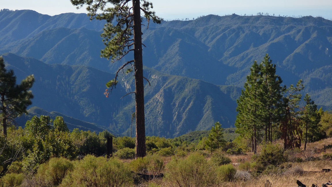
Mason and I started hiking from Pine Ridge Trailhead (4,330 ft) at around 4:20am. It was a beautiful clear morning with temperatures in the mid 30s. To the north, we could make out a glow emanating from cities around the Monterey Bay. The first half mile of trail out of the trailhead was wide and clear, then it became slightly overgrown on both sides, but still very well defined.
Trailhead coordinates (lat/lon): 36.294951, -121.566597
Mason and I started hiking from Pine Ridge Trailhead (4,330 ft) at around 4:20am. It was a beautiful clear morning with temperatures in the mid 30s. To the north, we could make out a glow emanating from cities around the Monterey Bay. The first half mile of trail out of the trailhead was wide and clear, then it became slightly overgrown on both sides, but still very well defined.
3.4 miles after leaving the trailhead, we arrived at Church Creek Divide (3,675 ft). We only stopped for a few seconds to consult the trail sign before continuing along the Pine Ridge Trail. As we stopped for a short snack break 30 minutes later, the faint glow of the rising sun was already visible to the east. 2.9 miles after leaving Church Creek Divide, the trail contoured onto and along the north side of SVC. We left the trail right after passing by an obvious landslide area, and headed south directly up the slope on loose sandy crud. What appeared to be the highpoint as seen from the trail was a false summit. Once atop it, the true summit was visible across a small plateau to the southwest. Getting across this plateau involved some light bushwhacking through low manzanita. Beginning at the last few hundred feet, the bush came with a vengeance and we spent several minutes thrashing through it before popping out at the summit.
leaving the Pine Ridge Trail

view southwest from the false summit

summit area

view north-northwest from summit

northeast

southeast


southwest

northwest

The register was a standard ammo box which contained two notebooks, one of which was almost completely filled with long essay entries.

Our planned descent from VDC was to head down its west ridge to the saddle (4,550 ft) between SVC and Pine Ridge where the Pine Ridge Trail came to a 4-way intersection with three other trails. The first few hundred feet of the descent went alright, but then the brush came with a vengeance. We were bushwhacking through some of the thickest scrub oak I had ever seen. It grew 6-10 ft high and covered the entire hillside. At first I stayed on the south (left) side of the ridge, which became very unbearable very fast. I thrashed back onto the ridge and down its north side and soon found myself descending steep and sandy (but considerably less brushy) terrain to meet back up with the Pine Ridge Trail. After reaching the trail, I continued along it for a short distance to the VDC-Pine Ridge saddle.
views from descent


I reached the saddle and promptly put on my bushwhacking clothes upon seeing my legs already scratched up and bleeding. 20 minutes later, Mason had arrived at the saddle. It seemed like he had stayed primarily on the south side of the ridge in even nastier brush. After Mason had donned his bushwhacking clothes, we set out west towards Pine Ridge which was a short and easy walk to the summit.
heading towards Pine Ridge
views from the summit of Pine Ridge


Next up was a summit which I had dubbed "Break Peak," located roughly halfway between Pine Ridge and VC. Descending Pine Ridge's west ridge involved light to moderate bushwhacking through 1-3 ft tall manzanita. Break Peak's east ridge was mostly clear of brush.
looking WNW from Pine Ridge

view SSW towards Mt. Olmstead

Mason in full bushwhacking attire

Pine Ridge behind us

We reached the top of Break Peak and promptly took a quick break. Mason mentioned that his ankle was bothering him, likely from twisting it around in all the brush, and questioned whether or not he should continue the traverse. He eventually decided that he would press on towards VC and see if the ankle got any better or worse.
view SSW from Break Peak

WNW

The initial few hundred feet of descent on Break Peak's northwest ridge contained moderate brush which forced us to remain on the south (left) side of the ridge. After that, the brush became light and we quickened our pace. Halfway between Break Peak and VC, Mason mentioned that I would have finish the traverse without him. His ankle was getting progressively worse. He gave me some of his water and we parted ways. We agreed that if I wasnt back by morning, he would call SAR.
views from the ridge between Break Peak and VC


summit of VC

I hit the summit of VC at 11:35am. From the summit, I could see the remainder of the traverse to VDC, including the three peaks which lay in between. The ridge looked long and tedious with its icky bushwhacking. I sat on the summit and ate a few slices of pizza while pursuing through the register.
benchmark and register

view southwest from VC

northwest

Almost immediately after starting my descent of VC's northwest ridge, the brush increased dramatically. Then came loose and unstable cliffs- the very cliffs which had resulted in Bob Burd's failure on his 2004 attempt of the traverse. The ridge was divided in cruddiness, with its southern (left) side containing class 3-5 cliffs, and its northern (right) side containing bushwhacking. I remained on the left side as long as the cliffs remained class 3 and below, and headed to the right side when it surpassed class 3+. Once I hit the east ridge of the next peak (Round Rock Peak), the southern cliffs disappeared and all became bushes. For half an hour all I could hear was the cracking and snapping of branches as I ascended the ridge. The rocky summit was a great relief.
views between VC and Round Rock Peak


looking south from Round Rock Peak

ESE

WNW

On a lower summit about 50 ft west of the true summit, I located a small register containing two scraps of paper. The person who had placed the register had claimed the first ascent of Round Rock Peak in the 60s.

Next up on the traverse was Ventana Mesa Peak. When Bob had done the route in 2006, he noted that this next section between Round Rock Peak and Ventana Mesa Peak contained the worst bushwhacking on the traverse, involving crawling under thick clumps of endless shrub oak. As it turned out, the bushwhacking was not as bad as Bob made it out to be. For the first 3/4 of the descent down Round Rock Peak's northwest ridge, I made my way through a maze of dead branches and shrub oak- moderate to bad stuff. Whenever I could, I would venture towards the south (left) side of the ridge to downclimb cruddy class 3 terrain rather than bushwhacking. For the remainder of Round Rock Peak's northwest ridge and the first half of Ventana Mesa Peak's southeast ridge, the bushwhacking was characterized by a forest of extremely annoying and scratchy dead branches. For the second half of the ridge, I was delighted to see that the terrain was nice, grassy, and clear of brush. It was the most wonderful feeling ever, being able to actually walk without getting poked. prodded, and scratched all over.
the ridge to Ventana Mesa Peak seen from Round Rock Peak

looking back at Round Rock Peak from halfway down its northwest ridge

the "dead and scratchy" section


I reached the summit of Ventana Mesa Peak at 2:30pm and was immediately taken away by the views westward towards VDC. The south and west sides of the mountain were composed of a multitude of sheer cliffs, ridges, and gullies, some of which were likely unclimbed.
view SSE from Ventana Mesa Peak

west

northwest

For this next section between Ventana Mesa Peak and VDC (which includes Twoface Peak), Bob had indicated that the terrain was mostly free of brush. From the summit of Ventana Mesa Peak, it certainly did not look so, and not to my surprise, it wasnt! This next section would contain the worst bushwhacking on the entire traverse.
Roughly a thousand feet north of Ventana Mesa Peak along the ridge lay what looked like a giant rock outcropping which would cliff out on the other side. Bob had mentioned nothing of this in his report, but I recalled that they had dropped a few hundred feet down the west (left) side of the ridge immediately from the peak via a cruddy looking dirt gully, then contoured northwestward to meet back up with the ridge. Was this potential cliff-out the reason they had done that? Well, I was about to find out.
I dropped about 50 ft down the same (and very obvious) gully which Bob had used, then contoured back onto the ridge (this was to avoid a section of very nasty brush just north of Ventana Mesa Peak). I wanted to stay on the ridge as much as possible. As the bushwhacking grew nastier, the views of VDC grew better.


I reached the top of the outcropping, and realized that the ridge had indeed cliffed out. I immediately dropped off the east (right) side of the ridge for a few hundred feet, downclimbing some cruddy class 3 rock. Shortly after bypassing the cliff, the brush came back thicker than ever. It was over my head and had me clawing through it like there was no tomorrow. As I came closer to Twoface Peak, the brush only intensified, forcing me through forests of extremely thick scrub oak. I felt like I couldn't take it anymore, and just sat there and screamed for 20 seconds. After that, I just didn't care anymore. I took off and charged the brush, crashing through the evil branches. Everything- my pack, my clothes, and my skin was getting utterly shredded. The bottom half of my pants were already gone, and several new bloody scratches were forming every second on both my legs. As I got to the base of Twoface Peak, I looked up in relief as the brush suddenly gave way to rocks. A few hundred feet above me was the summit of Twoface Peak, and in between was....yes!...ROCKS! I gratefully scrambled up, feeling so graceful, so free. There were countless ways to climb up this face- all of them class 3+. Never before had loose class 3 rock felt so good. I topped out on the small rocky summit to find excellent views in all directions.
a particular nasty section of whacking (I had to stand on my tippy toes and hold the camera over my head in order to get this photo)

looking back at Ventana Mesa Peak

Ahhhhh.....Rocks!

starting the class 3+ scramble up Twoface Peak

views from the scramble


view southwest from Twoface Peak

west

southeast

To descend Twoface Peak, I simply followed the spine of short its class 3 southwest ridge for a few hundred feet, which dropped me to the saddle between Twoface Peak and VDC. From there, I simply headed directly up VDC's broad ESE ridge. The bushwhacking was moderate, consisting primarily of chest high manzanita. After what felt like an eternity of manzanita, I finally reached the summit of VDC at 4:40pm.
heading down Twoface Peak's southwest ridge


ascending VDC's ESE ridge


view NNW from VDC

north

ESE

south

WSW

northwest

closeup of Pico Blanco

There was less than an hour of sunlight left, so I did not remain on the summit for long. I knew that much of the 14 miles of trails back to Pine Creek Trailhead were overgrown, and wanted to get as far as possible while the light lasted. I spent a few minutes enjoying the view, then began making my way north along the Ventana Trail, which was somewhat overgrown here and there, but mostly easy to follow.
views from Ventana Trail


I remained on the Ventana Trail for 3.4 miles to Puerto Suello Gap (3,530 ft): a trail junction with the Puerto Suello Trail branching off to the east (right). By that time, the sun had already been down for 20 minutes and it was getting dark fast. I took out my headlamp and ate a quick snack before starting down the Puerto Suello Trail. Some people had mentioned that this old and unmaintained trail was no longer passable, but Bob had mentioned that it was fairly easy to follow during his 2006 excursion of the Ventana Triple Crown.
For the half mile, the trail was visible and easy to follow, even with the plethora of deadfall every 20-30 ft along the trail. After the first half mile, the trail became increasingly overgrown and at some points, very difficult to follow. "Not now!" I thought, as my headlamp began to dim. Eventually the trail was essentially nonexistent, and I found myself bushwhacking once again. Perhaps the worst thing was the deadfall. There were an incredible amount of fallen trees, one every few feet, which I would have to climb over and bushwhack through. It seemed very likely that over 99% of these trees had fallen in a big windstorm which had impacted the area in December 2014, judging by the fact that the leaves on all these trees were still green. The "trail" supposedly paralleled a large creek, which I could not see because the fallen trees had actually stacked up on one another and covered the entire creek. I had to essentially guess where the creek was. A few times, I would step between fallen tree trunks thinking that what lay underneath was solid ground, but then found myself falling several feet into the creek, often resulting in a calf cramp. My headlamp eventually died, and I put it away, staring at the dark mass of brush ahead. Faint rays of moonlight emanated from the high clouds overhead. I would just have to make do with what I've got.
The thrashing and tree-climbing continued for what seemed like hours. It was a repeated cycle of getting scratched up, hoisting myself up, and falling into the creek. As I neared Hiding Creek Camp, little bits of trail began appearing, and I gladly followed them. As I reached Hiding Camp (1,730 ft), I plunged my head into the water and gratefully lapped it up. It had taken several hours to cover 1.7 miles of distance from Puerto Suello Gap.
After blindly searching for the trail in the dark for about 20 minutes, I finally located it crossing the creek. I got on it, and remained on it for what seemed like 15 minutes before it crossed the creek again. This was the point which had me confused. The map did not indicate the trail crossing the creek until almost a mile after Hiding Camp. The only place where that could've happened in between was if I had accidentally taken the spur trail towards Round Rock Campsite, which lay in a side canyon branching south from Hiding Canyon. Had I really traveled that far stumbling in the dark with no light? It couldn't be so. Eventually I reasoned that I was still within the first quarter mile of the camp, where the map indicated the trail paralleling the creek. Thinking that the trail had simply eroded away, I plunged my feet into the cold waters of the creek and began making my way upstream.
I headed upstream for what seemed like 20 minutes, to a point where the creek began making a long curve around some land mass. For some odd reason I thought that I was at the split between Hiding Canyon and Ventana Mesa Creek, and that the land mass the river was curving around was a small peninsula-shaped hill extending from the mountains north of Hiding Canyon. The map indicated that the trail went over this hill, so I promptly began climbing up towards the east. The bushwhacking once again came back with a vengeance. Up ahead, I could see yet more dark masses of brush illuminated by the faint moon. This was never going to end, was it? It felt like I was thrashing up that slope for an eternity, and that I had gained several hundred feet of elevation, far more than the ~160 ft indicated by the topo map which would get me to the trail. I tried to get a bearing with the topo map, but all the terrain below me looked the same- pitch black. Trying to navigate by topography was essentially impossible, which made trying to navigate at all essentially useless. Eventually I decided that I was just going to get lost if I kept pushing it, and decided to spend the night on the hillside.
I took off my pack and just sat there for a few minutes, thinking what possibly could've gone wrong, how stupid I was for not having the patience to just spend the night at Hiding Camp and hike out the next morning when there was sunlight to work with, and how worried Mason must be right now. I suddenly realized that my body temperature was dropping fast since I was no longer moving, and for the next 30 minutes, proceeded to rip up every bit of dead brush I could find and make a huge pile of it around my pack. When I was satisfied with the pile, I molded it into a giant "nest" shape and crawled in, pulling some of the brush over myself in the process. It definitely felt warmer now. I closed my eyes and fell asleep. At the moment, it did not occur to me to check the time, but judging by the position of the moon in the sky, I would say that it was just after midnight.
I slept on and off throughout the night. It never got very cold, and the brush provided good insulation. I was filled with joy as the eastern horizon eventually began lighting up. As soon as it was light enough to see the surrounding terrain, I began heading down and to the south in order to gain a visual of the surrounding terrain. To the south were two rivers separated by a broad hillside. But that was odd. There should be three of them.
And then it clicked. I was looking at the the south fork of the Carmel River which branched off to the left (southeast), and an unnamed creek which branched off to the right (southwest). Wallah. I had accidentally taken the spur trail to Round Rock Campsite the previous night, followed the south fork of the Carmel River upstream, and ascended a spur ridge dividing Hiding Canyon and the south fork of the Carmel River.
I did not want to go back through that awful bushwhacking. Taking a look at the map, I saw that the south fork eventually intersected Pine Valley, which would get me back on the trail. For the next few hours, I followed the south fork of the Carmel River upstream, rock hopping and lightly bushwhacking. It was tedious work, but at least I knew where I was. Shortly after passing the fork for Bear Basin Creek, I came across the first of two magnificent waterfalls (which were labeled "Pine Falls" on the topo map). The first one involved some class 2-3 climbing along its right side in order to get by. The second waterfall was visually stunning. A steady band of water poured directly off a cliff and into an incredibly turquoise pool of water. I tried to take a picture of it, but realized that the camera was dead.
After passing the second waterfall, a use-trail appeared, which took me to the Church Creek Trail in Pine Valley (3,150 ft). I happily made my way up this superhighway of a trail 1.8 miles to Church Creek Divide (3,675 ft), then 3.4 miles back to the trailhead, quickening my pace. I recalled agreeing with Mason the previous day that if I was not back to the trailhead by Sunday morning, he would call SAR.
As I rounded the last bend at 11:40am and gained a view of the trailhead, I noticed a sheriff's vehicle parked there. Mason had gotten back to the trailhead about 1.5 hours after sunset the previous day. He had called SAR Sunday morning before I arrived, and a nearby on-duty sheriff had just pulled into the parking lot a few minutes before I arrived. Nothing else had happened. I could see the relief on their faces. After a short conversation, much of which was directed at the cruddy nature of the Puerto Suello Trail, the sheriff left.
Due to the recent absence of periodic fires clearing out the brush, the Ventana Triple Crown is now essentially impossible to complete in a day. There was undoubtedly a great deal more brush compared to when Bob claimed his first ascent in 2006. Until the next fire comes through, the route will only get increasingly difficult. This was a very fun route, but there is no way in hell Im ever doing it again (at least until the next fire comes through).
Final Stats
27.6 miles
11,900 ft gain/loss
(Since Blogger does not let me upload these files at full size, email me at eric.jsc@gmail.com for a full size version of this map)
27.6 miles
11,900 ft gain/loss
(Since Blogger does not let me upload these files at full size, email me at eric.jsc@gmail.com for a full size version of this map)

Weather Forecasts
Trailhead & all peaks general forecast (NOAA)
Ventana Double Cone (Mountainforecast)
Peakbagger Pages
South Ventana Cone
Pine Ridge
Break Peak
Ventana Cone
Round Rock Peak
Ventana Mesa Peak
Twoface Peak
Ventana Double Cone
Summitpost Pages
South Ventana Cone
Ventana Cone
Ventana Double Cone
Other
Ventana Wilderness Forums
Ventana Wilderness Alliance
You've earned your Ventaphile stripes. Having tagged SVC and VC last year I agree that a one day link up of the triple crown will have to await the next brush clearing fire. The level of detail in your TRs is always impressive.
ReplyDeleteHa! Wow! Thanks for the detailed report! I used to get down there often and enjoyed reminiscing a bit. Swimming through brush higher than my head coming down from SVC was enough for one day last time I visited the Ventana. Losing my dog bushwhacking back from the Grey Rocks in the Trinity Mountains was my last major scratch fest. I retrieved the dog the next day, but not my desire for that sort of hike yet. Yeah, maybe after a fire sometime nice and cool...
ReplyDelete