
December 27-30, 2014
The Northeast Ridge of Lone Pine Peak (IV-V, 5.6-5.7) is a formidable looking feature jutting out from the rugged east side of Lone Pine Peak. It is the second most popular of three main ridges on the east side, with the more popular one being the Complete North Ridge (V, 5.7) and lesser popular one being the East Ridge (rating unknown).
Mark and I hoped to do the Northeast Ridge as a 3-day winter ascent, starting the climb from Lone Pine Campground (5,890 ft) on Saturday. We planned to slog/climb up the ridge and bivy just below the start of the technical climbing (~9,700 ft) by Saturday night. On Sunday we would wake up bright and early, climb to the summit (12,944 ft), bivy there, and watch the sunrise on Monday morning. Our planned descent route would be a slog down the class 2 chute of the standard Northwest Slope.
Getting to the trailhead (no camping or parking fees in winter!)
Trailhead coordinates (lat/lon): 36.597529, -118.186360
The two of us left Lone Pine Campground at around noon on Saturday, heading in a general southwestern direction towards the obvious Northeast Ridge. From the beginning of the ridge itself (6,300 ft) all the way up to ~8,800 ft, the terrain was a mix of steep sand slogging and postholing in recent snowfall. Starting from ~8,800 ft, the brush and large boulders increased dramatically, forcing us to weave all over the ridge and slowing down progress. Not long before sunset, we reached a flat spot at ~9,200 ft on the southern side of the ridge, and decided to bivy there.
Northeast Ridge seen from Lone Pine Campground

Mt. Whitney seen from Lone Pine Campground

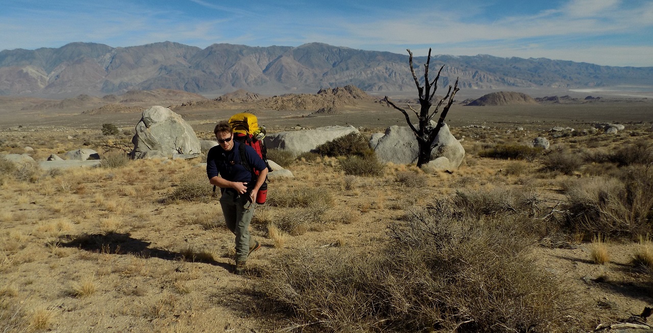
heading towards the Northeast Ridge

the ridge gets icky

our bivy site

The next morning, we woke up shortly after sunrise and soon were quickly on our way up the ridge. It was a surprisingly warm day with morning temperatures in the teens. The weather was incredible. The ridge gleamed under a mostly clear sky. The act of staying directly on the ridge became increasingly difficult as the boulders and brush increased, and it wasnt until 10:30am when we reached the first pitch (5.6-5.7) of the technical section (9,780 ft).
morning view from camp

more scrambling up ridge

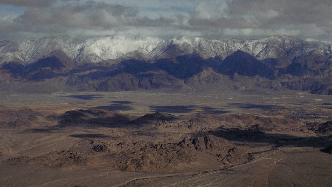
view towards the Whitney Basin

It took a little while to do the first pitch due to two reasons. The first of these came as I accidentally dropped one of my rock shoes into a deep crack and spent a good deal of time jamming myself into the tight space in order to retrieve it. The second reason came when we took a look at the first pitch, and saw that the left (south) side of the ridge was covered in a thin layer of new snow, making the slabs look incredibly sketchy. It took a little effort to start the pitch by climbing directly up onto the snow-free arete where the pro was very poor, but it was manageable.
first pitch

After the first pitch, the terrain eased up to class 3-5.4 which we simuled. The beta mentioned that we should stay on a pretty obvious large ledge which wrapped around the north side of the first tower. The ledge went on for a few hundred feet, and then seemed to disappear. Instead of walking around a corner to see if the ledge kept going, we headed up left onto the ridge crest itself. Upon reaching a small notch just above what we thought was the first tower, we headed directly up a ~50 ft very exposed section of ridge (5.6-5.7) with zero pro. Shortly after, we downclimbed a large crack (5.5-5.6) down the southern side of the ridge and located two small indentations in the rock which would fit two people lying down flat. Since it wasnt long til sunset, we decided to bivy there, conveniently anchoring ourselves to a sling which we slung onto a large flake between the two indentations.
simul climbing after the first pitch

climbing up towards the ridge crest

sunrise at our second bivy site (10,170 ft)


It was looking to be another great weather day as we packed up at our second bivy site on Monday Morning. The sky was fully clear, and there was only a slight breeze coming out of the north. But as we heaved our packs on just before climbing the first pitch out of camp, we noticed several spindrifts which were swirling above us at the ~11,500-12,900 ft level. As we climbed around the rock which shielded us from the wind, we were immediately hit with 40mph gusts. Thinking that the wind would eventually subside or that it really wasnt that bad above us, we continued up, climbing up numerous 20-35m pitches. We stayed on the south side of the ridge whenever we could, since the sun was shining on it and the wind was light compared to the northern side. Eventually the terrain on the southern side turned difficult and forced us onto the ridge crest, where 60-70mph winds screamed from all directions.


By 1pm we had reached a point just below the top of the second tower at ~10,370 ft. Hurricane force winds blasted us from every possible direction. We came around a corner and saw that the entire upper mountain was engulfed in a giant spindrift rising over 1,000 ft above the mountain itself. It was right then and there that we both agreed to retreat back down the ridge. Climbing anymore above was a disaster waiting to happen.
a look at the upper mountain from our turn around point

As we downclimbed along the ridge, the wind only grew stronger. It was a very tedious process which had us shivering even under all our layers. Sometime around 4:30pm as it was beginning to get dark, we made a wrong turn onto the north side of the ridge when we should've stayed on the ridge itself. At one point, the rope became horribly tangled and a good 20 agonizing minutes was spent unraveling it bit by bit. By then it was getting dark and the wind was roaring so loudly that it was difficult to hear even our own voices. Everything outside the tiny lights from our headlamps looked like sheer drops into nothingness. On and on went the endless pitches.
Eventually Mark located a small drafty crack in the rock which we decided to spend the long and uncomfortable night in. It took a while to get settled in, as the ground space in the crack was less than 2 by 10 ft. Most of our gear dangled from the ceiling of the crack or was stuffed into a narrow upper portion of it. None of us had much desire to eat or drink as there was no snow to melt and our one remaining gas canister was almost out. There was no possible way for both of us to lie flat on our backs, and we tossed and turned all night in increasingly uncomfortable positions. The wind howled through the crack in what seemed like 80mph gusts, blasting snow in our faces. It sounded like we were jammed into the underside of a large freight train.
But overall the crack was a lifesaver. It blocked out most of the wind and even somewhat insulated us from the freezing air outside. Except for parts of my face which were sticking out of the sleeping bag, I felt surprisingly warm for most of the night. I remember dozing off back and forth and even remember dreaming. Mark later recounted that he had probably fallen asleep but never fully seemed to loose consciousness. He seemed to be feeling much colder than I was, having a lighter sleeping bag and less layers on.
I remember waking up from one of my little naps (around midnight?) and realized that the wind had almost completely stopped. Now and then a slight breeze would come through the opening of the crack. I shifted my body around in order to gain a view of the narrow sliver of sky and mountains visible to the north, and saw a sky full of glittering stars and the numerous ridges and gullies of the massive mountain sparkling under the starlight. It was an amazing sight. I felt mightily relieved, and soon drifted off into a comforting snooze.
I awoke to the presence of a weak light coming through the opening in the crack. Morning had come at last! It had been 15 hours since we had crawled for our lives to this spot. I shifted myself around to get a glimpse of the opening, and noticed that the previous night's starry sky had been replaced by one which was full of thick gray clouds. The bottoms of the clouds were lowering, and had already obscured the last thousand feet of the upper mountain. The air was frigid, with temperatures in the negatives. The wind was still a gentle breeze, but it was quickly picking up again. It was the perfect recipe for a storm. We got moving.
good morning from the Lone Pine Peak Hilton!

my first morning glimpse of the outside world

Mark inside the crack

It took a little time to get all our stuff together. When we finally were able to crawl outside, it had began snowing. I put Mark on belay and he headed east, hoping to locate a ledge system which would get us back on route. As I sat there for the next 15 minutes, the snow came down harder and began to accumulate. The cloud bank lowered so that visibility was not more than a few feet. A few moments later I had climbed over to Mark and saw the dismayed look on his face. The ledges up ahead were very tiny and coated with snow. We felt stuck.
After standing there worrying for a little while, the clouds cleared for a very brief period of time so that we noticed a large ledge below us. It was difficult to tell how far below it was, but it was definitely a psychological booster. We made the decision to rappel to the ledge.
The rappelling went pretty slow as the wind kept tangling up the rope on the way down. It pretty much felt like we were rappelling into nothingness, as the clouds had once again obscured everything that was more than 5 ft away from us. In all, we made two raps before arriving on the ledge. We could see that the ledge stretched east, but couldn't see the end of it which was in the clouds. By this point, both of us were totally out of it. I could see Mark sitting on the snow, hunched over, probably warming up his toes. He must've been exhausted from leading all those pitches. The wind and snow were forcefully driving at every inch of our bodies. I decided to climb east along the ledge and see what was there. We were tired out of our minds. Every bone in our bodies were aching, but it bothered me even more that what lay to the east was unknown. "This is the moment of truth," I thought, as I plodded through the knee deep snow. The outcome of this ledge will determine whether we bask in the glory of salvation or be damned to spend another day out in this harshly exposed environment, possibly risking death, and if we are lucky, getting plucked off the ridge by Inyo SAR once the storm clears. How long will we last in this weather? Three days? Four? Maybe even five? How long can we last in this environment without food or water? The ledge went on and on. I was so incredibly tired, stumbling through the snow and getting hit by the wind like a rag doll.
second rappel with momentary clearing

As I reached a spot maybe about 200 meters from our last rappel, I suddenly caught a glimpse of something which sparked a momentary sense of jubilation. The clouds moved back in again. I stood there staring at the blank white space, confused about what I had just seen. I couldn't make any sense of it. It was like a teaser, announcing that something big was about to go down. I stood there and waited for the clouds to move away. 10 minutes later, the bands of white slowly thinned and what surfaced was a series of cracks and ledges heading up and to the right. I continued staring at it, somewhat puzzled.
And then it hit me. Those ledges were part of our ascent route. We had taken them because there seemed to be no way to get further westward. I was standing somewhere not to far above the first pitch. Yes!!! Somehow we did not see that the large ledge we were on had kept going due to a blockage by a large tree. The ledge we had just rappelled onto was THAT ledge! I stood there in disbelief, with the feeling of sweet relief washing over me. I stumbled back over to inform Mark of the good news.
I saw the gray form of Mark ahead of me through the blizzard. He looked like a ghost, floating in empty space. I trudged up to him and shouted as loud as I could: "WE'RE GOING HOME TONIGHT!!" At first he stared ahead in disbelief, but as the seconds passed, I could sense the relief passing over him. It was time to get out of there.
We got our stuff together, flaked out the rope, and began simul climbing along the ledge. As we descended, the clouds began clearing dramatically. The snow stopped falling. The mountain revealed itself fully plastered with snow, looking completely different from the previous day. Little by little, the Owens Valley began appearing in little pockets, and soon the sun even broke through the clouds. It was a wonderful feeling to finally see the sun.


At the top of the initial first pitch, we unroped. Mark set up a total of three rappels to get down the pitch, a process which took over an hour to do.


We continued roping up for a few more pitches even after descending the initial first pitch. The snow had coated several of the slabs. We reached the end of the technical section with just under two hours of daylight to spare, and hastily packed everything up and began descending the long stretch of ridge ahead. Aside from a few snow covered slabs, the descent went without a hitch. It was just a constant strain on the knees and back, and seemed to take forever. Sometime around 6pm we noticed the desert sagebrush and were jubilant that we had finally hit the desert floor. 30 minutes later we were back at Lone Pine Campground. Even then, both of us were already contemplating the thought of attempting this ridge again in the future.
late afternoon view (left to right) of Mt. Russell, Mt. Carillon, and Gambler's Special Peak

Final Stats
6.5 miles
4,860 ft gain/loss

Weather Forecasts
Lone Pine Campground (trailhead)
6,500 ft along Northeast Ridge
8,700 ft along Northeast Ridge
12,000 ft along Northeast Ridge
Lone Pine Peak (summit)
Peakbagger Pages
Lone Pine Peak
Summitpost Pages
Lone Pine Peak
Northeast Ridge
Other
Northeast Ridge (Mountain Project)
High Sierra Topix message board
Insane!!! I'm glad that you guys finished well despite the circumstance. Sounds like one hell of an adventure!
ReplyDeleteJust happened to come across this. Great reading. I hope to read of your successful summit in the future.
ReplyDelete