June 28-29, 2014
The Swiss Arete (or north buttress) of Mt. Sill forms a striking feature which divides the northeastern and northwestern faces of the mountain. This short and sweet classic Sierra climb is perfect for anyone who is just getting into technical climbing.
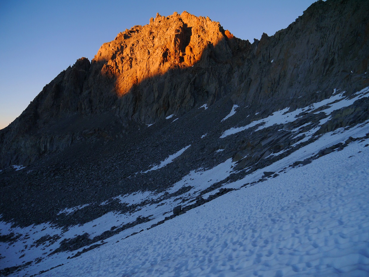
Swiss Arete viewed from Glacier Notch
| Peak | Elevation | Topographic Prominence | Summit Coordinates (lat/lon) |
|---|---|---|---|
| Mt. Sill | 14,153 ft | 413 ft | 37.095968, -118.503212 |
| Mt. Robinson | 12,967 ft | 387 ft | 37.117836, -118.517326 |
Getting to the trailhead: From Big Pine, turn west onto W. Crocker Street, which will soon turn into Glacier Lodge Rd. Travel 11 miles to the end of this road. This is the day use trailhead. The overnight parking lot can be found a half mile back on the north side of the road.
Trailhead coordinates (lat/lon): 37.128314, -118.427643
Adam and I began heading up the trail from the overnight trailhead shortly after 6am Saturday. Our plan was to climb the Swiss Arete that day, and bag a nearby peak Sunday morning before heading out (see map).
Big Pine Creek overnight trailhead
From the trailhead (7,680 ft), we took the trail 7.3 miles up the North Fork of Big Pine Creek past a few of the Big Pine Lakes to a spot shortly after Third Lake where the Glacier Trail branched off to the southwest, marked by a sign. From there, we took the Glacier Trail 0.9 miles to Sam Mack Meadow (11,000 ft). Shortly after reaching the meadow, a small trail branched off to the left, marked by a sign that simply read "trail." This trail meandered in a general southern direction, petering out 1.2 miles later at a spot approximately 0.5 miles NE of Glacier Lake. From there, we continued in a general SSW direction, aiming for a wide shallow saddle at the base of Mt. Gayley's northwest ridge known as "Gayley Saddle" (12,380 ft). We ended up setting up camp a short distance away on a large flat rock not far from the outlet of Glacier Lake.
views from South Fork Trail
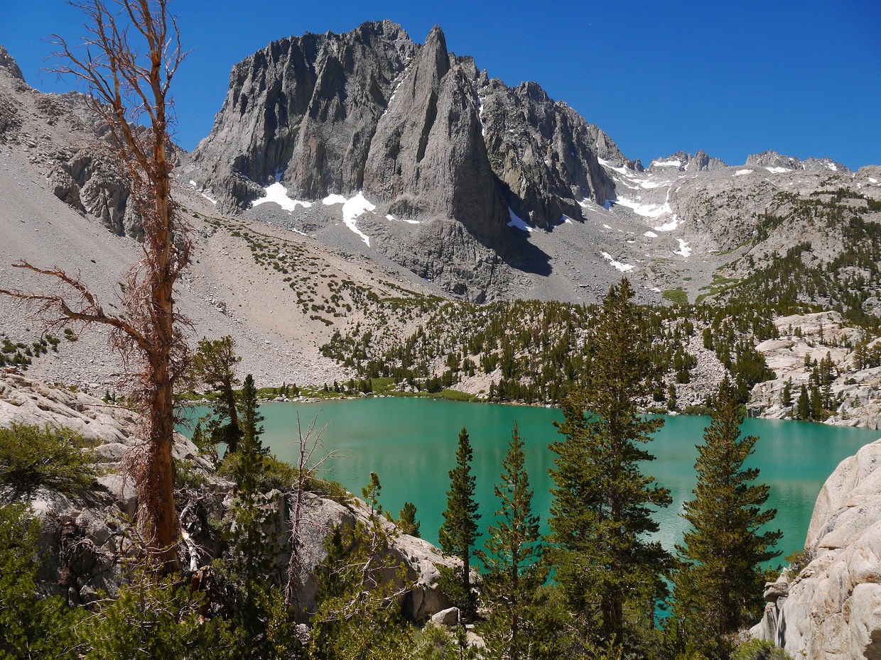
Temple Crag and Second Lake
Sam Mack Meadow
Big Pine Lakes seen from the trail above Sam Mack Meadow
heading towards Gayley Saddle
our route up Sill from camp, seen from Gayley Saddle
Glacier Lake
From Gayley Saddle, the key is to locate a large class 2-3 garbage gully heading up to Glacier Notch (13,150 ft). At first, the gully is not apparent, but as one heads south from Gayley Saddle, it will appear very clearly to the left (east).
looking up at the route from Glacier Notch (consult this photo topo for more detailed information on the technical section).
The standard start for the Swiss Arete begins at ~13,500 ft, about halfway up the North couloir. We chose to start lower down on the Arete at the ~13,300 ft level due both to a recommendation by someone who posted the route on Summitpost and our unwillingness to walk up the North Couloir with its slippery suncup-laden snow.
Shortly after we got onto the arete, the terrain quickly turned to class 4-5 rock which was pretty solid. We put on our rock shoes and scrambled up this terrain which turned out to be pretty fun.
After a few sections of low class 5 cracks, the ridge leveled out a bit for some fun class 3-4 scrambling.
The actual climb began as the ridge suddenly steepened. P1 (5.5-5.6) was a fun warm up to the route.
P1 ended at a large ledge just below a rock split by a large crack. P2 traversed a ledge to the right of this rock, then ascended some fun 5.7 cracks around the left corner to another ledge.
first half of P2
P3 started off similar to P2, but contained a slightly awkward 5.6 step-across at the start onto a ledge on the right side of the arete. From there, there were two options. Option 1 was to keep following the ledge to the right around a corner to the standard 5.7 crux crack. Option 2 was to climb a short 5.8 crack visible from the step-across. We ended up taking the second option.
afternoon shot of the Palisade Glacier
P3 ended at a great ledge split by several cracks. From there, the remaining two pitches were pretty simple and self explanatory. They involved mainly class 4 rock with a few low class 5 moves, and contained many possible variations.
P4 and P5 seen from the great ledge
We topped out on the summit of Mt. Sill less than an hour before sunset, both feeling fairly exhausted.
summit views
Our descent was via the standard North Couloir route. From the summit, we headed a few hundred feet down the southwest ridge to the ~13,900 ft level, where a cairn marked a small notch where we would turn right onto the northwest face. From the notch, a short class 4 downclimb led to a small semi-exposed ledge which headed across the northwest face to the notch between Mt. Sill and Apex Peak. From the notch, a quick slog down the North Couloir brought us back to Glacier Notch, at which we retraced our steps back to our camp near Glacier Lake.
walking across the ledge
sunset glow on Mt. Gayley
Sometime around midnight, we were awakened by two people on a ridge west of camp who were shouting and making whistling noises. We later found out that a member of their party had sustained a leg injury which prevented them from walking. The other two had hiked back down to their camp at Sam Mack Meadow to retrieve his overnight gear since the helicopter would not arrive till morning. All the yelling and whistling was from their attempts to locate him (see accident report).
The next morning, we were treated to a spectacular sunrise which lit up the surrounding Palisade peaks
We now had half of the day to do some peakbagging. Adam still needed to climb Mt. Gayley which I had climbed in 2012, and I still needed Mt. Robinson which Adam had climbed in 2008. We split off to climb our separate peaks, planning to meet back up either at Sam Mack Meadow or the trailhead.
From camp I headed in a general NNW direction across several tedious moraine fields and ledge systems to the outlet of Sam Mack Lake, which lay at the base of Robinson's east ridge.
looking towards Robinson from Sam Mack Lake
Sam Mack Lake
The east ridge of Robinson was your typical Sierra slog. It contained long bouldery slopes interspersed with short class 3 sections. I remained mainly on the left side of the ridge which looked to contain more solid rock. The last few hundred feet contained a short and exposed section of class 3 ridge.
summit views:
Palisade Glacier
Thunderbolt to Polenomium closeup
Mt. Agassiz
Sam Mack Lake and the north fork of Big Pine Creek
For the descent, I headed down a large gully which lay in between the east ridge and northeast ridge. The gully was a horrible screeish mess, and I wish that I could've just taken the east ridge back down.
looking down the gully
back at Sam Mack Lake
To get to Sam Mack Meadow from Sam Mack Lake, I descended a short distance south to a large creek drainage gully, and followed it downstream until it joined up with the meadow. At some point, this gully narrowed and was covered with unstable snow bridges with the creek flowing underneath. I stuck to the rocks, even when it meant downclimbing class 3 boulders with the creek flowing right on top of me. I emerged at Sam Mack Meadow sopping wet and feeling thoroughly refreshed.
Sam Mack Meadow seen from the top of the drainage
looking back at the drainage from Sam Mack Meadow
After a bit of lingering and snacking in the meadow, I headed down the North Fork Trail to the trailhead.
views from the hike out
Final Stats
23.9 miles
8,860 ft gain/loss
Weather Forecasts
Trailhead
Sam Mack Meadow
Palisade Glacier, Mt. Robinson
Mt. Sill
Peakbagger Pages
Mt. Sill
Mt. Robinson
Summitpost Pages
Swiss Arete
Mt. Sill
Mt. Robinson
Other
Swiss Arete (Mountain Project)
Swiss Arete (Supertopo)
High Sierra Topix message board


Fantastic beta, thank you very much for the thorough write up!
ReplyDeleteGreat write up, one of the best I've found - not too worried about the climb but a little concerned about the descent as I've read varying accounts with yours seeming very straight-forward and others having epics. Anyway, headed up that way tomorrow, hoping all goes well! Cheers!
ReplyDeleteThank you for sharing this valuable knowledge.
ReplyDeleteI've read a lot of blogs, but I've never seen anything quite like this. Furthermore, I'm grateful for the opportunity to introduce myself through your posts. All you've written has left me speechless. For an instance, I've bookmarked this for future reference because it's still really useful, even after many years. You have defined clearly about rock climbing in Switzerland, instruction & adventurous moments that we can enjoy. It's very good feel to be part of unique mountain adventures.
Awesome post , I’m going to spend more time learning about this topic see more about Robinson Helicopter
ReplyDeleteI was recommended this web site by my cousin. I am not sure whether this post is written by him as nobody else know such detailed about my difficulty. You are amazing! Thanks! learn more about the helicopters
ReplyDeleteI realise this is off topic but while your site looks nice, it could be far better if you’ll be able to use lighter colors too in the design. This will encourage a lot more readers come to check it out more often! an industry leader in helicopter manufacturing
ReplyDeleteI can’t really help but admire your blog, your blog is so adorable and nice . Robinson's social media
ReplyDelete