
May 31-June 1, 2014
Deerhorn Mountain and Mt. Stanford (south) are two thirteeners which lay on ridges bordering the Vidette Creek drainage, a large alpine canyon spilling out into the upper part of Kings Canyon. Mt. Stanford is often referred to as the "shyest peak in the Sierra" being that even though it is one of the Sierra's highest and most prominent peaks, it can only be seen clearly from a few neighboring areas. Gregory's Monument is a highpoint along Stanford's south ridge, which offers a short exposed class 3 traverse from Stanford. Deerhorn Mountain is the highpoint of the ridge northwest of Stanford. It contains what some refer to as some of the best class 3-4 routes in the Sierra, consisting of both solid rock and exhilarating exposure.
| Peak | Elevation | Topographic Prominence | Summit Coordinates (lat/lon) |
|---|---|---|---|
| Deerhorn Mountain | 13,281 ft | 650 ft | 36.713077, -118.410387 |
| Mt. Stanford | 13,973 ft | 1,014 ft | 36.703911, -118.395807 |
| Gregory's Monument | 13,911 ft | 131 ft | 36.701913, -118.395848 |
Getting to the trailhead
Trailhead coordinates (lat/lon): 36.772560, -118.341186
Our plan (see map) was to start from Onion Valley Trailhead (9,210 ft), taking the Kearsarge Pass Trail 4.7 miles to Kearsarge Pass (11,810 ft), then 3.9 miles down to Bubbs Creek (9,530 ft). From Bubbs Creek, we would take the JMT/PCT 0.5 miles south to intersect Vidette Creek, then leave the trail and head up Vidette Creek Drainage to the base (11,530 ft) of Deerhorn Mountain. After setting up camp at the base of Deerhorn, we would climb Deerhorn via either the northeast ridge, northeast buttress, or northeast couloir, then head back to camp. The next day, we would wake up early, climb Mt. Stanford via its north ridge, then descend to camp and head back to Onion Valley.
Tommey and I got somewhat of a late start from Onion Valley since Tommey's car failed to start while we made a stop in Lone Pine the previous night. In the morning, we walked over to the local towing company and found out it was simply due to a few loose connections.
We arrived at Onion Valley shortly after 10am and decided to stay with our original plan of tagging both Deerhorn and Stanford. It was a standard afternoon on the Kearsarge Pass trail with the usual crowds. It was amazing how much snow had melted off the area since I was there just one week earlier.
west side of Kearsarge Pass

Bullfrog Lake


looking down into the Bubbs Creek drainage


our eventual route up Vidette Creek Drainage (photo taken on September 13, 2014)

Upon reaching the junction in the Bubbs Creek Drainage, we turned left, walking for ~0.5 miles on the JMT to an open area (Vidette Meadow) containing bear boxes, then heading cross country south, crossing the roaring Bubbs Creek via a large fallen log. Once on the other side, we located a use-trail heading in a SSW direction up Vidette Creek drainage.
Vidette Meadow with East Vidette


crossing Bubbs Creek

The use-trail continued for a short distance before petering out just before Lake 10,500 ft (the large long lake just west of East Vidette). Above Lake 10,500 ft was a headwall which contained two prominent gullies, one on its left (east) side and another on its right (west) side. We took the left gully since it was covered with snow as opposed to the other one which looked to be a mix of snow and scree (aka. posthole party). This left gully deposited us a short ways above Lake 10865, the largest of the Vidette Lakes.
East Vidette looking not so mighty anymore

the left gully

both gullies (seen on September 13, 2014)

looking back at Lake 10,500 ft

Deerhorn seen from Lake 10865

From Lake 10865, a second headwall could be seen to the south. We surmounted this one by slogging up deep snow on its left side.
the second headwall (seen on September 13, 2014)

After the second headwall, we were pretty much at the base of Deerhorn. All three prominent northeastern routes were clearly visible. We set up camp and saw that it was 5:40pm and there were approximately 2 hours until sunset. That would allow us ample time to summit before sunset. We were sure to pack our headlamps, knowing that it would get dark sometime during the descent.
above the second headwall

Deerhorn


From camp, we slogged up the initial 400 ft of the northeast couloir, going through left over debris from an old avalanche and postholing with every step. As the postholing became worse, we found that we had wandered to the base of the northeast ridge (12,240 ft), and almost immediately decided that it was to be our ascent route.
base of northeast ridge

The first few hundred feet of the ridge found us slipping and sliding up a series of class 4 ledges. The climbing wasn't to difficult, but some of the cracks were filled in with ice which had us a little nervous. Eventually the slope angle lessened, and for the next several hundred feet (up to 12,800 ft), we zigzagged up a series of class 3 slabs. Some of these were coated with ice. Some were not.

At ~12,900 ft, both sides of the ridge suddenly dropped and we found ourselves on a short section of exhilarating knife-edge. Due to ice, we slowly scooted our way across it, arriving at what is considered to be the crux: a single step-across at the end of the knife edge. Both of us felt that the step-across was not to bad. The big thing that made it scary was exposure. We felt that the knife edge was trickier from a climber's perspective.
start of the knife edge


10-20 ft above the crux was a notch, which we scrambled up to and crossed over to the other side. From there, it was short and easy class 2-3 scrambling to the summit, which was awaiting us with a register and superb views in all directions. Since there were about 30 minutes remaining til sunset, we decided to remain on the summit to watch it, thinking that it was probably unlikely that anyone else had come across this unique opportunity before.

views from Deerhorn's summit


As the sun slowly sank below the horizon, we discussed descent options, and agreed that the northeast couloir would be the most obvious route. From the summit, we descended easy and somewhat loose class 2-3 terrain to the obvious lowpoint (13,130 ft) between Deerhorn and a slightly lower horn to the northwest. This marked the top of the northeast couloir.
looking northwest from Deerhorn

We strapped on our crampons and began kicking steps down the couloir. Due to a large snowdrift at the lowpoint, the initial ~40 ft of descent consisted of a 50 degree slope. After that, the slope leveled out to 30 degrees, and gradually lessened. The descent went without a hitch, and we were back at camp an hour later, happy to find that the snow had refrozen for the night and we were not postholing like we were a few hours earlier.
looking down the northeast couloir

Back at camp, we hastily ate dinner and crawled into our bags to warm up and sleep. It was a clear starry night with no clouds, and the temperature was dropping fast. We set the alarm to an hour before sunrise, wanting to get to Mt. Stanford the next morning before the sun broke out and turned the snow to postholing mush.
Sometime around 5:30am, we groggily crawled out of our bags without eating anything, and proceeded to grab our axes and crampons and proceed south, which we knew was in the direction of Deerhorn Saddle. Apart from the crunching of steps and occasional clanking of ice axe against rock, all was silent. The sky gradually lit up, and before long we were starting at the final 500 ft of gain to Deerhorn Saddle. Normally this section would be well buried under snow at this time of year, but due to a very dry winter, it was a mix of snow and mostly scree. Up we went, slipping and sliding over blankets of scree, gasping for breath once we had reached Deerhorn Saddle (12,635 ft). From there, we turned our attention east to the long ascending ramp in the direction of Mt. Stanford. For the next hour, we ascended this straightforward class 1-2 ramp which was a mix of sand and rock hopping, eventually arriving at a break in the ramp at 13,747 ft. From Google Earth, it looked like there was a sheer drop down the other side, but upon closer inspection we were able to locate one of several class 2 routes down to the lowpoint (13,680 ft) on the other side.
Mt. Ericsson

Deerhorn Mountain

Mt. Brewer

Kern Ridge and Kaweahs

looking down Vidette Creek Drainage

ascending the ramp towards Stanford

looking south from the break

From the 13,680 ft lowpoint, we continued south, ascending slightly west of the ridge crest up a shallow class 3 gully. The rock was rock solid and not a single hold broke loose. The only features which stymied us from time to time were little rivulets of ice. Above the shallow gully, we popped back up onto the main ridge, where the remaining distance to the summit was class 3. We stayed more or less on the ridge, bypassing a few small pinnacles.


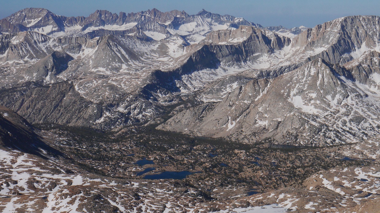
views from Mt. Stanford


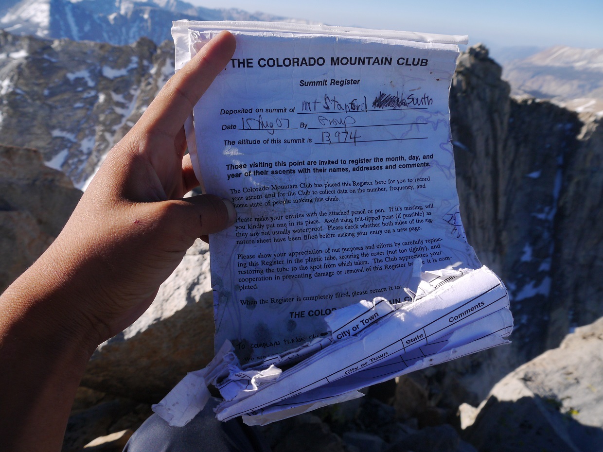
register
Looking south from Stanford, Gregory's Monument was just over 0.1 linear miles away. Since it was so close, I suggested us heading over to it, but because Tommey stuck strictly to the SPS list and didn't care about any other peaks, he declined. We remained on the summit for around 20 minutes, then broke off as Tommey headed back towards camp while I decided to tag Gregory's.
The standard class 3 route between Stanford and Gregory's drops about a hundred feet east of the connecting ridge. Because the ridge looked cool, I decided to traverse on it as long as possible and see what came of it. The initial descent between Stanford and the lowpoint before Gregory's was straightforward class 2-3. After that it got interesting. The ridge immediately turned blocky, and I was able to keep the route to class 4 by weaving around the blocks and making occasional short class 4 downclimbs. The main rule was: when in doubt, drop slightly down the east side, then resume traversing.


In all, it had taken around 20 minutes to traverse from Stanford to Gregory's. After digging around in the snow, I located a small can with a makeshift register. After signing it and snapping a few photos, I retraced my route back across the ridge, finding it even more enjoyable than the previous time through.
register on Gregory's

views from Gregory's


looking back towards Stanford

Mt. Ericsson and the Ericsson Crags

one last look at Gregory's from Stanford

From Stanford, I more or less retraced our route back to camp, finding much slushy snow. Tommey had already left camp by the time I got there, so I hastily packed up and headed down Vidette Creek Drainage, running into him less than an hour later. Our pace eased up as we descended the drainage. A few puffy clouds materialized, occasionally blocking out the beaming sun. By 5:30pm, we were back at Onion Valley, feeling pretty happy about the successful outing.


Final Stats
29.6 miles
12,660 ft gain/loss

Weather Forecasts
Onion Valley Trailhead
Kearsarge Pass
Bubbs Creek
11,100 ft in Vidette Creek Drainage
Deerhorn, Stanford, Gregory's
Peakbagger Pages
Deerhorn Mountain
Mt. Stanford
Gregory's Monument
Summitpost Pages
Deerhorn Mountain
Mt. Stanford
Other
High Sierra Topix message board
John Muir Wilderness
No comments:
Post a Comment