
May 24-26, 2014
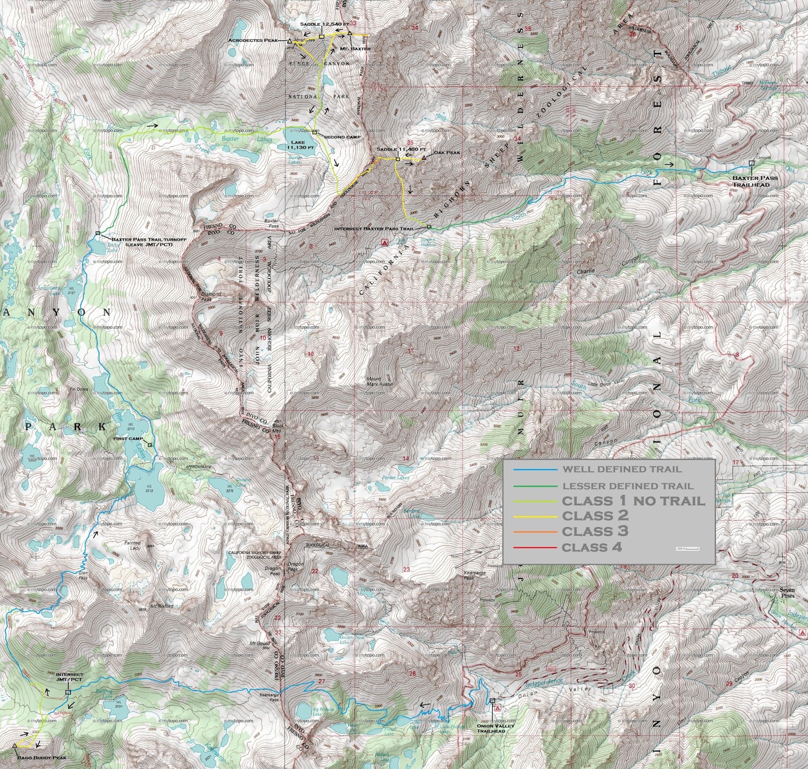
Over memorial day weekend, a group of us (Bill, Dagmar, Sung, Craig, and I) planned to do a 3-day backpack from Kearsarge Pass to Baxter Pass (see map). We planned to start from Onion Valley (9,210 ft), taking the Kearsarge Pass Trail over the pass and onto the John Muir Trail (JMT). From there, we would follow the JMT over Glen Pass and along the Rae Lakes, camping at Rae Lakes, then eventually splitting off from the JMT and onto the Baxter Pass Trail at a junction north of Dollar Lake. The Baxter Pass Trail heads up through Baxter Canyon and up and over Baxter Pass, then drops down into the north fork canyon of Oak Creek, ending at the Baxter Pass Trailhead (6,040 ft). We planned to camp the second night at the biggest of the Baxter Lakes, giving us a chance to climb Mt. Baxter and Acrodectes Peak.
| Peak | Elevation | Topographic Prominence | Summit Coordinates (lat/lon) |
|---|---|---|---|
| "Bago Buddy Peak" | 11,450 ft | 328 ft | 36.766254, -118.421309 |
| Mt. Baxter | 13,136 ft | 603 ft | 36.8619, -118.3653 |
| Acrodectes Peak | 13,182 ft | 1,339 ft | 36.860694, -118.375231 |
| Oak Peak | 11,709 ft | 259 ft | 36.845061, -118.35258 |
Getting to the trailhead (Onion Valley) coordinates (lat/lon): 36.772560, -118.341186
Getting to the trailhead (Baxter Pass) coordinates (lat/lon): 36.844856, -118.297698
After getting walk-in permits and setting up a car shuttle between the trailheads, the five of us headed up the Kearsarge Pass Trail. This popular trail stretched 4.7 miles with very gradual switchbacks from the trailhead (9,210 ft) to Kearsarge Pass (11,810 ft). It had snowed about a foot in the area a few days prior. Most of the new snow was gone, but lingering clouds kept us pleasantly cool on what otherwise would've been a sweaty march under the sun.
Onion Valley Trailhead

passing Gilbert Lake


looking south from a spot just below Kearsarge Pass

views west from Kearsarge Pass

Great Western Divide closeup

After taking a short break at the pass, we proceeded along the trail down the other side towards the JMT, staying right at a trail fork shortly after the pass. The trail intersected the JMT 2.6 miles after leaving Kearsarge Pass.
views from trail


While hiking towards the JMT, I noticed a small pointed peak 0.9 miles east of Mt. Bago which sported over 300 ft of prominence according to the topo map. This peak was located fairly close, so I decided to check it out, approaching its summit via its snow covered north face. I approached by walking up the slope (which was less than 30 degrees) to a small saddle just east of the summit, then following the ridge to the highpoint. The summit block contained an exposed class 3 move. Since this peak (along with Mt. Bago) hung almost directly over the Bubbs Creek Drainage, it contained excellent views into Kings Canyon and towards the Great Western Divide. I later dubbed this peak "Bago Buddy Peak" since it made up the eastern tip of Mt. Bago's east ridge.
my ascent and descent routes from Bago Buddy Peak

a smaller similarly shaped block just before Bago Buddy Peak's true summit block

view southeast from summit

south


southwest


west

northwest

After coming down from the summit, I had a little trouble locating the JMT due to snow coverage. I searched around for a bit, then realized that I was above it. Upon locating it, I headed up towards Glen Pass, meeting back up with the group about a mile below the pass.
East Vidette seen from JMT


Charlotte Lake

heading up to Glen Pass


spectacular views from Glen Pass


The north side of Glen Pass contained a fair amount of snow, prompting some of us to don crampons.


looking back up towards Glen Pass (our footprints can be seen on the left side of the image)

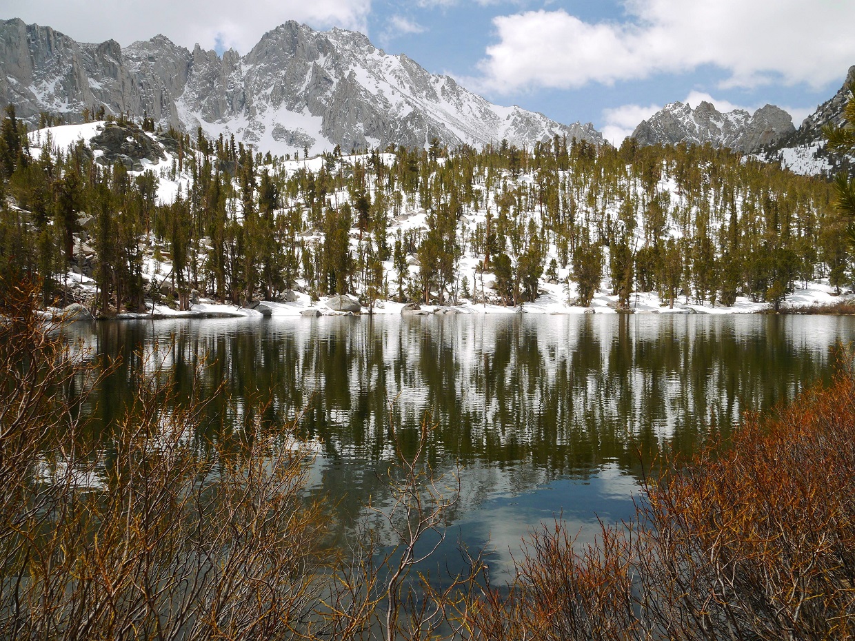
From Glen Pass, we continued on the JMT towards the Baxter Pass Trail junction north of Dollar Lake. Along the way, we passed by several of the very scenic Rae Lakes. We ended up camping on the east side of the second big lake (labeled as "WL 3212" on the topo map) at a very large flat sandy area.
nice afternoon lighting on Painted Lady


the first of the Rae Lakes


The next morning, we woke up bright and early and continued along the JMT.

Fin Dome

Arrowhead Lake


Dollar Lake


turnoff for Baxter Pass Trail

crossing the outlet of Dollar Lake

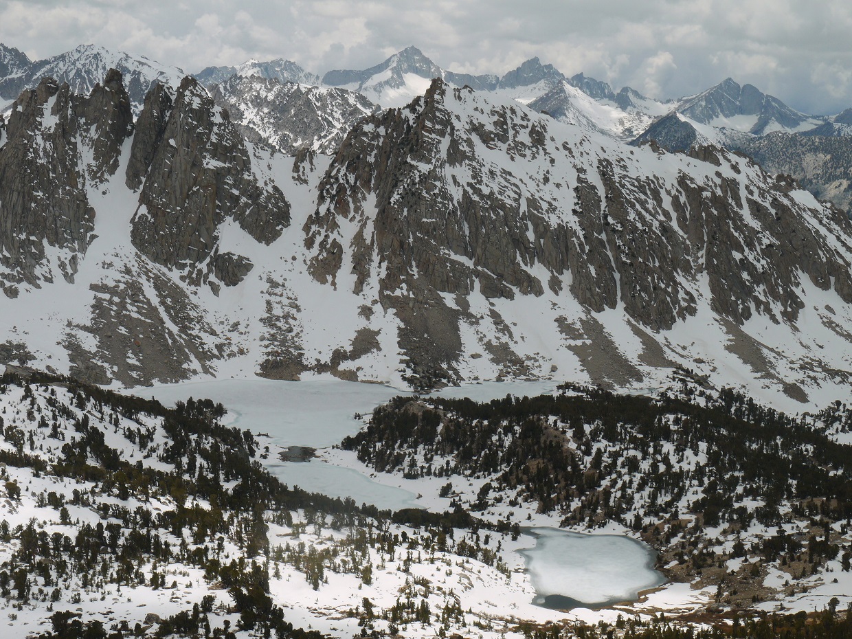
The unmaintained Baxter Pass Trail paralleled the JMT northwards for a short distance, then headed east up Baxter Creek canyon. For the first mile or so, the trail was poorly defined, but discernible. As the trail turned the corner into Baxter Creek canyon, it disappeared completely and we were not able to find it again. Even though there was no trail, the cross country up the canyon was very easy, weaving between several of the Baxter Lakes. Near the end of the canyon, we came upon the biggest of the Baxter Lakes (which I will refer to as Lake 11,130 ft). We ended up setting up camp in a grove of trees on the northeast side of this lake.
looking down into Woods Creek drainage

the Baxter Pass "Trail"

approaching Lake 11,130 ft

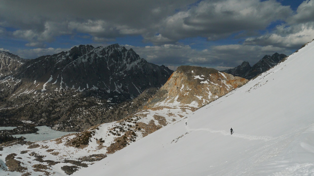
After setting up camp, we grabbed our daypacks and headed for Mt. Baxter and Acrodectes Peak, which were located a short distance north of camp. From camp, we headed north up a large talusy canyon to a saddle (12,540 ft) which separated the two Peaks. From saddle 12,540 ft, one could head east along the ridge to Mt. Baxter or west along the ridge to Acrodectes Peak.
view north from camp

fields of talus

view of Saddle 12,540 ft

We first decided to go for Baxter, heading up its west ridge. The ridge contained class 2 rock which was generally loose and unstable, but easy to negotiate. As the ridge merged into a large plateau at 13,000 ft, we ended up walking across the plateau and overshooting the true summit, which lay on the northwest side of the plateau.
ascending Baxter's west ridge

register

summit views


descending west ridge

route up Acrodectes east ridge

We descended back to Saddle 12,540 ft, and headed up the east ridge of Acrodectes Peak. The rocks on this ridge were generally solid, and we all felt that it was far more enjoyable than Baxter's west ridge.
We donned crampons for this small snowfield just below the summit.

the light gets better

We ended up spending quite a bit of time on the summit of Acrodectes both due to its incredible summit views and our surplus of daylight. We were not able to find a register despite our efforts to turn the summit inside out looking for one.
incredible summit views


On the southeast face of Acrodectes were several long snow gullies dropping into the canyon we had used to ascend to Saddle 12,540 ft. Since the snow was soft, we managed to glissade down one of these gullies, jubilantly descending over 1,000 ft of elevation in a few minutes. Now with numb butts and light-hearted spirits, we retraced our steps back to camp.
Craig leaping for joy

We arrived back at camp with plenty of daylight to spare, and spent the rest of the afternoon airing out our wet gear and trying to cram down as much of our remaining food as possible.
The next day, we packed up and headed up towards Baxter Pass. All we had to do today was get over the pass and descend to Baxter Pass Trailhead. I had previously heard of a scree gully shortcut to bypass Baxter Pass which was located along the Sierra Crest northeast of the Pass. Curious to see if this shortcut would work, I headed towards the crest while the rest of the group headed towards Baxter Pass. Once on the ridge, I could see the shortcut very well. There were several large class 2 scree gullies dropping down south into the north fork canyon of Oak Creek (the canyon containing the Baxter Pass Trail). It looked like I would be able to descend to 10,000 ft in no time.
Now with all that extra time, I thought about bagging an extra peak. To the northeast of where I stood was a pointy looking mass of rock. Upon consulting the map, I saw that it actually had some noticeable prominence (over 250 ft) which made it look more peak-like. This peak, which was located 1.3 miles SSE of Mt. Baxter, branched east off the Sierra Crest. I began heading northeast along the crest to a point just below another rocky mass (which I will refer to as "Point 12,257 ft"), and proceeded to traverse around it in order to attain the connecting ridge to the peak (which I later found out was named "Oak Peak")
view of Mt. Mary Austin from the Sierra Crest

route to Oak Peak

The traverse around Point 12,257 ft was horrible, containing multiple rotten ribs and gullies of loose class 2-3 rock. It probably would've been better to go up and over Point 12,257 ft instead of around it.
At last, the remaining terrain looks benign!

I descended to a saddle (11,460 ft) west of Oak Peak and dropped my heavy pack. From there, I simply followed the ridge east towards the highpoint. The last 100 ft or so of ridge before the summit contained some exposed class 5-ish looking moves which I did not want to try in heavy boots. I dropped slightly north (left) of the ridge and was able to bypass it with low class 4 terrain on generally solid rock.
class 4 bypass

The summit contained an interesting little Andy Smatko register which had not been signed for 42 years. I had no idea what Fotter Peak was, but guessed that it was a name they had dubbed for Point 12,257 ft.

view west from summit

south

I descended back to Saddle 11,460 ft and proceeded down a scree gully which dropped south from the saddle. This class 1-2 gully contained a few areas of pleasant boot skiing, but was mostly comprised of compacted sand and talus. The descent went quickly, and it wasnt long before I intersected the Baxter Pass Trail at 9,400 ft and met up with the group shortly after. As we descended lower, the Owens Valley heat began to feel increasingly intense. As always, the last two miles of trail were a seemingly endless slog, and we were glad to finally arrive at the trailhead in the 95+ degree heat.
tricky creek crossing

Final Stats
30 miles
11,000 ft gain/loss
Weather Forecasts
Onion Valley Trailhead
Kearsarge Pass
Rae Lakes
Mt. Baxter and Acrodectes Peak
9,000 ft along Baxter Pass Trail
Baxter Pass Trailhead
Peakbagger Pages
Bago Buddy Peak
Mt. Baxter (note: The coordinates and location of this peak on the provided map are incorrect)
Acrodectes Peak
Oak Peak
Summitpost Pages
Mt. Baxter
Other
High Sierra Topix message board
What a fantastic trip, and we love all the photography! Congratulations on pulling off the climbs, and the snow travel. Baxter is a heinous boulder slog indeed. Cheers, Ian and Lizzie Harlen.
ReplyDelete