March 2, 2014
Square Top is a prominent flat-topped peak located in the San Ysidro Mountains in the western Anza Borrego Desert. It contains an interesting 15ft class 5 summit block which can be climbed using the "meat anchor" technique.
A few miles to the southeast of Square Top is Hot Springs Mountain, which we planned on climbing afterwards. Hot Springs Mountain is well known for being the highest mountain in San Diego county, but attaining the summit would not be very interesting since almost the entire hike would be on a dirt road.
| Peak | Elevation | Topographic Prominence | Summit Coordinates (lat/lon) |
|---|---|---|---|
| Square Top | 4,469 ft | 549 ft | 33.360929, -116.514387 |
| Hot Springs Mountain | 6,533 ft | 2,633 ft | 33.315157, -116.579795 |
| Corral Benchmark | 6,407 ft | 247 ft | 33.30833, -116.556916 |
Getting to the trailhead (Square Top): From Warner Springs, head 10 miles east on Camino San Ignacio, then head NE on Tukwet Rd for about 2 miles to a dirt parking area overlooking Coyote Canyon. Much of Camino San Ignacio is dirt road, but negotiable with 2WD. 4WD is recommended for Tukwet Rd. Caltopo link
Trailhead coordinates (lat/lon): 33.324006, -116.511069
Getting to the trailhead (Hot Springs Mountain, Corral BM): From Los Coyotes Reservation Campground, head north on Sukat Rd/Hot Springs Mtn Rd. Drive as far up this dirt road as you wish, and follow it to the summit. Use the same Caltopo link as above.
Where we parked (lat/lon): 33.288351, -116.550848
Patrick, Craig B, Craig J, Sung, and I started hiking east down the road towards Cougar Canyon around an hour after sunrise. It was a cool damp morning, with the Santa Rosa Mountains to the north looking nice and shiny under a coat of fresh snow.
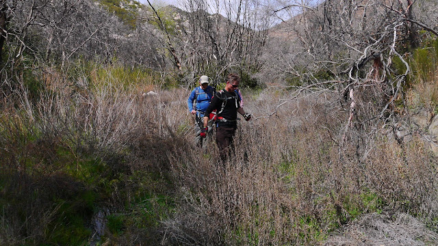
Upon reaching Cougar Canyon, we continued north, following the creek. Pretty soon, the road had disappeared and we found ourselves doing some light bushwhacking from time to time.
As Cougar Canyon began curving in a more northeastern direction, we left the canyon and continued in a general NNW direction (see map). The map indicated a dirt road which would take us just south of Sheep Canyon. Evidently the map was old, and much of the road no longer existed. We would hike on bits and parts of road, interspersed with sections of light bushwhacking.
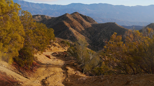
From our vantage point south of Sheep Canyon, we obtained a clear view of Square Top to the north.
After dropping a few hundred feet into Sheep Canyon, we began the short and surprisingly enjoyable sand/rock slog up the south side of Square Top. There were a multitude of possible routes, all of them class 2.
weirdly colored water in Sheep Canyon
ascending Square Top
Now came the highlight of Square Top- the summit block, which was a easy but cool-looking 15 ft class 5 friction climb. Craig got out the rope (30m/8.5 mm) and we all began rummaging around in our packs for our harnesses. We climbed the block one by one using the classic meat anchor technique. We threw the rope over the block and had the belayer stand on its south side since the climbing route was on its north side. After surmounting the block, the climber would simply lean back and get lowered by the belayer. It was pretty much like doing a short toprope at the climbing gym.
the summit block
Patrick utilizing his spidey senses
views from the summit
We enjoyed the summit and played around with the block for roughly an hour, then retraced our steps back to the trailhead.
After getting back to the trailhead, Craig B and Patrick decided to head off for Pike and Cody benchmarks. The remaining three of us decided to head for Hot Springs Mountain. The summit of Hot Springs Mountain can be reached by hiking up a dirt road on its south side. As we hiked up the road, the low clouds dipped down, giving the area a lush rainforested appearance that is not often seen in San Diego county. Near the summit was an old fire lookout tower which was no longer in operation. To the east of the tower was the true summit, which could be reached via a slightly bushwhacky use-trail. Surmounting the summit block required a short scramble up a narrow class 2-3 crack which was interesting to climb while wet. There was a small summit register which was sopping wet and impossible to sign.
heading up the road
lookout tower near the summit
use-trail to the true highpoint
scrambling up the summit block
benchmarks
On the way down from Hot Springs, we decided to tag Corral Benchmark, which was a short distance east of the road. We ended up doing a short but somewhat nasty bushwhack up the west side of the hill containing Corral. Little did we know that there was a nicely defined trail/firebreak to the south.
After Corral, it began getting dark, so we headed back down and called it a day. It had been another fun day exploring some of the hidden nooks and crannies of eastern San Diego.
Stats for Square Top
7.2 miles
2,660 ft gain/loss
Stats for Hot Springs Mountain, Corral Benchmark
7.7 miles
1,800 ft gain/loss
Weather Forecasts
Peakbagger Pages
Summitpost Pages


No comments:
Post a Comment