
March 2, 2013
The Sheep Hole Mountains are a Mojave Desert range located approximately 25 miles northeast of Joshua Tree National Park. The highpoint of the range (Sheep Hole Mountain, 4,613 ft) boasts 2,218 ft of prominence, indicating a high possibility of awesome views from its summit. Because of its easy accessibility compared to other surrounding desert peaks, Sheep Hole Mountain is a relatively popular destination for local peakbaggers.
I was planned to climb Sheep Hole Mountain with a group of seven that day. Since they didn't plan to start until 9am, I had interests in getting up early and climbing Sheep Poop Mountain (3,770 ft), an unofficially named peak in the Bullion Mountains a few miles west of the Sheep Hole range. Sporting approximately 950 ft of prominence, Sheep Poop Mountain by far surpasses the USGS requirement of a peak as having at least 300 ft of prominence.
Getting to the trailhead: From Twentynine Palms, travel east on CA-62. After 7 mi, turn left onto Godwin Rd. Travel 2 mi, then turn right onto Amboy Rd. Continue 16 mi to a spot shortly after Sheep Hole Pass. A prominent radio tower (and a short dirt road leading up to it) will appear to the right. Take this dirt road (2WD accessible) to an open lot at the base of the tower.
Trailhead coordinates (lat/lon): 34.239481, -115.720826
After a pleasant night camped near the trailhead under the stars, I set off for Sheep Poop Mountain sometime between 5-5:30 am. The first ~2.5 miles involved walking northwestward on the desert floor. From the trailhead, the Bullion Mountains looked like one solid clump of mountains, so navigation was very important in locating the correct points to aim for. As I came closer to the mountains and was able to distinguish one peak from another, I aimed for a gap southwest of the southwestern bump labeled "825T" on the Topo map (see map at bottom of page). After the gap, I turned west and continued hiking along the desert floor into a "cove" with mountains on three sides. Shortly after entering the cove, the mountains closed in so that the desert floor ended at a small canyon that angled northwest. Since this canyon is insignificant and unnamed, I will refer to it as "Canyon SPSE1" (short for "Sheep Poop Southeast Canyon #1). I followed Canyon SPSE1 up for 0.2 mi northwest before it ended abruptly on the desert floor southeast of Sheep Poop Mountain. From there, a false summit of Sheep Poop Mountain was visible.
dawn in the Bullion Mountains

looking up Canyon SPSE1

View of Sheep Poop Mountain from the head of Canyon SPSE1

From this point on, the routefinding would be easy. I headed directly up Sheep Poop's East Slope and onto its summit ridge. Like most terrain in the Bullion Mountains, the East Slope was composed of loose compacted sand. The climbing itself did not surpass an easy class 2.
dramatic sunrise on Sheep Poop's East Slope


As I came to the false summit, a spectacular sunrise was in full blast. I stopped for a few moments to snap some photos before continuing on to the true summit.


From the false summit, I set off northwest along Sheep Poop's prominent Southeast Ridge in a class 1 traverse, reaching the summit (3,770 ft) at 6:38 am.
looking northwest from false summit

getting close to the true summit

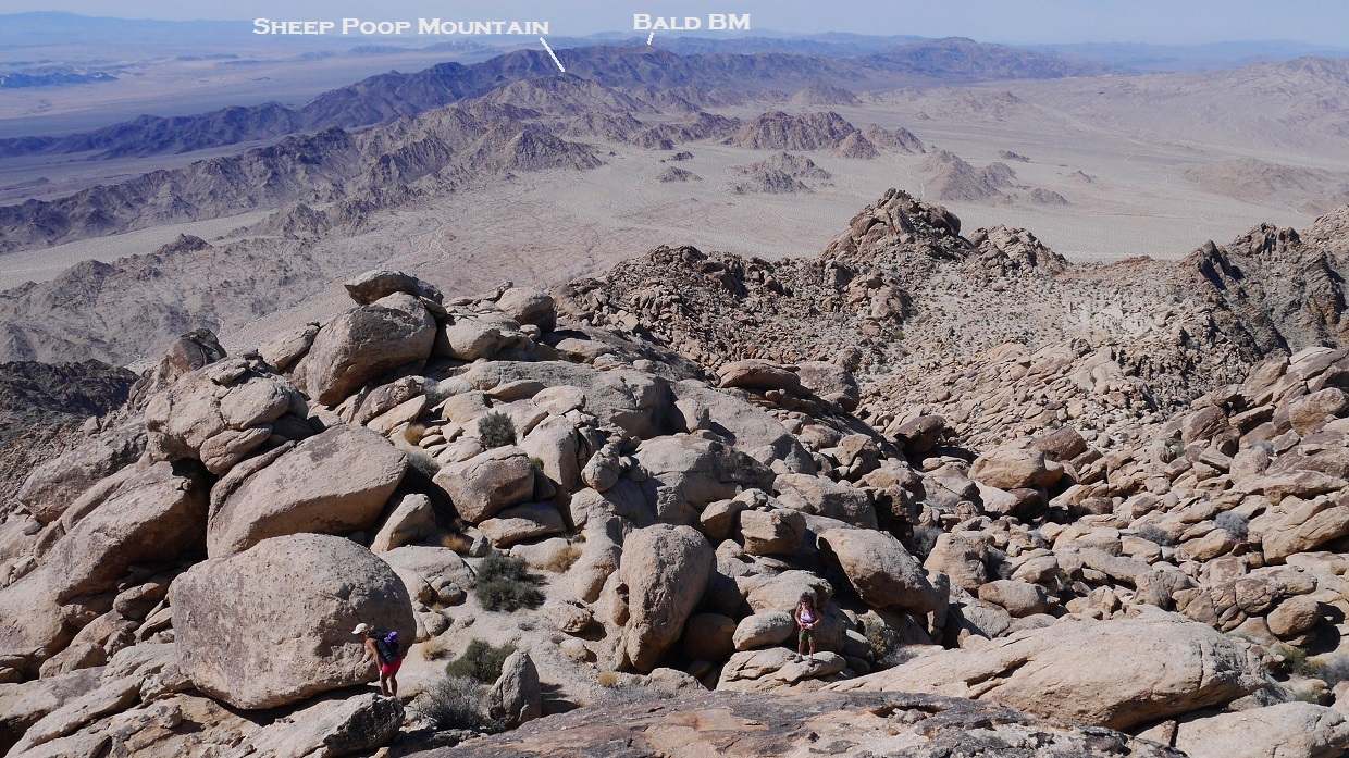
view north from summit


northeast

southwest

register

After about 45 minutes on the summit, I headed down back the way I came, jogging the steady downhill incline of the desert floor.
last photo before leaving the summit area

looking east from the head of Canyon SPSE1

This is my route to Sheep Poop Mountain viewed from the east (note: Because I had camped the previous night at a spot south of Sheep Hole Mountain TH, I started from there. It does not matter which one of those trailheads are used).

After getting back at 8:30 am and stuffing down a quick breakfast of ramen, I headed over to the Sheep Hole Mountain Trailhead to meet with the group. The general directions to reach the summit of Sheep Hole Mountain were very simple: get up onto the main ridge, then turn right and follow the ridge to the summit.
We began hiking towards Sheep Hole Mountain at around 9am, aiming for a canyon that headed up the mountains east of the trailhead. Upon reaching it, we took a left fork that headed towards the left side (north) of Point 4,280 ft. We would later descend using a fork to the right (south) side of Point 4,280 ft which was faster and contained better terrain than our ascent route.

looking up from the base of the main canyon

We climbed up the left forking canyon at a leisurely pace, enjoying its solid rock and dry waterfalls. Though the route could be kept all class two, there were many short and fun class 3 variations.


odd rock formation

Upon reaching a saddle on the main ridge north of Point 4,280 ft, we turned right (south) and continued following the main ridge. This involved some very fun class 2-3 climbing with many possible variations.

As we passed below Point 4,280 ft, I quickly scrambled up to it out of curiosity. From its summit, Sheep Hole Mountain was visible to the southeast. I noted a wooden stake propped up on Point 4,280 ft's summit with a empty glass jar below it- perhaps the remnants of an old register.
view southeast from Point 4,280 ft

west

We continued southeastward towards the summit on class 2 rock with occasional class 3 moves. A small plateau was present immediately northwest of the summit. From this plateau, there were two ways to get up to the summit. We ascended directly up the summit's northwest side which contained some large and fun class 3 boulders. These boulders looked simple from below, but required some negotiation. We would later descend southwest off the summit on an easy class 3 route with smaller rocks before heading north and hooking back onto the plateau.
looking back at Point 4,280 ft

view of summit from plateau

The first few of us reached the summit (4,613 ft) at 1:40 pm. A spectacular view of rugged peaks spread out in all directions. A large ammo box register was present, filled with several books and scraps of paper. The oldest scrap dated back to 1983.
summit block

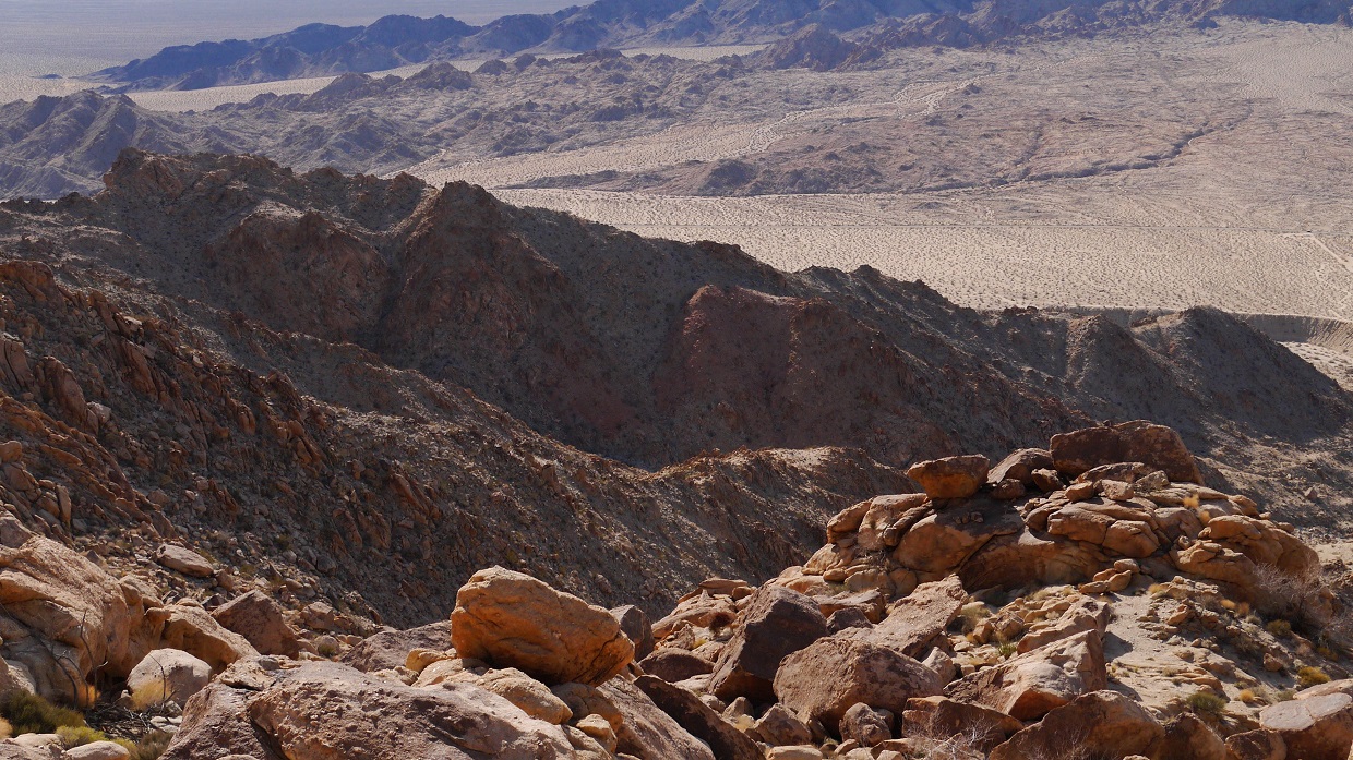
view northwest from summit

north

east

southeast


southwest

west

mini history lesson

We began began descending from the summit at 2:20 pm (using the descent route mentioned earlier). Upon reaching the south side of Point 4,280, we headed directly down a canyon to the west of it.
views from descent


view of the Sheep Hole Mountains while heading back on Amboy Rd

Final Stats
Sheep Poop Mountain: 7.2 miles 1,750 ft gain/loss
Sheep Hole Mountain: 4.9 miles 2,800 ft gain/loss

Weather Forecasts
Trailhead
Sheep Poop Mountain
Sheep Hole Mountain
Peakbagger Pages
Sheep Poop Mountain
Sheep Hole Mountain
Great description! Thanks. Which peak was more challenging?
ReplyDeleteGreat writing! Thoroughly enjoyed reading this!
ReplyDeletewas the weird rock with the girl in it the mountains namesake?
ReplyDelete