
March 31, 2013
Leatherneck Ridge is a prominent ridge on the north side of the San Jacinto Mountains. It was recommended to me by a friend while we were hiking up the nearby Skyline trail. Leatherneck is commonly seen by hikers on Skyline, but gets fewer visitors because of the lack of a trail. There are several ways to climb this ridge. The shortest, steepest route that requires least elevation gain starts at the lower (Valley Station) of the Palm Springs Aerial Tramway at 2,400 ft elevation. This is the route Dagmar and I took on this particular hike. There are several other subsidiary ridges one can use to access this ridge which start from Hwy 111. The variation with the most elevation change starts at 760 ft of elevation. The variation that is longest and most gradual starts at Windy Point at 1,060 ft. All the options interest me, and I am planning to check them out soon.
Getting to the trailhead (from the west): Take I-10 east, 6 miles past Cabazon, and turn right onto CA-111. Travel 8.5 miles on CA 111, then turn right onto Tramway Rd. This road is very well advertised. Travel 3.5 miles to the lowest parking lot on the right. Start here.
Trailhead coordinates (lat/lon): 33.841065, -116.612402
Dagmar and I parked at the main parking lot at the lower tram station and walked down to the lowest parking lot for the start of the route. The lowest parking lot had a "closed" sign at the entrance and we didn't want to risk getting towed. We started at 6am just as the sky was lighting up. It was a nice clear day with temps in the high 50s at the start. At the trailhead, temps were expected to rise up into the high 80s, and we wanted to be high up on the ridge by then.
A 20 ft drop and a creek crossing separate the parking lot from the bottom of the ridge. It required a few minutes of very light bushwhacking. We had expected to run into some poison oak, but encountered none. The climbing starts immediately after the creek crossing. It is steep, but nothing I would consider tricky in terms of technical difficulty. I didn't remember anything past class 2.
800 ft above Valley Station

Dagmar climbing

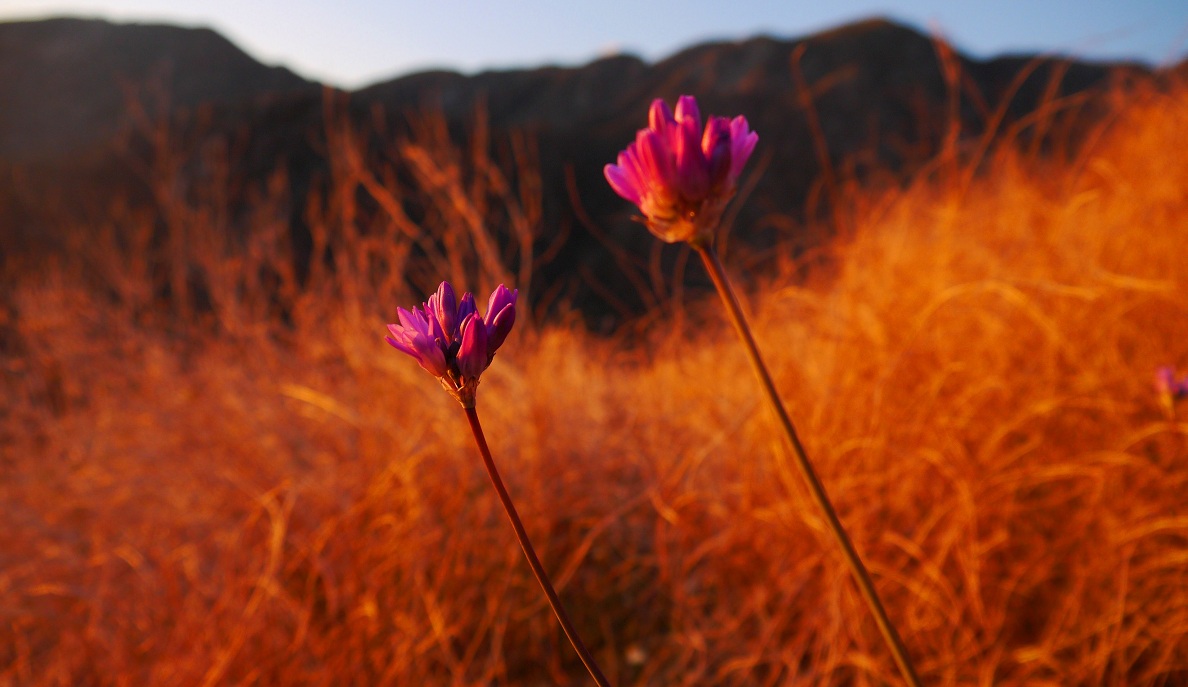
nice glow

The terrain was much like this for the first 2,700 ft of gain.

alpenglow


getting closer to the main ridge (photo taken at 4,000 ft)

views


The steepest part of the entire hike was the 1 mile and 2,700 ft gain stretch between the creek crossing and junction with the main ridge.
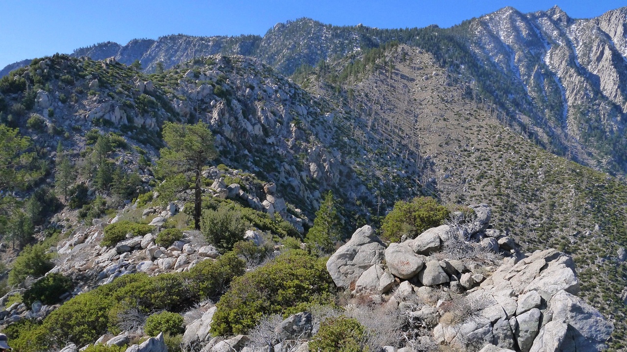
The terrain gets dramatically more gentle on the main ridge

San Gorgonio


At 6,100 ft the first pine trees started appearing.


Leatherneck Ridge consists of two main sections of bushwhacking. Both sections are short and the bushwhacking is nothing bad. The first section lasts 0.3 mi between 5,800 ft and 6,400 ft.
view from first bushwhacking section

After the first bushwhacking section, the bushy slope turns into a nice, grassy one, which lasts for 0.45 mi between 6,400 ft and 7,420 ft.


At 7,446 ft we topped out on a bump. This is where the ridge we ascended meets up with the Windy Point ridge from Hwy 111. There was an amazing view of Mt. San Jacinto's north face from here.


From here, there were a series of minor bumps all the way up to the upper plateau of Mt. San Jacinto (8,600 ft). We quickly figured out that it was easier to go up and over every bump rather than around them. It significantly reduced bushwhacking and sidehilling. Immediately after the 7,446 ft bump, the second section of bushwhacking began. It lasted for 0.5 mi and ended at 7,600 ft at the slope of a bump, three bumps away from the 7,446 ft one. It was easy to recognize that bump as its slopes displayed signs that a fire had come through the area.
view further up the ridge while descending bump 7,446

The views just kept on getting better.


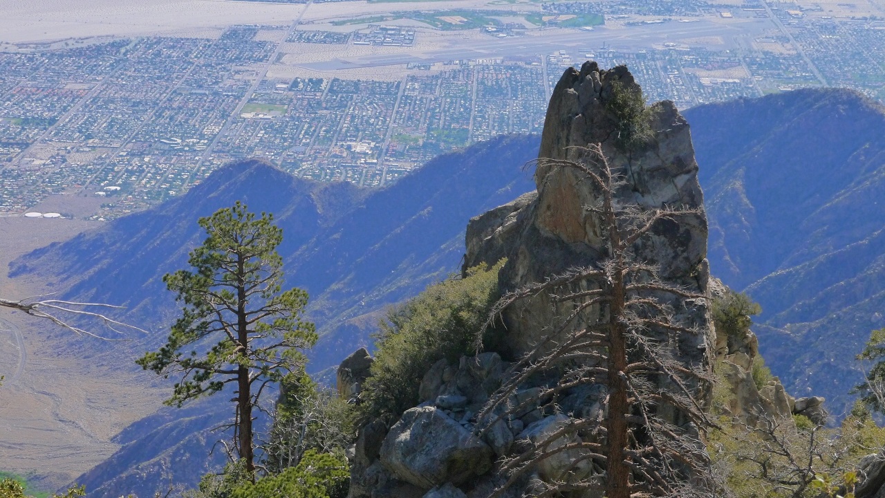
Finger Rock

what Skyline looks like from Leatherneck

backside of Finger Rock
nearing the end of the second section of bushwhacking


From the end of the second section of bushwhacking, there were 1.14 miles remaining until the Upper Plateau at 8,600 ft. The amount of pine trees greatly increased, providing some much wanted shade.


We started running into snow at 8,100 ft. Most of it was avoidable. There were a few strong class 2/low class 3 moves, but they were also avoidable. Overall, I would consider Leatherneck Ridge class 2.


looking back at our progress

getting closer to Harvard Peak (the leftmost bump)

We topped out at 8,600 ft and headed towards a saddle. From the saddle, we could see Harvard Peak (9,550 ft) and a false summit of Yale Peak. We dropped into a gully separating the two peaks and headed towards the right, reaching the summit at 12:34 pm.


class 3 summit block of Harvard Peak

view southeast from Harvard Peak

west

We had lunch on Harvard Peak. The weather was perfect: in the high 50s with a slight breeze. Dagmar said that she was going to start heading back towards the tram and climb Yale Peak along the way. I headed off towards San Jacinto Peak just before 1pm. We planned to meet back at the tram at 4pm. From Harvard Peak, I headed west to a saddle between Harvard and Cornell Peak, then dropped down into Tamarack Valley and onto the Sid Davis Trail. The trail was mostly covered by snow, and I would periodically find and loose it. Eventually I gave up finding the trail and headed for the base of Jean Peak, where the Sid Davis trail joins the main San Jacinto Peak Trail. The snow was soft and I was postholing up to my knees in some areas. The main trail turned out to be free of snow, allowing me to jog up the gradual incline at a steady pace. When I reached Miller Saddle, I broke off from the main trail and decided to take a shortcut on a east ridge of San Jacinto Peak (aka. "Ellen's Shortcut" and "The Winter Route"), which I had done several times before as snowshoe hikes. This turned out to be a bad decision. The snow was really soft and every step was a knee deep posthole. It took me over 20 minutes to get to San Jacinto Peak from Miller Saddle.
I reached the summit of Mt. San Jacinto at 2:20 pm. It was one of those nice days when the summit was above the clouds which looked like giant puffy cotton balls. The temp was around 40 degrees and there was a slight 15 mph breeze. I took some pictures, drank some water, and started jogging back down the main trail.


After turning off the main trail and back onto Sid Davis, it was more postholing until Tamarack Valley, where the snow ended. I made it to the tram station at exactly 4pm. The entire hike had taken slightly over 10 hours. Leatherneck Ridge is a highly fun and awesome route, and I highly recommend it to anyone with a sense of adventure.
Final Stats
11.5 miles
9,800 ft gain

Weather Forecasts
Trailhead
Halfway up Leatherneck Ridge (4,950 ft)
Palm springs Aerial tramway upper station
Summit of Mt. San Jacinto
Peakbagger Pages
Mt. San Jacinto
Summitpost Pages
Mt. San Jacinto (although Leatherneck Ridge is not mentioned, there are many other good routes that head up the same mountain)
Other
Mt. San Jacinto message board
Webcam at 8,000 ft elevation near upper tram station
Palm springs Aerial tramway website
Epic, simply Epic!
ReplyDeleteYou can also can access the ridge from behind the pumping station at the bottom of main parking lot if you're looking for extra fun.
ReplyDelete