
August 8, 2015
Shepherd Crest is a 4-mile ridge extending from the Sierra Crest to Virginia Canyon in Eastern Yosemite. The two eastern miles of Shepherd Crest are heavily serrated, making it look fun (and/or scary) to climb. Both east and west highpoints were goals for day 2 of the 2015 Sierra Challenge, alerting many of us to the existence of this more obscure and interesting part of the Eastern Sierra.
| Peak | Elevation | Topographic Prominence | Summit Coordinates (lat/lon) |
|---|---|---|---|
| Shepherds Crest East | 12,020 ft | 560 ft | 38.0047, -119.3124 |
| Shepherds Crest West | 11,900 ft | 560 ft | 38.0156, -119.3275 |
Getting to the trailhead: Park at the Saddlebag Group Campground just east of the dam.
Trailhead coordinates (lat/lon): 37.964484, -119.272137
Since it was the first Saturday of the challenge, this was a very popular day, with over 20 participants heading to Shepherd Crest alone. The sun rose at 6am as we took a trail along the west side of Saddlebag Lake, lighting up Excelsior Mountain which stood out prominently to the north.

From the north side of Saddlebag Lake, we followed a series of well defined trails northwest to Steelhead Lake. Shortly after Steelhead, the well defined trail turned into a series of use-trails zigzagging in several directions. We soon lost the use-trail we had utilized, and simply made a beeline for Shepherd Crest East, which lay to the northwest. There was some easy class 3 to get up a small headwall onto the Sierra Crest, but other than that it was pretty standard Sierra rock hopping. By 7:50am, the first of us had reached the summit of Shepherd Crest East. It had quite a unique view. I was able to pick out several of the crags jutting out of Tuolumne Meadows as well as Half Dome to the southwest.
North Peak

one of several tarns above Steelhead Lake

cross county views


small headwall before Sierra Crest


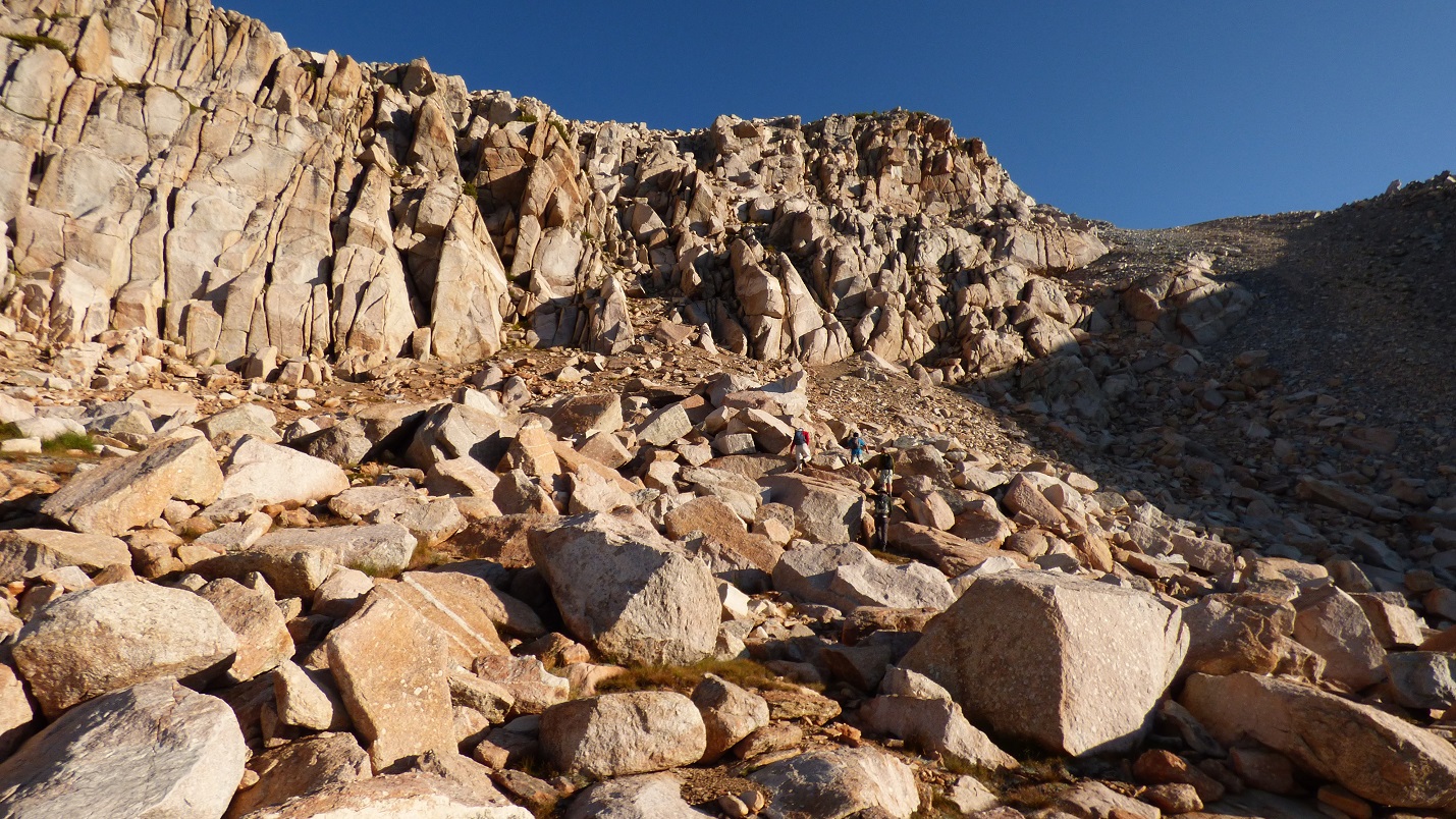
last bit of slog to Shepherd Crest East

summit of Shepherd Crest East


looking northwest
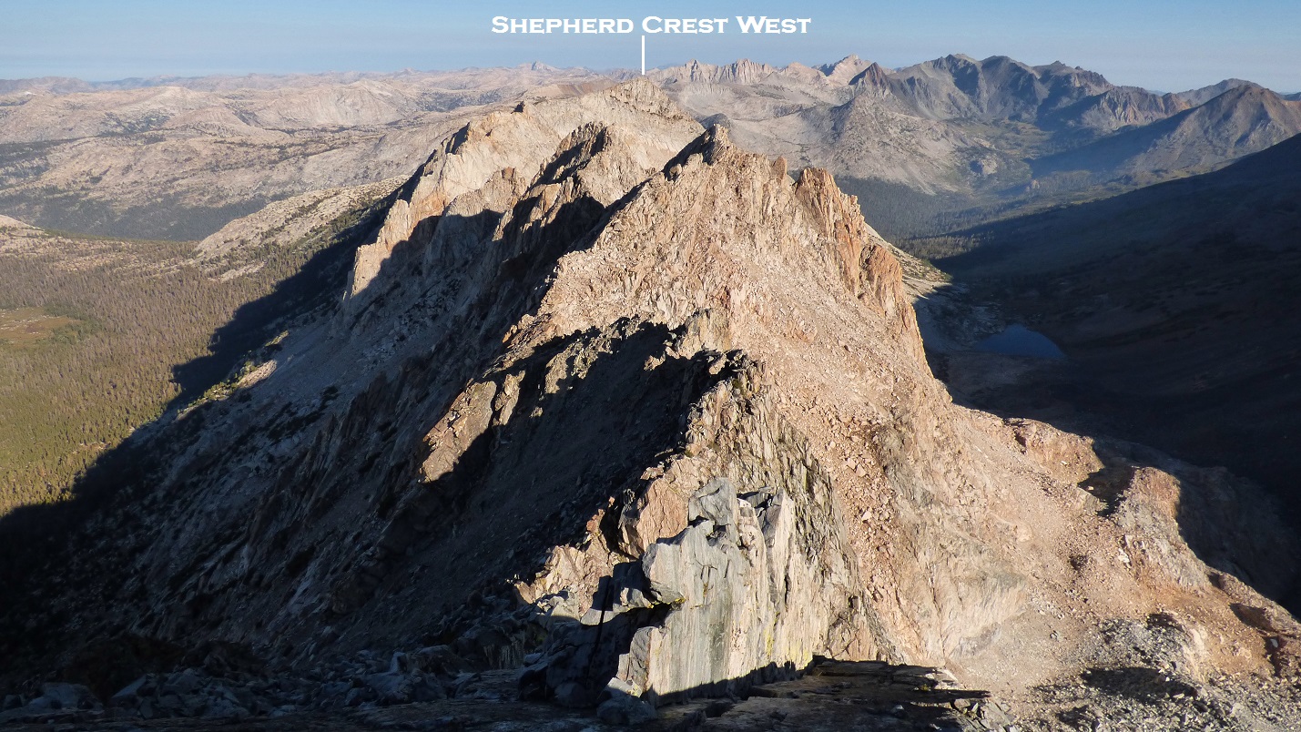
Roughly 1.2 linear miles northwest was Shepherd Crest West. In between lay the serrated ridge I had been told about. It looked fun, and I decided to just go ahead and check it out. Everyone else was content on going around the ridge to the west and then ascending east back up to Shepherd Crest West, so I set off along the connecting ridge solo.
The ridge was defined by five prominent towers. The first one was class 3-4 with excellent rock quality. Sometimes the tops of the ridge would get too blocky, and I was able to drop a few feet to the west on class 4 cracked slabs. This really was great rock, and I wondered why people didn't climb here more often. Surmounting the third tower required a short but exposed class 5.6-5.7 move. It was only after I made the move that I realized I was having too much fun and had broken my personal rule for not climbing anything harder than 5.4 without a rope and protection. I made a mental note of this, and continued along the ridge, vowing to back down should I encounter anything harder than 5.5.


The fifth tower/pinnacle was what finally put a stop to my little ridge ramble. I shimmied up a 5.5 crack on its eastern side, topped out, and found the other side to at least 5.7 which would require a rappel. Because I did not have rappel gear with me, back down the 5.5 I went.

5.5 crack

From the notch east of the fifth tower/pinnacle, I descended north down an obvious class 3 escape gully, which contained the expected scree and other loose crud of sorts. Once in the moraines north of Shepherd Crest, I was able to contour northwest, paralleling the crest, until I found some convenient class 3 shortly before Shepherd Crest West which allowed me to hop back onto the crest. I hit the summit of Shepherd Crest West at 10:40-ish to find Bob and a handful of others there, perusing over an interesting register which dated back to 1933.
class 3 escape gully (crud)

class 3 back onto crest (fun)


Shepherd Crest West summit views


register

Having had enough exposed ridge for the day, I followed Bob and friends back the way they had came. From the summit, we descended a small sandy valley (which actually had a name: Little Lost Valley) southwest to where it funneled south into a steeper and narrower chute full of compacted sand. We were careful not to knock down any debris as there were still others ascending the same chute.
Little Lost Valley

inside the main chute

looking back up at the chute

As the chute eventually spit us out on the west side of Shepherd Crest, we naturally separated from eachother, with each of us taking what we thought was the most efficient contour back southeast. Like most Sierra contours, it was somewhat tedious, but very scenic.

Eventually I reached the pass between Shepherd Crest East and North Peak to meet up with Robert, who was trying hard to power up and over the pass as fast as possible.

Shortly after the pass, we arrived back at Steelhead Lake and the trail we had taken earlier to get there. Since both of us were in jogging mood, we jogged the rest of the way back to the trailhead, arriving sometime after 1pm. I laid down under some trees and relaxed as other participants slowly trickled back, watching cumulus clouds slowly build over the Sierra Crest. Eventually some of them would produce rain several hours later, but for now they were the tame puffy type.


Final Stats
14 miles
5,700 ft gain/loss

Weather Forecasts
Trailhead
Shepherd Crest
Summitpost Pages
Shepherd Crest East
Peakbagger Pages
Shepherd Crest East
Shepherd Crest West
Other
Bob Burd's trip report
No comments:
Post a Comment