
June 19-21, 2015
After traversing the Glacier Divide for the previous three days, I immediately headed back to the Sierra to join another party which was headed for Mt. Goddard via Starr's Route. Mihai, who had organized the trip, wanted a "guide" for Starr's Route. His plan was to do the route as a 3-day trip. We would hike to Evolution Lake on day 1, do Starr's Route on day 2, and hike back out on day 3. Because I had already climbed Mt. Goddard in 2012, I planned to do Starr's Route with them, then divert north to climb an interesting looking unnamed peak which I had noticed in 2012. I later dubbed this peak "North God."
| Peak | Elevation | Topographic Prominence | Summit Coordinates (lat/lon) |
|---|---|---|---|
| "North God" | 12,964 ft | 504 ft | 37.116013, -118.722365 |
| "Wanda Peak" | 12,434 ft | 534 ft | 37.122172, -118.738947 |
| "Davis Rock" | 11,462 ft | 255 ft | 37.127886, -118.729548 |
| "Sky High Peak" | 12,978 ft | 174 ft | 37.196971, -118.664253 |
Getting to the trailhead
Trailhead coordinates (lat/lon): 37.230710, -118.618828
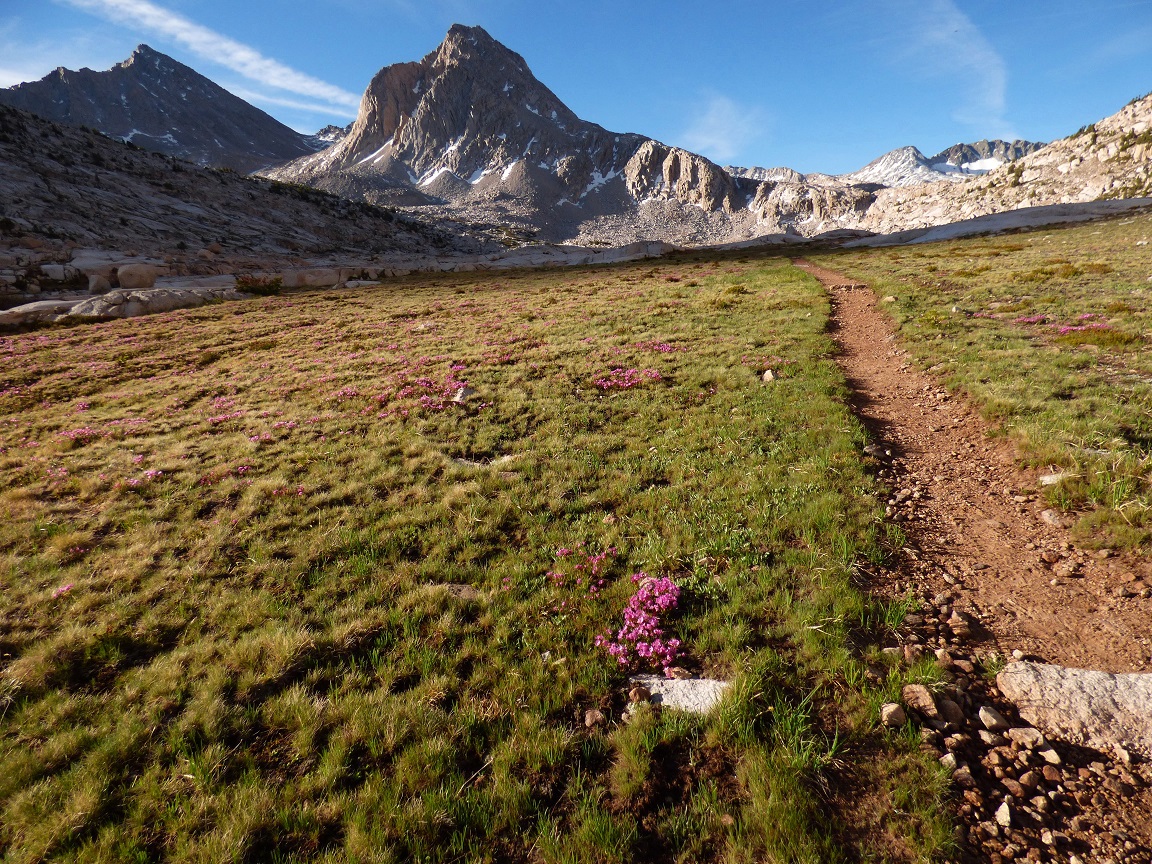
Alberto, Inga, Mihai, Dale, and I began hiking up the Lamarck Lakes Trail from North Lake (9,360 ft) at around 8am, starting off at a very relaxed and steady pace. After walking from the overnight parking lot to the trailhead, we took the Lamarck Lakes Trail 2.5 miles to a point just before the outlet of Upper Lamarck Lake (10,940 ft), then split off to the left (south), following a use-trail which would take us up to Lamarck Col in another 2.5 miles.
view from the Lamarck Lakes Trail

The trail to Lamarck Col was pretty easy and straightforward. After switchbacking up a slope to the south of Upper Lamarck Lake, it curved southwest up a broad valley which would basically terminate at Lamarck Col. Shortly before Lamarck Col, the trail became faint, but the navigation was easy because all we had to do was keep hiking up the valley.
heading up towards Lamarck Col


Below the col was a patch of lingering snow, which took a few postholes to climb over. Before we knew it, we were at the col (12,910 ft).

From Lamarck Col, a well defined trail began switchbacking down into Darwin Canyon for a few hundred feet, then disappeared almost completely. We continued descending to the southwest, making a beeline towards the inlet of the second highest of the large lakes in Darwin Canyon (inlet: 11,650 ft). The terrain was straightforward class 1-2, although it was possible to make it all class 1 if one searched hard enough.
looking down Darwin Canyon

view of Mt. Darwin

After reaching the Darwin Lakes, we headed west down Darwin Canyon, staying as close as possible to the northern shores of the lakes. The terrain was very friendly, with little rock hopping and even ocassional use trails. By this time, a few people in the group had gotten tired, and our average place was less than 1 mph. We would not be able to reach our goal of Evolution Lake today. The weather was perfect, and the mosquitoes wernt quite too bad at the elevation we were at.
looking down Darwin Canyon
views in Darwin Canyon


After the last of the Darwin Lakes, the terrain opened up and became wide and grassy. We had arrived at Darwin Bench. We now angled south down the bench.


We decided to camp on a knoll (11,300 ft) overlooking a shallow lake (the largest lake on Darwin Bench). It was obvious that people had camped there before, and there were more than enough spots for all of us. The only downside to this spot were the mosquitoes, which seemed to have re-appeared with a vengeance as soon as we had crossed onto Darwin Bench. There were also several marmots out and about, so we made sure to secure our food.
On the southern side of camp was a large flat rock with a very scenic view of the shallow lake. After everyone had finished setting up their tents, we converged on this rock to eat dinner and enjoy the view. We could see Goddard clear as day in the distance. In the foreground were the large peaks of The Hermit, Mt. McGee, and other peaks of the McGee Traverse.


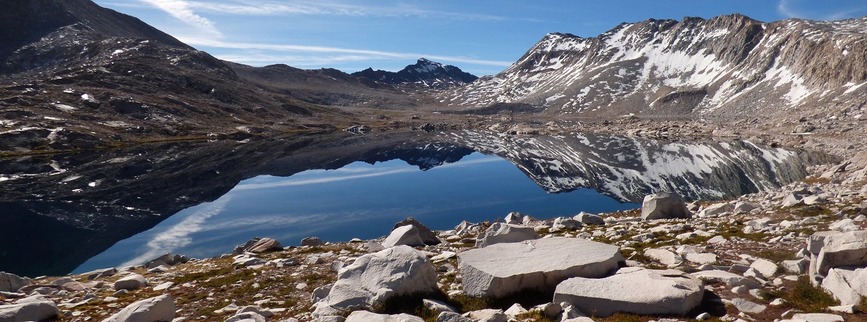
The next morning, we got going at around 5:45am, heading south from camp to intersect the John Muir Trail (JMT) in Evolution Basin. Our group now consisted of just Alberto, Mihai, and I, as Inga and Dale had decided to remain at camp and forgo Goddard. From camp, an increasingly well defined use-trail was present, and reaching the JMT was an easy task. Once on the JMT, we headed south for 4.7 miles to the outlet of Wanda Lake. Along the way, we passed by several highly scenic lakes and classic High Sierra views.


We reached the outlet of Wanda Lake shortly after 8am and sat down for a longish break. From here, we left the trail and headed southwest up and over a broad ridge to the base of Starr's route. The terrain was mostly class 1-2 rock hopping.
Wanda Lake


looking southwest from the top of the broad ridge

Starr's Route (photo taken on July 14, 2012)

The massive mountain loomed over us, looking exactly as I remembered it from three years ago. Even though the route looked intimidating, it gets no more difficult than class 2+. The terrain was mostly ledgey and involved zigzagging back and forth in order to ascend. After spending roughly two hours making it up ~500 ft of the route and having a debate on whether the route was class 2 or 3, Mihai decided that it was too technical, and decided to turn around along with Alberto. Since I did not have any reason to do this route again, I turned around too, now looking intently towards North God to the northwest. A more detailed description of Starr's Route can be found here
heading up (and back down) Starr's Route


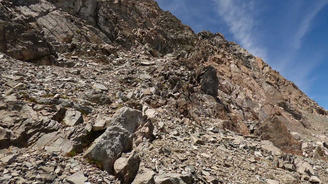
Back at the base of Starr's Route, we took a snack break and then we parted, with Mihai and Alberto heading back to camp and me heading towards North God. From our position, I headed west, crossed a moraine, and climbed a very loose diagonally sloping class 3-4 ramp to gain North God's southeast ridge. Once on the ridge, I simply followed it to the summit. The ridge was a very fun class 3-4 knife edge scramble, with incredibly airy drops on its eastern side. I hit a short class 5 section roughly 200 ft below the summit. Thankfully, the rock here was solid.
the loose cruddy ramp

looking up the ramp
on the southeast ridge


At the summit, I located a small register buried deep under a cairn which contained signatures back to 1941.


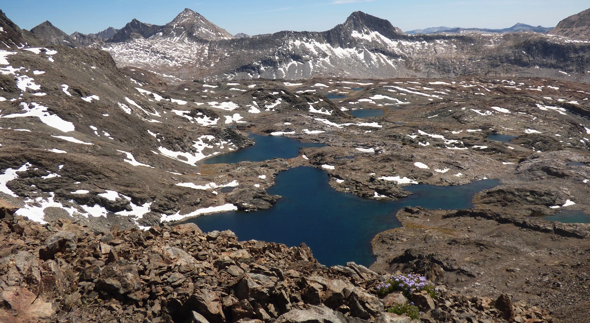
view south from North God's summit

north

Now I planned to drop down the northwest ridge of North God, cross over Hudson Pass (The lowpoint northwest of North God), and continue west onto the east ridge of Martha Peak. Looking at the register on North God, several people had mentioned coming up from the west and northwestern sides of the mountain, utilizing a series of class 3-4 loose chutes.
I began traversing northwest along the ridge. After a very short class 3 section, the ridge plateaued out for another short section before dropping off. I now found myself looking down a series of incredibly loose chutes, and loose they were, with me barely hanging on to some of the holds, most of which would pop right out with the slightest kick. I saw my chute as class 3 rather than class 4, but I could've easily taken a different one than those who had written about it in the register. The chute eventually dropped me right at Hudson Pass, where I decided to cache my pack. I would be coming back here after doing Martha Peak.
the loose chutes


view WNW from Hudson Pass

The ascent of Martha Peak was straightforward class 2 from Hudson Pass. At the summit was a 1973 register along with a surprisingly new one placed in 2014.

view southeast from Martha Peak

south


east

I retraced my steps to Hudson Pass, reshouldered my pack, and headed down the north side of the pass, which was mostly annoying class 2 scree and talus. To the north was the last "peak" I had planned on bagging that day: Davis Rock.
views while descending Martha Peak

looking north down Hudson Pass

As I headed down Hudson Pass, some Lady Gaga song worked its way into my head, and whatever I tried, it would not go away. I don't even like Lady Gaga at all. I absentmindedly began humming it to myself, and then began full on singing it punk rock style because I realized that there would be no one for miles to hear my awful vocals. By the time I had nearly reached Davis Lake, I was having a lot of fun with it, almost screaming it in some punk metal voice, and moving my body in some robotic fashion to the beat, occasionally slipping on some loose talus and almost falling over. As I reached Davis Lake, I suddenly heard some far off voice yelling "Heyyyyy!" I abruptly stopped singing. Oh sh*t! My horrible impersonation of Lady Gaga had attracted the attention of some rangers and I didn't even have my permit, having left it back at camp.
Thankfully, they were not rangers, but were instead two young women who seemed to be somewhat lost. There was a small finger of Davis Lake between us, so we resorted to shouting across the lake in order to communicate. She started off with saying something along the lines of "Do you know if we can get to Martha Lake from here?" I shouted back, "Yes, that should be somewhere to the south." One of them pointed towards Hudson Pass, shouting "Can we get over that?" to which I replied with "Yeah, its class 2." They had a short discussion before shouting "Thanks!" I wished them a safe trip and then proceeded north towards Davis rock, feeling slightly embarrassed.
The ascent of Davis Rock was a very short class 2 scramble. There were multiple possible routes.
view south from Davis Rock

southwest

south-southeast

From Davis Rock, I spent an hour boulder hopping east back to Wanda Lake, savoring the last hour above treeline where I wouldn't be tormented by the hordes of mosquitoes that were soon to come.


back at Wanda Lake

From Wanda Lake, I retraced the route we had taken that morning back to camp, arriving at camp roughly 45 minutes before sunset. I found the group having dinner, perched on the flat rock overlooking the lake.


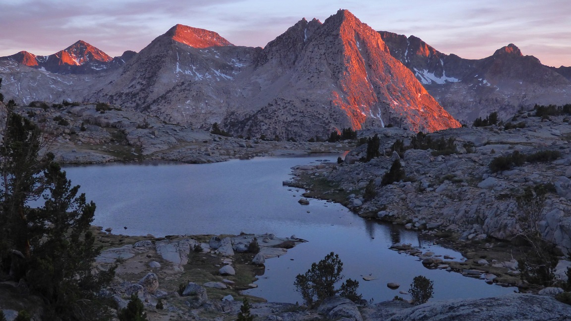
As we ate dinner, we enjoyed a fantastic sunset lighting up Goddard and much of the McGee Traverse to the southwest.


We started hiking at around 5:45am the next morning, retracing our steps back over Lamarck Col and down to North Lake. Along the way, I decided to tag a small peaklet (which I dubbed "Sky High Peak" after Sky high Lake) which was located 0.4 mi NNE of Lamarck Col, and could be clearly seen from the col. I ascended the south ridge (class 2-3) and descended the southeast side (class 2). There were 65mph winds raging at the summit, so I satisfied my peakbagger ego by planting each foot individually on the summit block and calling it a success.
Mt. Darwin in the morning

west side of Lamarck col

Sky High Peak seen from Lamarck Col

looking back at Lamarck Col from Sky High Peak

Final Stats
36 miles
12,910 ft gain/loss

closeup of the off trail portion west of Wanda Lake

Weather Forecasts
Trailhead
Lamarck Col/Sky High Peak
Darwin Bench/Evolution Basin
all other peaks
Peakbagger Pages
North God
Martha Peak
Davis Rock
Sky High Peak
Other
High Sierra Topix message board
No comments:
Post a Comment