
January 4, 2014
The Agua Tibia Mountains are a medium-sized range in northern San Diego county. The physical structure of the range consists of mostly undulating hills which seem to build on top of one another. At the lower elevations, the terrain is covered with thick chaparral which has rebounded quickly ever since a large fire burned through most of the range in 2007. At the higher elevations, the hills are covered with conifers and separated by large meadows, giving one the feeling that they are somewhere further up north.
In the northern part of the Agua Tibia Mountains are four small peaks which can be strung together into a loop by utilizing a network of trails. If it weren't for the trails, this loop would likely take multiple days to complete due to heavy brush. Craig and I planned to start the loop from the Dripping Springs Campground. We would take the Wild Horse Trail to Crosley Saddle, bagging Wild Horse Peak and Agua Benchmark along the way. From Crosley Saddle, the Cucta Trail (to the left) would bring us pretty close below the summit of Eagle Crag. After Eagle Crag, we would retrace our steps to Crosley Saddle, then take the Palomar Magee Trail northwestward towards Agua Tibia Mountain. From Agua Tibia Mountain, we would take the Dripping Springs Trail back to the trailhead.
| Peak | Elevation | Topographic Prominence | Summit Coordinates (lat/lon) |
|---|---|---|---|
| Wild Horse Peak | 3,277 ft | 137 ft | 33.44162, -116.957599 |
| Agua Benchmark | 3,112 ft | 194 ft | 33.434554, -116.950034 |
| Eagle Crag | 5,077 ft | 57 ft | 33.387349, -116.956523 |
| Agua Tibia Mountain | 4,779 ft | 848 ft | 33.409848, -116.982086 |
Getting to the trailhead
Trailhead coordinates (lat/lon): 33.464693, -116.971760
sign at parking area

Craig and I started hiking from the parking area at 6:30 am, walking up the road through Dripping Springs Campground for 0.4 miles to Dripping Springs Trailhead, which was well marked and adorned with three large information boards. From the trailhead, a trail headed south for less than a quarter mile, then branched into two trails, with the Wild Horse Trail to the left and Dripping Springs Trail to the right. We took the left fork. The Wild Horse Trail was very well defined and easy to follow. Like many trails in the Agua Tibia Wilderness, it gained elevation very slowly, meandering to and fro along a hillside.
Agua Benchmark comes into view

About 4 miles after leaving the Dripping Springs Trailhead, we began scanning the brush towards the right for any signs of a use trail heading up Wild Horse Peak. The first sign that presented itself was a cairn placed at the base of a gully. Due to some knowledge gained from a trip report which advised against taking any gullies to Wild Horse Peak, we continued on. Shortly after the gully, we encountered a small cairn at the base of one of several small ridges heading up to the right. We left the trail and began climbing up, finding a very faint use trail.
exit point for Wild Horse Peak

looking up from the exit point

The off trail portion to Wild Horse Peak was very short, requiring 0.4 miles of travel one way. Even though many people had described this peak as a horrible bushwhack, we didn't think it was that bad (although it could be, if one were to deviate from the route). From the trail, we headed northwest up the subsidiary ridge to intersect a main ridge. Immediately after leaving the trail, the ground became covered with loose rock, followed by softer terrain for the remainder of the ascent. Just before the main ridge, a large pile of large rocks (which I will refer to as the "East Rocks") came into view. We turned left at these rocks and gained the main ridge, following it to the summit.
initial off trail


East Rocks

view of the summit shortly after East Rocks

views from summit


register

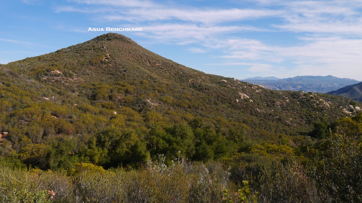
Next up was Agua Benchmark, an easily recognizable bump southeast of Wild Horse Peak. We descended back to the trail from Wild Horse Peak, then followed it for 0.8 miles to a saddle west of Agua Benchmark at 2,920 ft.
route to Agua Benchmark viewed from Wild Horse Peak

Agua Benchmark viewed from Saddle 2,920 ft

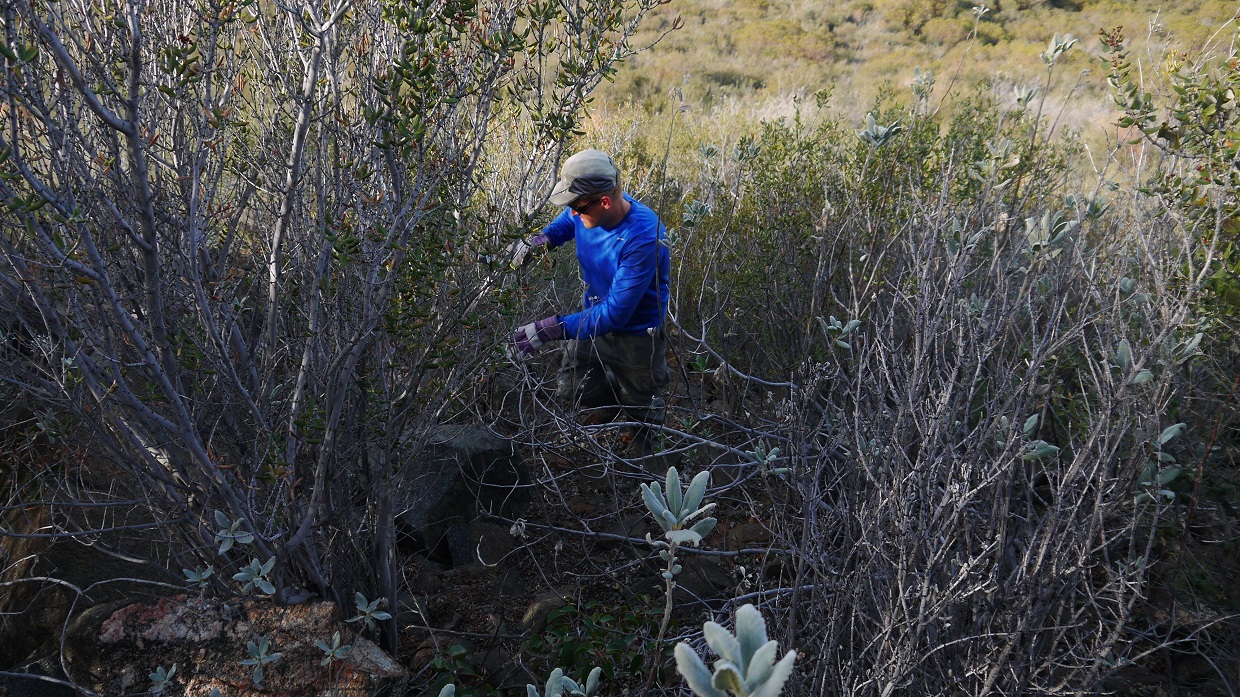
From Saddle 2,920 ft, we left the trail and bushwhacked a short distance to the summit of Agua Benchmark. This would be our heaviest bushwhack of the day.


summit and views


view northwest

benchmark

register

descending

After the quick detour to Agua Benchmark, we continued along the Wild Horse Trail which began to slowly descend. 1.9 miles after leaving saddle 2,920 ft, the trail crossed a dirt road and resumed ascending.
views from trail


crossing dirt road

After crossing the dirt road, the trail continued for another 2.7 miles to Crosley Saddle (3,930 ft). Along the way, it passed through some very green groves of oak trees.


sign at Crosley Saddle

Eagle Crag seen from Crosley Saddle

looking down Agua Tibia Creek Canyon

From Crosley Saddle, we turned left and headed southeast on the Cutca Trail.


After 2 miles on the Cutca Trail, we located a rock-choked gully that branched off to the right and was marked at the base with a cairn. This was the turnoff for Eagle Crag.


After a few hundred feet in the gully, our forward process was impeded by a thick wad of brush which grew in the gully ahead. We climbed up to the left and paralleled the gully upwards, utilizing several small deer trails which headed up in the same direction. As the ground began to flatten out, the brush in the gully thinned, and we crossed over to the right side of the gully, following a gradual slope up to the summit. There was some light bushwhacking here and there.
last hundred feet or so below the summit

summit views


register

After a snack break at the summit, we descended back the way we came and took the Cutca Trail back to Crosley Saddle.


From Crosley Saddle, we took the Palomar Magee trail towards our last peak of the day: Agua Tibia Mountain. We followed the trail for 1.8 miles to the northwestern side of Agua Tibia Mountain and located a path to the summit that had been cut through the tall stands of buckthorn.
views from Palomar Magee Trail


turnoff for Agua Tibia Mountain

From the turnoff, it was less than a quarter mile to the summit. Even though there was a recognizable path blazed through the buckthorn, the vegetation was quickly reclaiming the space it had previously occupied. The summit area of Agua Tibia contained two summit blocks. The eastern (lower) block could be surmounted with an easy class 3 move, and the western (higher) block could be climbed using a few class 2 moves.
eastern block (left photo) and western block (right photo)

summit views


benchmarks

register

Back on the Palomar Magee trail, we followed it for another mile to a junction with the Dripping Springs Trail, then took the Dripping Springs Trail 6.4 miles back to Dripping Springs Trailhead, then walked the remaining 0.4 miles to the parking area.
sign at Dripping Springs Trail junction

Final Stats
27.7 miles
6,500 ft gain/loss

Weather Forecasts
Trailhead
Wild Horse Peak, Agua Benchmark
Eagle Crag, Agua Tibia Mountain
Peakbagger Pages
Wild Horse Peak
Agua Benchmark
Eagle Crag
Agua Tibia Mountain
Summitpost Pages
Eagle Crag
Agua Tibia Mountain
Other
Agua Tibia Wilderness
Cleveland National Forest
No comments:
Post a Comment