
January 11, 2014
Iron Mountain (aka. "Iron Mountain #1" or "Big Iron") is located in the eastern San Gabriel Mountains in Southern California. The hike up Iron via Heaton Flats is popularly used as a training hike for more difficult endeavors. Much of the fame for this mountain comes from the book Trails of the Angeles written by John Robinson, who stated that Iron Mountain is the most difficult single mountain in the San Gabriels, and that no trail approaches the summit. Since then, there have been other summits "discovered" in the San Gabriels that are considered more difficult than Iron (such as Triplet Rocks), and the Heaton Flats route has been so widely used that a trail does now extend all the way to the summit. Even though the hike gains over 7,000 ft of elevation, the route very straightforward on all trails and serves as an excellent conditioning hike.
| Peak | Elevation | Topographic Prominence | Summit Coordinates (lat/lon) |
|---|---|---|---|
| Bonita Peak | 3,983 ft | 20 ft | 34.249842, -117.743554 |
| Iron Mountain | 8,007 ft | 707 ft | 34.288455, -117.713352 |
| Peak 3529 | 3,529 ft | 487 ft | 34.237539, -117.752748 |
| Glendora Mountain | 3,322 ft | 182 ft | 34.192029, -117.839121 |
Getting to the trailhead (note: An Adventure Pass is required for all vehicles parked at this trailhead)
Trailhead coordinates (lat/lon): 34.237013, -117.765243
Dave, Bill, Craig, Nina, and I started from East Fork Trailhead (2,030 ft) at 6:45 am, walking on the dirt road that headed north from the trailhead, paralleling the San Gabriel River. After 0.5 miles, the Heaton Flats Trail branched off to the right, marked by an outhouse and sign. The Heaton Flats Trail was well maintained and heavily used. It headed east for 1.3 miles to a saddle at 3,042 ft, then turned left and headed northeast, staying generally on or near the crest of a ridge.
Heaton Flats Trailhead

Heaton Flats Trailhead
views from Heaton Flats Trail


About a mile after Saddle 3,042 ft, a faint use trail branched off to the right. This was the turnoff for Bonita Peak, a very easy bonus peak that was about 2 minutes off the trail. Craig and I headed up the use trail for less than a hundred feet onto a ridge, then turned right and followed the ridge for a few hundred feet south to the peak. We were joined by Bill a few moments later, who had walked past the turnoff but aimed for the peak when he saw us standing on it. With its 20 feet of prominence and being only a few minutes from the trail, Bonita was more of a "feel good" peak rather than a "real" peak.
view southwest from Bonita

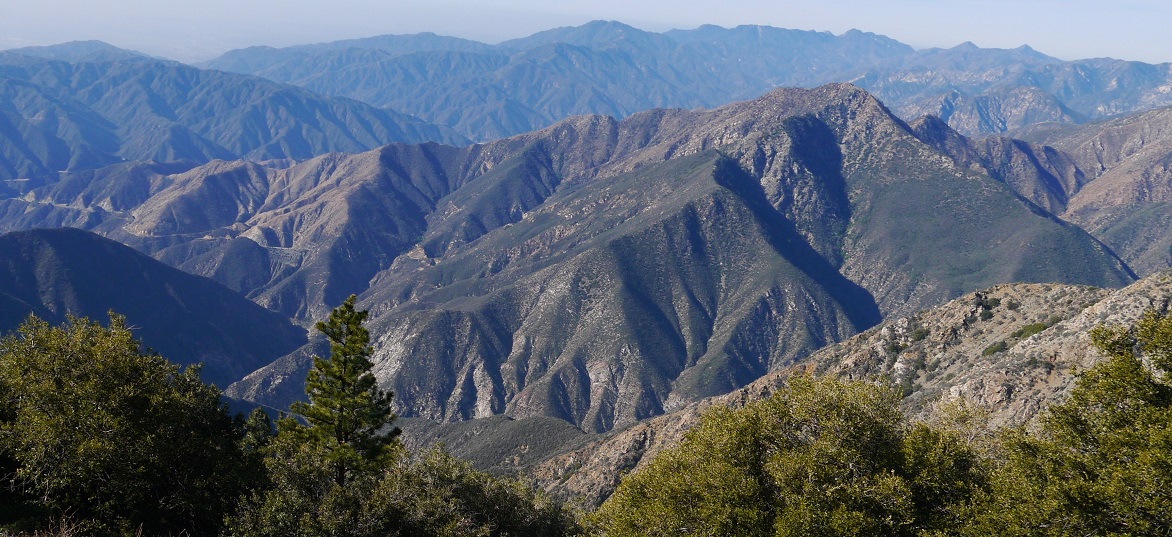
view northeast towards Iron Mountain

register

back on the Heaton Flats Trail


2.9 miles after leading Saddle 3,042 ft, we arrived at Allison Saddle (4,580 ft). From there, we left the Heaton Flat Trail and took a separate trail which continued up the South Ridge of Iron Mountain. The new trail ascended steeply and directly up the ridge. As we ascended higher, the steep sections became increasingly separated by longer stretches of more gradual terrain.


BIG yucca


We reached the summit at 11:30 am and remained there for over 45 minutes. A metal stake had been erected at the highpoint. Below it was a large and fancy register containing several books from the last few years. There were some expansive views to the north and west where the Hawkins-Baden Powell ridge dominated the horizon. As the day went on, several more groups arrived at the summit.
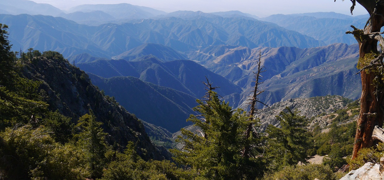
view northwest from summit


east

descending

views from descent


above Allison Saddle

As Dave and I reached Saddle 3,042 ft, I decided to climb Peak 3529, which was located southwest of the saddle and required only 487 ft of extra gain. Upon reaching the saddle, I kept following the ridge instead of descending the Heaton Flats Trail. There was a well defined trail about halfway up the peak, then a small use trail for the last half which required some light bushwhacking.
view of Peak 3529 through the smog

The summit of Peak 3529 was not much to get excited about. Much of the distant mountains were obscured by the smoggy air.

From Peak 3529, it was a short jaunt back the the trailhead where I met back up with Dave. After everyone had arrived back, Bill suggested heading into Azusa for a bite to eat, and we did just that.
After everyone had eaten and said their goodbyes, Craig and I headed back up into the mountains for another peak: Glendora Mountain. Craig, ever in his quest to bag the LPS list, had had this peak on his radar the whole time, and I wasn't going to pass up an opportunity for an extra peak either. Glendora was the definition of a "drive up" peak. The entire hike would be less than a mile with only a few hundred feet of gain. It was well past dark by the time we arrived at the trailhead.
Getting to the trailhead: Follow the directions in the "Getting There" section of this Summitpost page. We took the northern route.
Trailhead coordinates (lat/lon): 34.196336, -117.837887
From the trailhead (3,100 ft), we headed up a brush choked gully to the south and intersected Glendora Mountain's Northeast Ridge. Once on the ridge, we turned right and followed it a short distance to the summit, utilizing several use trails that cut through the open grassy terrain.
on Glendora's Northeast Ridge

register

city lights to the south

creepy summit shot

Stats for Bonita Peak, Iron Mountain, Peak 3529
15.2 miles
7,700 ft gain/loss

Stats for Glendora Mountain
0.6 miles
280 ft gain/loss
280 ft gain/loss

Weather Forecasts
East Fork Trailhead
Bonita Peak, Peak 3529
Iron Mountain
Glendora Mountain
Peakbagger Pages
Bonita Peak (note: The coordinates and map on this page display the location of Bonita Benchmark, not Bonita Peak. Bonita Peak is the bump a few hundred feet south of what is marked on the map.)
Iron Mountain
Peak 3529
Glendora Mountain
Summitpost Pages
Bonita Peak
Iron Mountain
Glendora Mountain
Other
Angeles National Forest
No comments:
Post a Comment