
October 12, 2013
Rockhouse Peak and Taylor Dome are two Southern Sierra peaks located in the Domeland Wilderness north of Lake Isabella. The terrain in this part of the Southern Sierra is gently undulating and plateau-ish, resulting in peaks that don't require much strenuous elevation gain. This would be a relatively easy hike with plenty of time to relax and socialize.
| Peak | Elevation | Topographic Prominence | Summit Coordinates (lat/lon) |
|---|---|---|---|
| Rockhouse Peak | 8,360 ft | 680 ft | 35.900959, -118.228508 |
| Taylor Dome | 8,802 ft | 700 ft | 35.856428, -118.303325 |
Getting to the trailhead
Trailhead coordinates (lat/lon): 35.868911, -118.326331
Trailhead (7,800 ft)

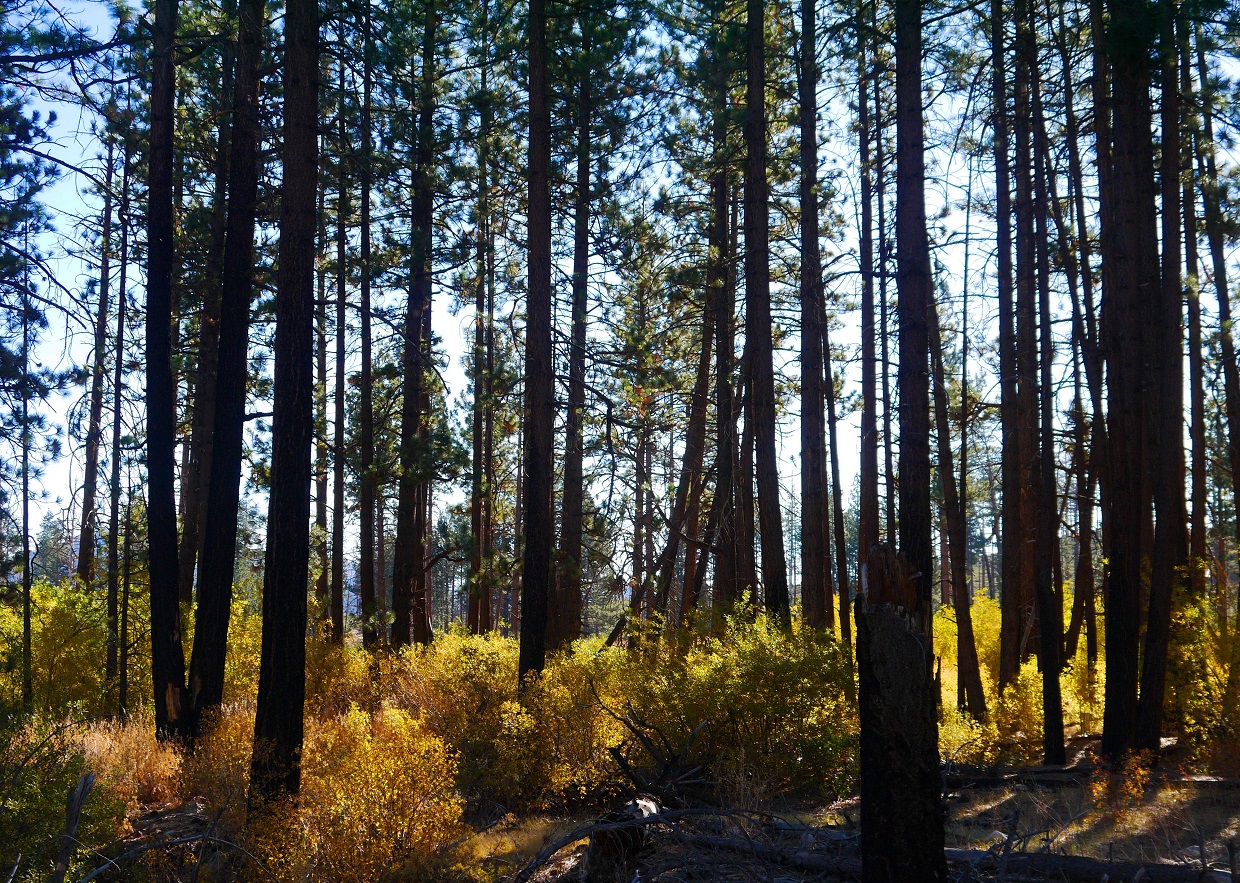
Six of us camped at the trailhead near Big Meadow the night before the hike in one of several nice primitive camping spots. We began hiking the next morning at 8:30 am, quickly warming up in the chilly air. The trail twisted and turned, ascending very gradually through a forest of conifers. I had previously envisioned the entire Southern Sierra to be composed of dry, desert terrain. It came as a pleasant surprise to me that this area was nice and green. There were even a few areas of fall colors scattered about.
Domeland Wilderness sign a short distance after the trailhead

nice colors

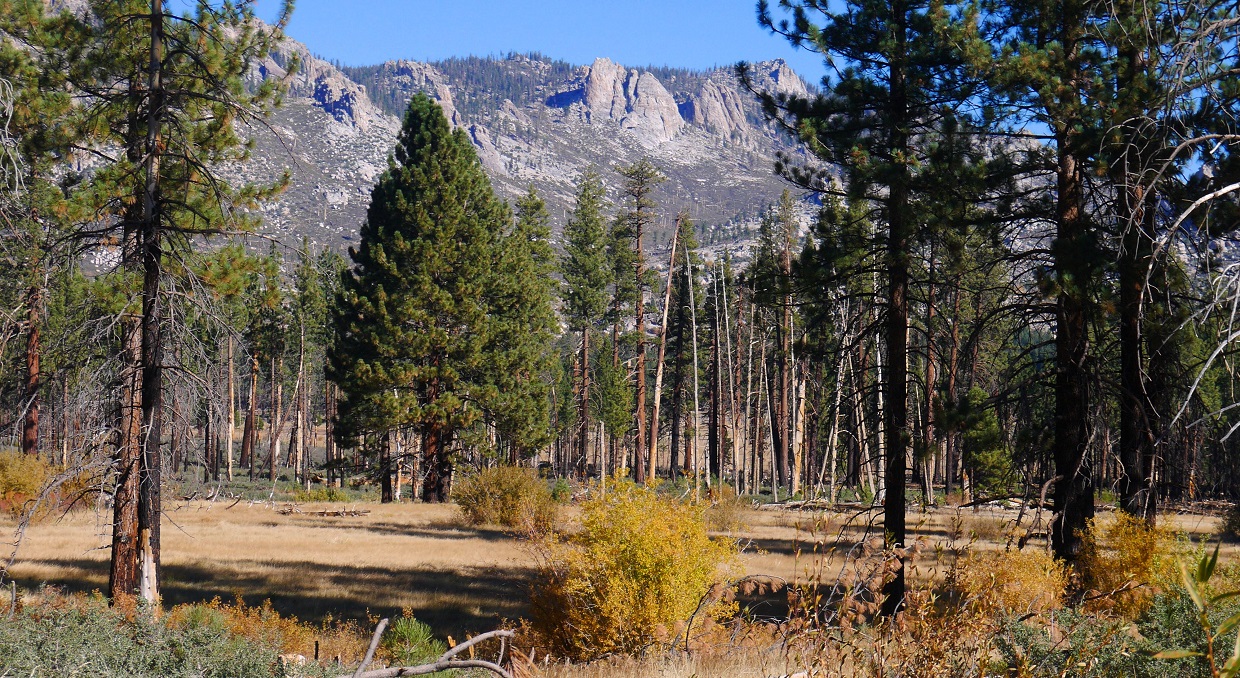
As the trail began gradually snaking downhill after reaching a saddle, Rockhouse Peak came into view.


looking northeast

As the trail came to the southwestern side of Manter Meadow (7,200 ft), 2.5 mi from the trailhead, we turned right onto a poorly defined trail that contoured northeastward around the meadow for 1.3 mi to Manter Creek. After this point, all trails leading to Rockhouse Peak would be poorly defined. The Topo map displays these trails clearly, but they had not been maintained for some time.
signs marking turnoff
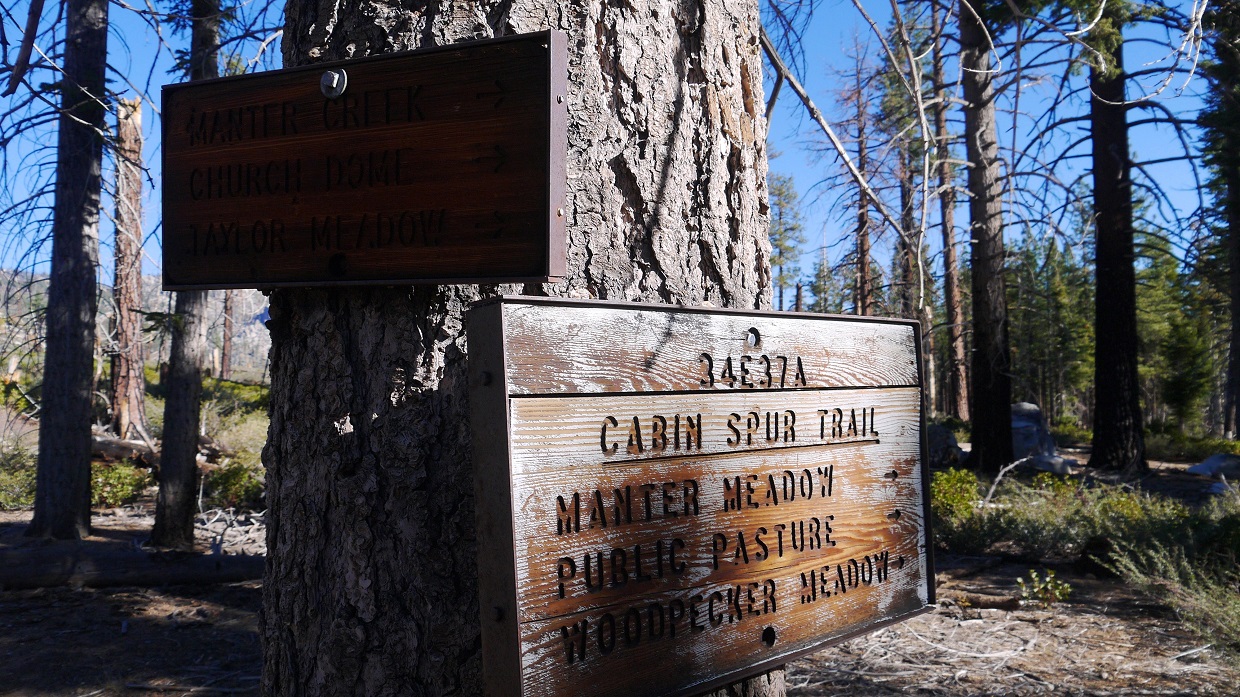
seen better days

just before Manter Meadow


views while contouring around (and through small sections of) Manter Meadow


signs at Manter Creek

From Manter Creek, a trail supposedly branched off to the right and headed ENE towards a 7,350 ft pass south of Rockhouse Peak.
Upon reaching Manter Creek, we did not see any signs of a trail at first, but continued east on the south side of Manter Creek. After a few hundred feet, a faint use trail appeared, which crossed the creek in another few hundred feet and remained on that side. A faint trail paralleled the creek, which gradually descended towards a merge with another creek shortly after Little Manter Meadow. Shortly after Little Manter Meadow, the trail fizzled out and vanished. We continued ENE on class 1 cross country terrain, ascending a canyon towards Pass 7,350 ft.
views along Manter Creek


Little Manter Meadow

views after Little Manter Meadow


canyon leading up to Pass 7,350 ft


Just before reaching Pass 7,350 ft, we turned left (northeast) and aimed for the left side of a rocky outcropping on easy class 2 terrain.


After the outcropping, we reached a flat, where Rockhouse Peak's summit block could be seen to the northeast.

We climbed to the base of the summit block, then contoured around to its northeast side where a class 3 crack presented itself. Contouring further around the block would result in easier routes, but this route looked fun. A pine tree grew at the base of the crack, providing an excellent marker since it was the highest tree growing in the area. The crack rose about 40 ft to a small notch, at which we turned left and scrambled up some easy slabs to the summit (8,360 ft).
view of Rockhouse summit block from the northeast

nice views


pine tree at base of crack

class 3 crack

Craig, Greg, and Sung at the notch

last bit of scrambling before summit


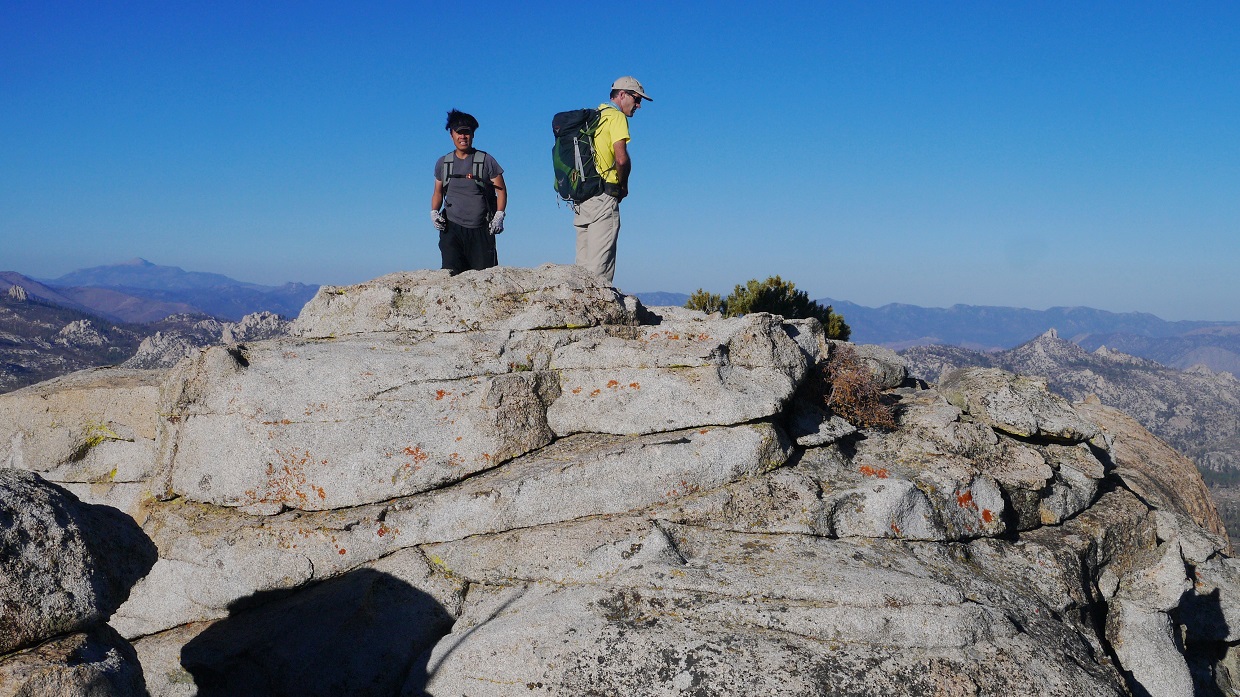
We reached the summit at 12:06 pm, finding several large smooth slabs. It was a perfect place for the six of us to converge and eat lunch. We located an ammo box with no register inside, inspiring us to improvise our own by signing our names on the back of a Topo map that one of us had brought.
view northeast from summit

east

southeast

southwest

northwest

north

zoom towards southern High Sierra

After about an hour on the summit, we headed back the way we came and towards the turnoff for Taylor Dome.


We ascended Taylor Dome via its Northeast Ridge, turning south off the trail 0.7 mi southwest of the Manter Meadow junction. The first few hundred feet of gain consisted of steep slopes/gullies, which then leveled off as a soft ridge heading south. The extreme south end of the ridge contained a large and prominent looking block that appeared to be the highpoint, but was not. Upon reaching the base of this block, we turned a sharp right (west), and skirted past three smaller blocks which had also appeared to be highpoints upon first glance. From the west side of the third block, Taylor Dome's true summit block appeared to the south. We contoured around to the summit block's south side to a notch separating it and another block further south. From the notch, a natural walkway contoured along the left (west) side of the summit block for about a hundred feet, ending at the base of a class 3 crack. The crack went up about 20 ft, topping out at the summit.
start of Northeast Ridge

first glimpse of the summit

on the soft ridge

buckthorn!


summit block viewed from the north

notch south of summit block

summit block and its natural walkway viewed from notch

class 3 crack


topping out at the summit (8,802 ft), 4:45 pm
view southeast from summit

south

northeast


east
To get back to the trailhead, we descended northwest from Taylor Dome's summit, contouring around several bumps on sandy terrain, aiming for a saddle south of Point 8176 (consult Topo map below). From the west side of this saddle, we turned right on a trail headed towards Big Meadow. This trail ended at a dirt road a few hundred feet south of the trailhead.
bear track

Final Stats
16.9 miles
4,300 ft gain/loss

Weather Forecasts
Trailhead
Manter Meadow
Rockhouse Peak
Taylor Dome
Peakbagger Pages
Rockhouse Peak
Taylor Dome
Summitpost Pages
Rockhouse Peak
Taylor Dome
Other
High Sierra Topix message board
Domeland Wilderness
Nice TR and pics - I hiked to the pass back in June 2005 - it was interesting to see how the area looks in fall, as well as the final push up to Rockhouse Peak.
ReplyDeleteHere's my June 2005 TR http://www.tarol.com/domeland
ReplyDelete