
August 22, 2013
Day 7 of the 2013 Sierra Challenge started similar to any other day of the Challenge. A surprisingly large group of people converged at Baxter Pass Traihead for a 6am start. The Challenge peak of the day was Diamond North, an unnamed thirteener 0.6 mi north of the more popular Diamond Peak. Most of us who were heading for Diamond North planned to attain the summit by traversing its class 3 Northeast Ridge from Baxter Pass. From the summit, it was possible to descend back down the Northeast Ridge or the class 3 Southeast Slope, which looked horribly loose. I had my mind set on the class 2 ridge traverse between Diamond North and Diamond Peak. Getting to Diamond Peak meant that I had the option to descend its Southeast Slope, a route I had climbed the previous spring.
Getting to the trailhead
Trailhead coordinates (lat/lon): 36.844856, -118.297698
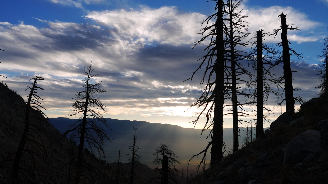
Day 7 start (photo by Bob Burd)

We started hiking up the Baxter Pass trail at 6:02 am. A spectacular sunrise greeted us from the east.


The Baxter Pass trail, which resembled a well defined use-trail, gradually ascended the canyon towards Baxter Pass. The first part of this trail indicated considerable evidence of fires and mudslides. Some sections of trail were blocked off by downed trees which had to be climbed over. The charred trees did however make for some pretty interesting silhouettes for photos.


Starting at a flat at 8,500 ft after the second creek crossing, the trail became overgrown and harder to follow. I managed to loose it a few times, but always found it again by following the canyon upwards and intersecting the trail shortly after. I was hiking alone now. Several people were quickly falling back due to trail difficulties. I considered myself at an advantage here having been on this trail (at least for the first few miles of it) a few months prior.
8,500 ft

I reached a flat shaded area known as Topo Camp (10,000 ft) at 7:45 am and filled up on water. The map indicated a few small creeks higher up, but I was not sure if they would be flowing due to a dry year.
view from Topo Camp

Not far above Topo Camp, the trail began heading up the north side of the canyon. It crossed a dry wash- evidence of a recent mudslide. After the wash, I was surprised to see the trail dramatically improve. It was well defined and could be easily followed. It seemed that the mudslides had not impacted areas above Topo Camp.
dry wash cutting through trail

Diamond Peak

From the switchbacks below Baxter Pass, I gained a nice view of Diamond Peak's East Couloir, and pondered the possibility of using it as a descent from Diamond instead of traversing back to Diamond North and following my ascent route back. The East Couloir was popular as a snow climb, but I had not read anything about people climbing/descending it in summer. It looked very sandy, indicating a quick heel-plunging descent.
Diamond's East Couloir

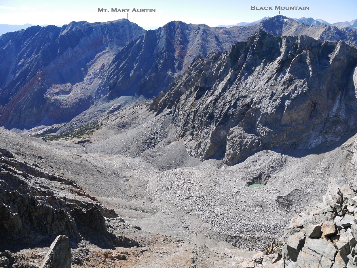
At a point just before Baxter Pass, I gained a view of Diamond North's Northeast Ridge. The ridge looked much easier than I had envisioned it to be. After consulting my map, I concluded that what appeared to be the highpoint was a false summit (which I will refer to as "Point 12,900 ft"), and the true summit was visible to the left of it.

Because the route was plainly visible from here, I decided to begin cross countrying towards the Northeast Ridge before Baxter Pass. The terrain up to Point 12,900 consisted of a short talus slog. Though the rock itself was loose, the relatively gentle slope made it feel much more solid.


From Point 12,900 ft, the true summit of Diamond North could be seen 0.2 mi to the southwest. I began traversing towards it along the class 3 ridge that lay in between. Though this traverse could be done with all class 3 climbing, it would involve contouring below the ridge on its south side which was covered with loose shale. It would also involve weaving though a maze of ribs and chutes. Staying on top of the ridge itself involved more difficult climbing (consisting of a few short class 4 moves), but the terrain looked considerably more solid. Deciding that it was better to rely on technique rather than a bunch of potato chips, I moved onto the ridge. Though the ridge was much more solid, I still found myself frequently checking holds to make sure they didn't wiggle or break off. Some sections of ridge contained piles of shale sitting on downward-leaning slabs over large drops. These piles were not too difficult to spot, so avoiding them was a manageable task.
Diamond North viewed from Point 12,900 ft

getting closer

just below the summit

I topped out on Diamond North's summit at 9:28 am and was blasted with strong gusts of wind. It had taken a little over 20 minutes to traverse to the summit from Point 12,900 ft. I grabbed the register which was in a glass jar, and turned my back against the wind to examine it and eat an energy bar.
view east from summit

southeast
southwest

northwest

north

northeast

register

After a short moment on the summit, I began traversing over to Diamond Peak along a horseshoe-shaped connecting ridge.


The traverse to Diamond was pretty easy, involving class 2 terrain at most. I ran into Sean descending not far below Diamond's summit. He had climbed Diamond Peak via its Southeast Slopes and was now traversing towards Diamond North. We gave eachother a few tips on the terrain we had just passed through, then continued on our separate ways. I reached Diamond's summit at 10:27 am and took a short break.
view north from summit
.JPG)
southeast

southwest


west

As I was signing Diamond Peak's summit register I heard rockfall towards the north, which seemed to be coming from Diamond North. An image formed in my mind of a conga line of climbers traversing Diamond North's Northeast ridge, knocking down rocks left and right. I was glad to be on a different peak. I scanned Diamond North's Northeast Ridge for any signs of climbers, but was too far away to see anyone.
I decided to descend Diamond via its East couloir, and began descending southeast off Diamond Peak towards the couloir's entrance.
entrance to the East Couloir viewed from Diamond Peak

Once I was standing at the top of the East Couloir looking down into it, it looked very doable. The first few hundred feet consisted of low class 3 climbing on loose screeish terrain. From below, it seemed that the couloir was composed of soft sand, but in reality the sand was semi-compact. Still, this descent option saved much more time than if I were to take Diamond's Southeast Slopes, which I knew from past experience contained a jumble of loose boulders.
looking down the East Couloir


Upon hitting the trail, I began jogging down at a brisk pace. The top and bottom parts of the trail were generally easy to jog. The middle portion not so much. I stopped a few times to fill up on water or snap a picture or two.
views from descent


trailhead

I got back to the trailhead at 1:31 pm to find no one else there. With the only shade coming from the trailhead sign, I took a nap under it and waited for the others to arrive. The first two to arrive were Sean and Sarah, who had jogged down the trail together. Sean had traversed to Diamond North and descended its loose Southeast Slope back to the trail. Because of his broken pinky finger, it would've been much more dangerous for him to traverse the Northeast Ridge.
Sometime around 4pm, everyone at the trailhead began heading back into town to fuel up and rest up for the next day. Based on the number of cars at the trailhead, roughly half of the day's participants were still on the mountain.
Later that day, Tommey and I were having dinner at a restaurant in Big Pine. Sometime after 8pm, Tommey checked his email to find a notice from Bob that there had been a tragedy and the rest of the Challenge was cancelled. Immediately we suspected that something had happened to Pat since she wasn't back to the trailhead when we left. After checking with a few others who had also gotten the email and were wondering that had happened themselves, we decided to head up to the trailhead and check if Pat's FJ was there. If it wasn't there, then we would at least be relieved that she was OK.
Shortly after leaving Big Pine, Tommey received a text from Jim. He was with Jeff, and they were not far below Baxter Pass. They wanted us to inform Bob on their situation and request an SAR for Des, who had been with them earlier but had disappeared some time ago. It was freezing cold where they were, and they could not afford to stop moving. We called Bob to see what he wanted to do. He said that he would take care of it, sounding very upset about something. The next thing he said was "You probably heard what happened to Pat today?" When we expressed apprehension, he gave a short and precise reply: "Pat Hadley died today." We sat there stunned and in disbelief, then headed back into Big Pine.
--------------------------------------------------------------------------------------------------
A few days later, we were able to gain a better understanding of what happened on the 22nd. The following is a timeline of the day's events. Many of these are simplified versions of what Bob mentions in his trip report.
This is a view of Diamond North from Diamond Peak (0.6 mi S of Diamond North). It will assist in the identification of certain route features mentioned below.

6:02 am- Sierra Challenge day 7 begins
9:28 am- Eric summits Diamond North via Northeast Ridge
~10:00 am- Sean summits Diamond Peak via Southeast Slope
10:15 am- Bob reaches Point 12,900 ft on Diamond North. He spots Pat negotiating the ridge some distance away.
10:27 am- Eric summits Diamond Peak
~10:30 am- A rockslide occurs on Diamond North's Southeast Slope which is heard by several groups. Many speculate that this rockslide either resulted in or was the result of Pat's fall.
~11:10 am- Sean summits Diamond North
11:15 am- Bob summits Diamond North to join Sean
11:30 am- Sean begins descending Diamond North via Southeast Slope. The rugged terrain prevents him from spotting Pat's body. Bob begins traversing towards Diamond Peak.
12:15 pm- Matt summits Diamond North
12:18 pm- Bob summits Diamond Peak
~12:30 pm- Michael summits Diamond North to join Matt
~12:40 pm- Chuck summits Diamond North to join Matt and Michael
~1:00 pm- Matt notices a body on Diamond North's Southeast Slopes, about 150 ft below the summit. He calls over the others to look. Michael climbs down to the body and identifies it as Pat. SAR is contacted.
~1:10 pm- Brad summits Diamond North to join Matt, Chuck, and Michael. Shirley, who is on the Northeast Ridge, decides she has had enough climbing and begins descending via Southeast Slope.
~2:00 pm- Chuck and Michael begin descending Diamond North via a combination of the Southwest Ridge and Southeast Slope.
~2:15 pm- Matt begins descending Diamond North following Chuck's and Michael's route. Brad descends at an unknown time, but in time to meet the other three at the base of the Southeast Slope.
~3:00 pm- Jim, Jeff, and Des summit Diamond North via Northeast Ridge. Not wanting to descend the Northeast Ridge or Southeast Slope, they decided to descend the Northwest Slope which would deposit them well on the north side of Baxter Pass.
~8:30 pm- Jim and Jeff are descending below Baxter Pass. Des has been missing for about an hour.
1:00 am (Friday)- Jim and Jeff return to Baxter Pass Trailhead.
7:00 am (Friday)- Des returns to Baxter Pass Trailhead after resorting to an emergency bivy the previous night.
--------------------------------------------------------------------------------------------------
Final Stats
15.8 miles
7,700 ft gain/loss

Trailhead
Diamond North, Diamond Peak (These peaks have elevations slightly over 13,000 ft. Keep in mind that this forecast is for 12,143 ft)
Peakbagger Pages
Diamond North
Diamond Peak
Summitpost Pages
Diamond Peak
Other
Bob Burd trip report
Sean O'Rourke trip report
High Sierra Topix message board
Inyo National Forest
No comments:
Post a Comment