
December 23, 2012
It was cold and rainy everywhere else in California, with heavy snows in the Sierras. We had initially planned to climb Cardinal Peak via the east ridge, but were deterred by forecasted 100mph winds and heavy snow that would be blasting the ridge on our entire ascent. We decided to go to the warm Mojave desert to climb a couple fun peaks- Mopah and Umpah. Mopah is a DPS peak. Umpah just looked fun.
Getting to the trailhead: If coming from LA of San Diego, head out on Interstate 10 East until you reach Highway 62, heading east to Morongo Valley, Joshua Tree, and 29 Palms. After getting onto Highway 62, follow it for approximately 91 miles to Vidal Junction, where Highway 62 intersects with Interstate 95. Turn left onto I-95 (north) for 12.1 miles. Look for a dirt road on the left side of I-95 (west side) signatured by a BLM marker for 'Mopah Peak Wilderness'. Follow this dirt road west for 4.4 miles until it ends at the wilderness boundary, at a permanent liftgate (constructed in 2004). 4-wheel drive vehicles or two-wheel drive vehicles with high clearance are needed to travel this dirt road to its end (there are several spots where the dirt road drops in and out of sandy washes). At the end of the road, there is a small parking area and camping spot (directions from Summitpost).
Trailhead coordinates (lat/lon): 34.335038, -114.722045
Pat, Tommey, and I got to the trailhead at around 9pm Friday night. Earlier that night, we had missed the turnoff to the dirt road from I-95 and spent an extra 15 or so minutes doubling back to locate the small BLM marker. It was not until a few hundred feet after the entrance that we saw the prominent "Mopah Peak Wilderness" sign, which was not visible from I-95. The first few miles of the dirt road consisted of hard packed dirt and pebbles, easily doable with 2WD. The last 2 miles or so consisted of a series of dips and sharp, jutting rocks. We could not have gotten in to the trailhead without Pat's FJ Cruiser. The temperature at the trailhead was very nice: in the mid 40s. We didn't expect it to get below 37F that night. Pat set up her tent bivy (She stuffs her sleeping bag, blankets, pillow, and probably even a small mattress in there- quite comfy) and I set up a tent with Tommey. Under the warm conditions, a tent wasn't necessary, but we saw that a small weather window had appeared on the 24-25 in the Sierras. We planned on going for Cardinal Mtn after this hike and wanted to test out the new tent.
We woke up the next morning just after sunrise and took longer than usual to pack. We all decided that 3 liters of water should be the minimum for each person to bring. Tommey and I both had around 3.5 Liters. I think Pat brought a little more.
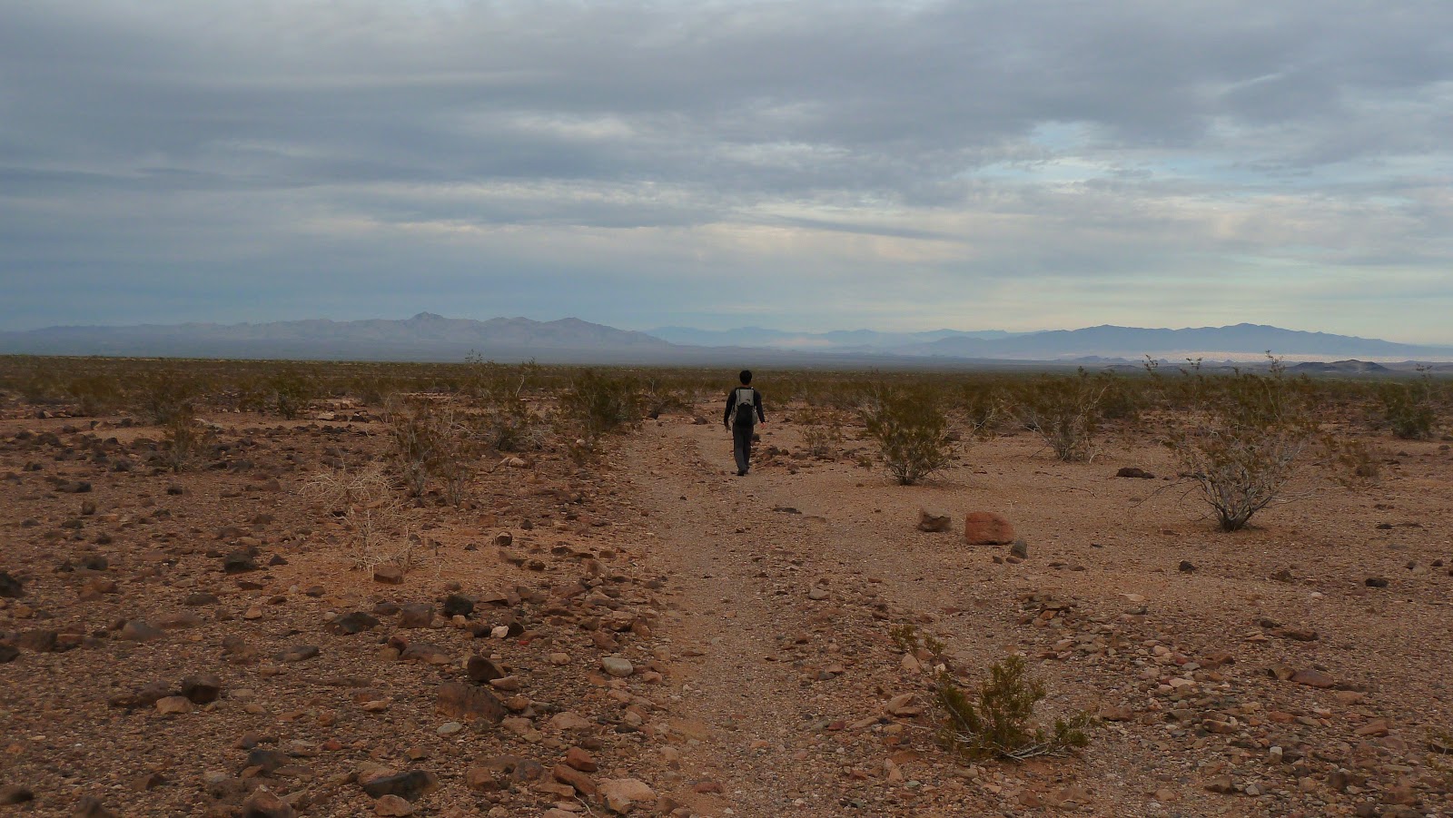
We started the hike by walking through an opening of a gate. The gate and surrounding fence was put there either to prevent livestock from exiting the area or to keep vehicles out of the wilderness. We followed an old jeep trail until it ended right before a prominent canyon to the right of Mopah.
starting out on the jeep trail with Mopah visible

We walked through the canyon for about a mile before seeing the base of Mopah. Pat took out a few pages of a Bob Burd trip report, which showed that he had aimed for the base, then contoured across the left side of Mopah until he reached a gully heading up the east face of Mopah. We decided to do the same.
Mopah

traverse around base of Mopah- the line ends at the base of Mopah's east face gully

Tommey and Pat

The gully turned out to be class 2 with a few sections of semi loose rock, but nothing horrible. The rock got more solid as we ascended.


The gully abruptly ended as a wall of vertical rock rose up in front of us. The only way to climb was to turn to the right (As mentioned by the Summitpost article, this turn resembles a "C"). We followed the slope and were soon met with our first class 3 portion, a 20ft section of rock with good holds. A dirty sling hung from the top of the section. The rock looked loose from below, but once I started climbing, it felt fairly solid.
class 3 section


After the class 3 section, we followed the slope up into a crack (or crevasse, or gully- whatever those things are called). Entering the crack required us to shimmy through a yucca plant growing at the entrance. From below, the crack looked like it consisted of loose, flaky rock. But just like the previous section, it was surprisingly solid. The climbing was no more than class 3. The crack ends at a tight squeeze between two rocks, so tight that we each had to take off our packs and throw them over to the other side.
the crack


From the end of the crack, we could see the crux of the route: a short, exposed class 4 move of about 15ft. There was a dirty sling at the top of the 15ft. Tommey tried the move first.
Tommey on the crux move- good climbing, but horrible camerawork on my part for overexposing the background


Pat climbing up

The remaining slope up to the summit was straightforward class 2.

As we topped out at the summit, we were hit instantly with bright sunlight, momentarily blinding us. It was an awesome day so far. The weather was perfect (~65F with barely any wind). We stayed on the summit for about 20 minutes, signing the summit register and feasting on munchies. Umpah Point, our next objective, was clearly visible to the south.
view SE from summit

south peaklet of Mopah in the foreground, and Umpah in the distance

some interesting peaks

descent view

above the crux move

Downclimbing the crux move wasnt as bad as we thought. Tommey and I grabbed on to the rock and hung as we gradually lowered ourselves. When we couldnt go any lower, we let go, making a small hop and landing on a small 6-inch wide ledge below us, which we could step off of to the left. Pat took the sling in her hands and improvised a rappel, very graceful compared to our momentary stomach-turning hops.
Pat rappelling

downclimbing the crack


back down the east gully

Since Umpah was to our right, we descended following a small rocky semi-wash that gradually curved right.

looking back at our descent route ("gully" refers to the crack, I labeled these photos beforehand and am too lazy to go back and change it)

For Umpah, we followed the most prominent gully to the left (gully 1) until it intersected with another one that curved sharply to the left (gully 2). Gully 2 ends at an obvious saddle. From the saddle, we turned a sharp right and upclimbed a ridge until it ended at the base of several vertical rock faces. The ridge is class 2-3. Bob Burd mentions an easier class 2 can be done by dropping to the other side of the saddle and climbing up a parallel gully.

The gullies all turned out to be easy class 2. The ridge felt like class 2 with a few easy class 3 moves. We looked over at the alternate class 2 gully to the left of the ridge and it looked boring, filled with a mix of scree and bushes.

crossover into gully 2

view of gully 2 from crossover

Tommey with Mopah

interesting peaks

the ridge

Upon reaching the end of the ridge, we looked to the right and saw the class 5.2 chimney that was the standard route, and started heading towards it. Tommey looked to the left and wondered why the standard route didnt go across the easy contour to the left. He started heading towards it. Pat and I decided we had nothing to loose and followed him. To our surprise, after turning a corner, we saw a gentle class 2 route aiming in the direction of the summit. We climbed up the route, which was class 2 with maybe one or two class 3 moves. As we topped out on a ridge, I could see the summit about a hundred feet to our north. We started walking towards the summit. I was sure that at any minute a deep vertical drop would separate our ridge from the summit, leaving us with no choice but to go back and climb the 5.2 route. It turned out that there was no drop and pretty soon we were standing on top of Umpah.
where the ridge ends and we turned left


summit view south towards Kettle BM

Mopah

Castle Rock

There was no register at the summit, so we decided to improvise one. We used a plastic container as the can. Pat had a pen and some paper (the printout of Bob Burd's trip report). We signed the trip report and stuffed it with the pen into the container and left it on top of Umpah. This was only intended to be a temporary register. Some of us intended to go back and replace it with a more durable one (after note: The register was successfully replaced with a metal one by another group on 1/20/13).

We retraced our steps and descended Umpah.

Mopah again


Weather Forecasts
Trailhead
Mopah and Umpah Points (Mopah Point has an elevation of 3,530 ft and Umpah Point has an elevation of 3,553 ft. Keep in mind that this forecast is for 3,116 ft.)
Peakbagger.com Pages
Mopah Point
Umpah Point
Summitpost Pages
Mopah Point
Umpah Point
Very thorough trip report. The photos are great with the routes shown. Thanks!
ReplyDelete