
home page
July 14, 2014
A thick band of cirrus clouds obscured the morning sun as we awoke at our camp at Henry Flats (10,560 ft). The only sounds came from a gentle lapping of water from the tarn we were camped next to, and a soft breeze whistling through the trees. Besides the nagging mosquitoes, it had been a near perfect night, with temperatures in the mid 50s and a slight breeze coming in from the southeast. By 7am, we had set off along the ridge for our first peak on the traverse: Upheaval Peak.
camp at Henry Flats

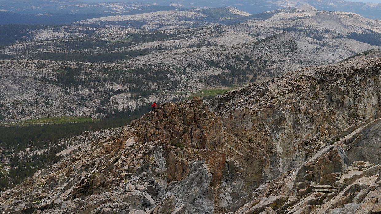
Initially, the ridge was easy, involving nothing more than class 1-2 walking on flat clinky rocks. As we approached Upheaval's northwest ridge (which began at the ~11,000 ft mark), the terrain turned into fun class 3 scrambling with a few class 4 moves on generally solid rock.
Upheaval Peak northwest ridge


a class 4-5 pull-up move


All too soon, our short but fun ridge came to an end, and we found ourselves standing on the summit of Upheaval Peak.
view northwest from summit (11,442 ft)

southeast

south

Descending Upheaval's southwest ridge involved similar terrain as climbing its northwest ridge, but was a little more tedious. We were able to keep it class 3 by dropping a few feet down on the east side of the ridge when class 5 pinnacles stood in the way.
Upheaval Peak southwest ridge


Next up was Heather Peak: a small red bump between Upheaval and Henry. Even though the peak seemed insignificant in the midst of its higher dominant neighbor, it still bore 320 ft of prominence, which usually would get it considered as "peak" status. From the lowpoint (11,220 ft) between Upheaval and Heather, Heather's northwest ridge was a simple class 1-2 walk-up.

view north from Heather's summit (11,620 ft)

southeast

Getting from Heather Peak to the lowpoint (11,330 ft) between Heather and Henry involved short spurts of class 3 and a few short knife edges. Ahead, the north ridge of Henry looked vertical and daunting, seeming more difficult than its reportedly class 3 rating.


As it turned out, the north ridge was not nearly as bad as it looked, and turned out to contain some very fun climbing. As we got closer to it, the numerous cracks and boulders of the ridge began to show themselves, and the climbing got no harder than a few moves of easy class 4 if one stayed directly on the ridge. It looked possible to keep the entire route class 3 and below by heading slightly to the left at the large section of white rock near the top.


Once the north ridge ended, a short section of knife edge brought us to the summit plateau. The actual summit was a short walk away to the southeast.


view south from summit (12,196 ft)

southwest

register

The next peak (which Andy Smatko had dubbed "Mt. Henryetta" in the register) was plainly visible to the south. Shortly after descending Henry, we ran into a short section of class 3 on Henry's south ridge.


After the next saddle (11,580 ft), the majority of Henryetta's northwest ridge contained class 2 terrain on slightly wobbly rock. The final bit of ridge steepened into a short class 3 finish.


As we reached the summit of Henryetta, the first drops of rain from a thunderstorm that was developing right over our heads began splashing down. We remained on the summit for about 5 minutes, then began a hasty descent down Henryetta's southeast ridge. Thankfully, the wind was blowing the storm west and away from us, and after another 15 minutes or so, it had moved a good distance away. Henryetta had contained one of my favorite views on the traverse. A large unnamed lake sat in a deep bowl east of the summit, bordered on three sides by steep dark cliffs. It looked incredibly surreal, like a portal into another universe.
view east from Henryetta (12,140 ft)

Andy Smatko's first ascent register

looking southeast towards our next peak: Turf Peak

Henryetta's southeast ridge was a mix of class 2 and 3, composed of sharp bits of metamorphic rock. At this point, Michael looked physically beat. He had been taking numerous breaks throughout the past two hours. As we stopped again for another break, he told me that he would not be able to finish the traverse, and wanted to bail from the ridge. The map indicated the next bail out point to be Hell For Sure Pass, which was located at the saddle southeast of Red Mountain, still two peaks away. Conveniently, the only trail to cross either the LeConte or White divides went through this pass. Michael planned to take this trail into Goddard Canyon, pick up the JMT, and set up camp at Evolution Lake. There, he would spend the next two days relaxing and bagging some peaks surrounding the lake (such as Mt. Darwin). Since I was to continue the traverse, we planned to meet back up at Evolution Lake either Wednesday night or early Thursday morning.
After this point, we said bye to eachother and continued on at our individual paces. I was hoping to make it to Lake Confusion later that day. Overhead, the clouds were growing heavy and looking about ready to burst.
views from southeast ridge


looking back up towards Henryetta

Turf Peak's northwest ridge was a pretty uneventful class 2 walk and boulder hop.

view northwest from Turf Peak summit (12,020 ft)

southeast

After some digging around, I managed to locate a "register" (if you could call it that). It was basically a business card stuffed into a Zipblock bag that was full of holes. There was no writing utensil included.

Traversing over to the next peak (Red Mountain) was pretty easy. It was a smooth class 1-2 descent to the saddle (11,520 ft) between the peaks and up Red Mountain's northwest ridge.


Red Mountain's summit was an interesting little spot. It seemed as though someone had taken cans of bright red paint and splattered them all over the summit. I did not linger for long, as it began to rain and a few loud thunderclaps sounded from the west.
Red Mountain summit (11,963 ft), looking southeast

south

There were several ways to descend Red Mountain's southeast ridge. I remained directly on the ridge itself, which contained a few sections of class 3 boulders and some small scraggly pines. Just east of the ridge were several patches of what looked like class 2 sand slopes with a few boulders strewn here and there.
looking southeast from Red Mountain's southeast ridge

south

The thundershower that had caught me on Red Mountain now looked much nastier.

Hell For Sure Pass (11,300 ft)

Shortly after Hell For Sure Pass, I became engulfed in yet another thundershower. This time the rain was heavier, and I sheltered under some rocks for about 20 minutes until the storm passed, then proceeded up Hell For Sure Peak's class 3 northwest ridge. I was surprised at how much slipperier the wet rock had become, and proceeded to climb more cautiously.
Hell For Sure Peak's northwest ridge


looking south from Hell For Sure Peak (11,837 ft)

Getting down Hell For Sure Peak's south ridge was an easy class 1-2 walk on small clinky rocks. Roughly halfway between Hell For Sure Peak and the next peak (Little Hutton) lay a tarn which I came to dub "Hell For Sure Tarn" (11,440 ft). So far, this was the only water source that lay directly on the ridge itself. The water looked pretty clean, and I gratefully recharged my bottles, feeling very thankful that I would not have to descend several hundred feet off the ridge to a lower lake to attain water.
Hell For Sure Tarn

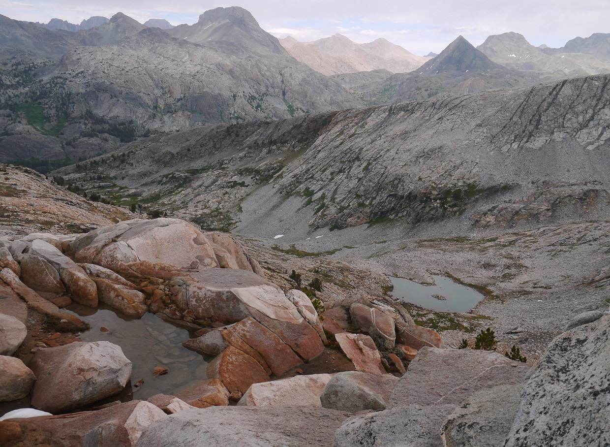
view towards Goddard Canyon
After the tarn, I noticed a grassy bench which ran along just below the ridge on its western side. This bypassed a large chunk of tedious rock hopping that was found on top of the ridge. In what felt like no time, I was standing on the summit of Little Hutton (11,690 ft). The last hundred feet or so had consisted of class 3 boulders.
To the west of Little Hutton lay Mt. Hutton, which would be an out-and-back detour. Since I would be coming back to Little Hutton, I left my pack on the peak and continued towards Mt. Hutton via east ridge. Ahhhh....how good it felt to get that that heavy pack off my back, even if it was only for a little while!
view of Mt. Hutton's east ridge from Hutton Pass: the saddle (11,470 ft) between Little and Mt. Hutton

lakes north of Hutton Pass

Mt. Hutton's east ridge was pretty much a big pile of boulders. Staying directly on the ridge itself involved very large class 3 boulders. Staying just below and to the south of the ridge involved hopping somewhat smaller class 2 boulders.
Several boulders later, I found myself on the summit. The storms had cleared, and the sun had broken through the clouds. It was a beautiful afternoon. Lakes all around the mountain were sparkling in afternoon sunshine. I laid down on the summit for a short while, taking it all in.
view south from Mt. Hutton's summit (11,990 ft)


west

north

northeast

NOT a "shitty summit!"

Arctic Lake (in foreground) not looking very arctic

I trudged back up to Little Hutton, collected my pack, groaned as it made its way back onto my back, descended Little Hutton's short class 2 southeast ridge, and began hoofing up Thumb Peak's blocky class 3 northwest ridge.


Thumb Peak contained two summits of similar height. It was hard to tell which one was higher so I ended up doing both. The western highpoint was a pile of rocks which the ridge naturally ascended to. A few feet away to the east stood a thumb-like pinnacle protruding out of the summit plateau (which is why I dubbed this peak "Thumb Peak"). This pinnacle could be surmounted with a class 3 friction move.
the pinnacle

view south from Thumb Peak (12,020 ft)


The descent off Thumb Peak and ascent of Schoolmarm Peak to the east was uneventful, composed of more ridges of class 2 boulder hopping. The one thing that was nice about this section was the vivid orange glow the late afternoon sun cast on the surrounding terrain, especially towards several ridges to the east.


At this point, I realized that I would not be able to make it to my goal of Confusion Lake before dark, so I settled on camping at a spot which I dubbed "Holster Saddle." This was the soft and sandy-looking saddle which stood between Holster Peak and Horsehead Peak.
view southeast from Schoolmarm Peak (11,990 ft)

From Schoolmarm Peak, it was another stretch class 2 boulder hopping to Holster Peak. Between the two peaks lay a scattering of small tarns and flat areas which were good for camping. The only downside was the copious amount of mosquitoes.
glowing ridges to the east


Holster peak reflected in one of the tarns

By the time I had began ascending Holster Peak's northeast ridge, the sun was a few minutes away from setting. I reached the summit with just enough light to snap a few grainy photos.
looking southeast from Holster Peak

I made my way down to Holster Saddle, which was just as I had imagined it to be. The only downside was that there was no water. On the other hand, the terrain was soft, sandy, and generally flat. I pitched the tent and crawled in as quickly as possible before the few lingering mosquitoes could take anymore bites out of me. The moon rose shortly after, making it seem as though someone was shining a bright flashlight on the tent. I ate a few pieces of jerky for dinner, then fell fast asleep in no time.
go to Day 3
No comments:
Post a Comment