
April 19-20, 2014
Located in the southern portion of the San Bernardino Mountains is a striking geological feature- a deep and spacious canyon known as Mill Creek Canyon, which is separated by two ridges: Yucaipa Ridge to the south and San Bernardino Ridge to the north. Both ridges are very prominent features which can be seen from over 100 miles away on a clear day. The Yucaipa Ridge makes up much of the southern backbone of the San Bernardino range, forming a wall of peaks which suddenly rise out of the surrounding low hilly terrain. The San Bernardino Ridge is the highest strip of land in Southern California, containing 9 peaks sporting elevations over 10,000 ft. Both ridges are connected on their eastern sides by a rounded saddle known as Mill Creek Jumpoff, forming a large and distinct "U" shape.
Both the Yucaipa and San Bernardino ridges play a large role in the Southern California mountaineering and peakbagging worlds. The San Bernardino 9 Peaks Challenge, which traverses all 10,000 ft peaks on the San Bernardino Ridge, has become a very popular route that is done by multiple parties every year. This can be seen in the multitude of trip reports on the route (1,2,3,4,5,6). Few groups have traversed the entire Yucaipa Ridge due to its terrain, but many have done large chunks of it, most of which were done in a east-west direction starting from (or somewhere near) Mill Creek Jumpoff (1,2,3).
As time went on, some began looking for a way to string together the two ridges into a single route. Perhaps the biggest obstacle in accomplishing this was getting across Mill Creek Jumpoff- an affair which involves a section of serious and brutal bushwhacking. This obstacle was solved when a gully heading up to the ridge west of Dragons Head (the same ridge containing portions of the Vivian Creek Trail) was discovered by an unknown party while crossing the Jumpoff. This gully, which is located a little over a tenth of a mile east of Mill Creek Jumpoff, still contains a good share of bushwhacking, but is a considerably better option compared to hiking directly across Mill Creek Jumpoff. On June 3, 2012 the first recorded attempt of connecting both ridges into a single route was made by Evan Welsh, who had started the route from Angelus Oaks, heading up to the San Bernardino Ridge, down Yucaipa Ridge, and ending at Bearpaw Reserve shortly before Allen Peak, summiting 18 peaks total. He completed his trek in an impressive 18.5 hours and dubbed the route "The Mighty U."
After looking at maps of both Yucaipa and San Bernardino ridges, I decided to do a similar traverse as Evan had done (see map) but would start from the base of Yucaipa Ridge, climb a few more peaks, and take two days to do it. I would start the route at the SCE hydroelectric station at the western toe of Yucaipa Ridge, traverse the ridge to Galena Peak, then cross over Mill Creek Jumpoff onto the Vivian Creek Trail and head towards Dragons Head and Bighorn Peak. The map had indicated large chunks of flat terrain in the area surrounding those peaks, so I put the location down for a potential spot to camp. The next morning, I would get up early and climb Dragons Head, Bighorn Peak, and San Gorgonio Mountain. Once on San Gorgonio, I planned to meet up with a group led by Zach Cyrus that was heading up the Vivian Creek Trail early that morning and doing the San Bernardino 9 Peaks Challenge. I would hike the remaining peaks with them, adding in East Dobbs and Dobbs Peak which were situated on a subsidiary ridge south of Jepson Peak. After bagging the remaining peaks, we would descend via the Momyer/Alger Trail to Momyer Trailhead in Forest Falls.
| Order | Peak | Elevation | Topographic Prominence | Summit Coordinates (lat/lon) |
|---|---|---|---|---|
| 1 | Mill Benchmark | 4,998 ft | 200 ft | 34.090749, -117.010682 |
| 2 | Allen Peak | 5,795 ft | 615 ft | 34.080551, -116.986747 |
| 3 | Birch Mountain | 7,826 ft | 286 ft | 34.076149, -116.947723 |
| 4 | Cedar Mountain | 8,324 ft | 224 ft | 34.06806, -116.928413 |
| 5 | Oak Glen Peak | 8,404 ft | 144 ft | 34.066579, -116.921933 |
| 6 | Wilshire Peak | 8,680 ft | 80 ft | 34.064001, -116.914946 |
| 7 | Wilshire Mountain | 8,832 ft | 92 ft | 34.063852, -116.90641 |
| 8 | Little San Gorgonio Peak | 9,133 ft | 593 ft | 34.060479, -116.8848 |
| 9 | Wanat Peak | 9,045 ft | 520 ft | 34.064712, -116.87479 |
| 10 | Cuchillo Peak | 8,868 ft | 209 ft | 34.067076, -116.866186 |
| 11 | Galena West Galena Peak | 9,358 ft 9,324 ft | 884 ft 70 ft | 34.070853, -116.849995 34.071159, -116.846383 |
| 12 | Dragons Head | 10,866 ft | 206 ft | 34.089843, -116.830743 |
| 13 | Bighorn Mountain | 10,997 ft | 377 ft | 34.090563, -116.818709 |
| 14 | San Gorgonio Mountain | 11,499 ft | 8,290 ft | 34.099162, -116.824853 |
| 15 | East Dobbs | 10,520 ft | 68 ft | 34.096324, -116.849167 |
| 16 | Dobbs Peak | 10,459 ft | 79 ft | 34.098344, -116.859806 |
| 17 | Jepson Peak | 11,205 ft | 145 ft | 34.10292, -116.844865 |
| 18 | Little Charlton Peak | 10,696 ft | 116 ft | 34.1102, -116.8503 |
| 19 | Charlton Peak | 10,806 ft | 266 ft | 34.114864, -116.853791 |
| 20 | Alto Diablo | 10,563 ft | 143 ft | 34.12705, -116.87328 |
| 21 | Shields Peak | 10,680 ft | 120 ft | 34.127234, -116.88203 |
| 22 | Anderson Peak | 10,840 ft | 880 ft | 34.124628, -116.894317 |
| 23 | San Bernardino East Peak | 10,691 ft | 191 ft | 34.124785, -116.909861 |
| 24 | San Bernardino Peak | 10,649 ft | 229 ft | 34.122439, -116.922405 |
Getting to the starting trailhead (SCE hydroelectric station): From Mill Creek Ranger Station, travel 0.7 miles east on CA-38. A small paved road leading to the SCE station will branch off to the right. This is the trailhead. There is no legal parking in the vicinity of the SCE station, so some options are either parking at Mill Creek Ranger Station and walking to the trailhead, or setting up a car shuttle. (coordinates: 34.087854, -117.040585)
Getting to the finishing trailhead (Momyer Trailhead) (coordinates: 34.087073, -116.914893)
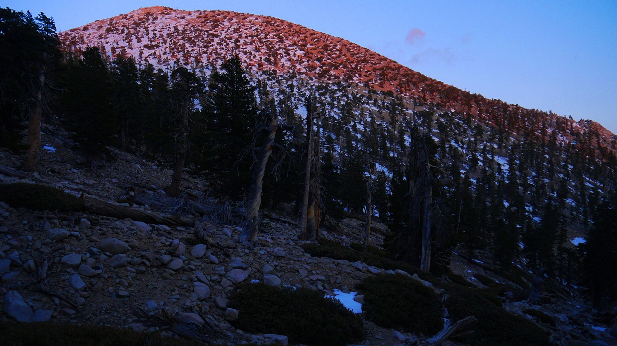
The eastern sky was starting to brighten as I began hiking from the trailhead (2,900 ft) shortly before 6am. It was a breezy morning with temperatures in the low 50s. I walked about a tenth of a mile to the end of the road that headed through the hydroelectric station, then headed up a small trail that branched off to the east (left), heading up the toe of Yucaipa Ridge. I started off slow, still adjusting to the 37lb pack on my back, and thought of the long ridges that lay ahead. As I ascended higher on the ridge, the cool breeze was gradually replaced with think humid air.
looking southwest from ~3,600 ft on Yucaipa Ridge

After about a mile, the trail intersected a fire road which continued along Yucaipa Ridge. After another uneventful 1.3 miles on the fire road, I found myself on the north side of Mill Benchmark. I left the road and bushwhacked the last few hundred feet of distance to the benchmark. The sun was just beginning to make its way over the crest of the San Bernardino Ridge to the east.

views from Mill Benchmark


The sun was shining brightly as I made my way down Mill Benchmark and back to the fire road. It would be another 2.3 miles along the road to the base of Allen Peak.
Allen Peak to the east

looking north

Allen Peak getting closer

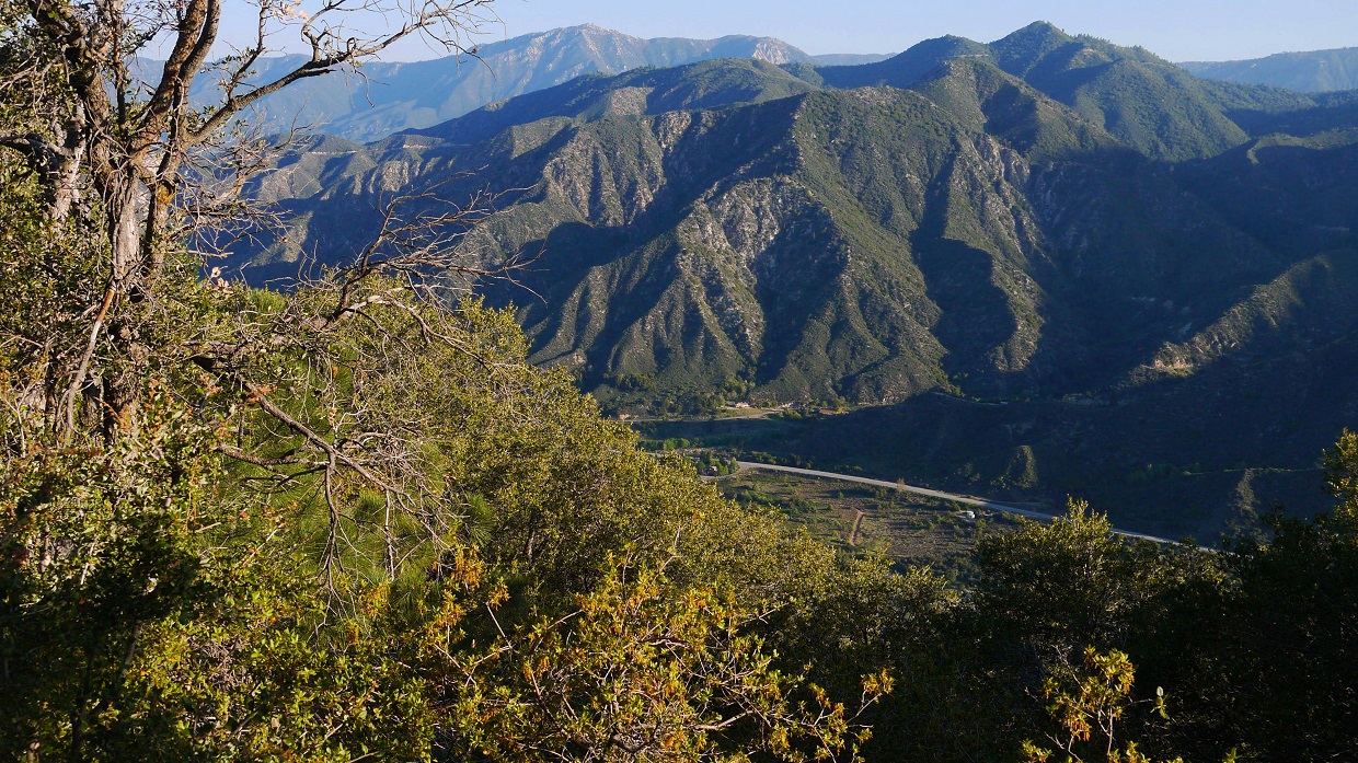
morning light on Mill Creek Canyon

As the road intersected Allen Peak's north ridge, a faint use-trail branched off up the ridge, climbing a short distance to the summit.
Allen Peak turnoff

views from ascent

view northwest from the summit towards San Bernardino Peak

south-southeast

Back at the road, I ate a quick snack and continued on my way, reaching a large saddle (5,175 ft) that lay in between Allen Peak and Birch Mountain. Just before the saddle was a gate indicating that I was entering The Wildlands Conservancy and a sign indicating directions to Allen Peak and the Oak Glen Divide Trail.

From Saddle 5,175 ft, I stayed on the fire road, ignoring another road which branched downhill to the north. The road, which now resembled more of a trail, headed up under a canopy of trees which provided some much wanted shade. I stayed on the road/trail for another 2.3 miles after Saddle 5,175 ft until it intersected the Oak Glen Divide Trail, which branched off north from a saddle with Point 6237 (labeled on topo map).
another gate shortly before intersecting the Oak Glen Divide Trail


San Bernardino Peak through the trees

turnoff for Oak Glen Divide Trail (note that the sign is facing the wrong way)

The Oak Glen Divide Trail started out very trail-like, then gradually became increasingly faint. It was clear that the trail was unmaintained, and what remained of it was slowly being taken back by mother nature. I remained on the trail for 1.6 miles to where it intersected Birch Mountain's northwest ridge, then headed up the ridge on a short cross country section to Birch's summit.
views from Oak Glen Divide Trail


view of Birch Mountain, shortly before leaving the trail

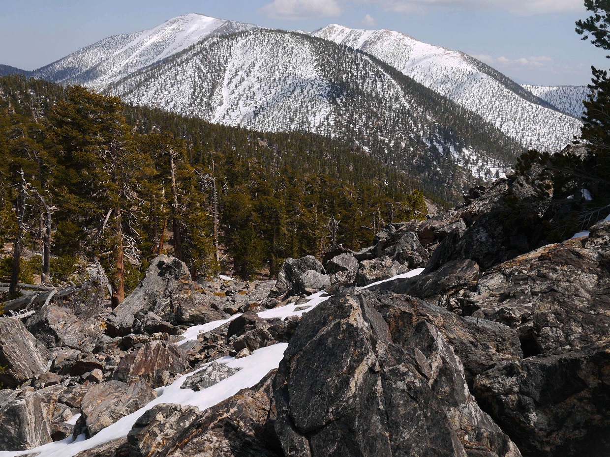
From the summit of Birch, the remainder of Yucaipa Ridge would consist of a series of undulating bumps with anywhere between 70 ft and 600 ft of elevation gain/loss in between them.
view southeast from Birch Mountain summit

I descended Birch's east ridge, picked up the trail, and lost it shortly after the saddle between Birch and Cedar. Other than a deceptive false summit, the hike to Cedar was a pretty straightforward walk along the crest of the ridge. The hike up the next three peaks after Cedar (Oak Glen Peak, Wilshire Peak, Wilshire Mountain) were done in a similar way.
trail junction (with invisible trails) shortly before Cedar Mountain

summit of Cedar Mountain, looking east

random nature shot!

looking east from Oak Glen Peak

northeast

At the summit of Wilshire Peak, I ran into Gregg and Mihai who were taking a snack break on the summit. They had started earlier that day somewhere in Oak Glen and were there for the day to bag four peaks (Cedar through Little San Gorgonio) on Yucaipa Ridge. After a short chat on the summit, they continued on towards Wilshire and Little San G, and I sat down to replenish some calories.
looking east from Wilshire Peak
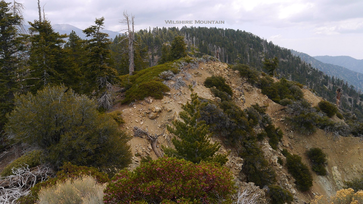
sign shortly before Wilshire Mountain

Wilshire Mountain's summit area was a plateau covered in trees which did'nt really have a summit-like feel to it, but it did contain an interesting summit block which seemed to have been randomly dropped out of the sky.

I walked for about 100 ft south from Wilshire's summit, intersected a dirt road, and followed it for about 0.8 miles to where it ended at some comm towers.
views from dirt road


I ran back into Gregg and Mihai at the towers, and we continued east along the ridge for a short distance to the summit of Little San Gorgonio Peak. From there, we were able to gain a view of certain sections of the traverse from Little San G to Galena Peak.
view northeast from Little San Gorgonio Peak

dark clouds over San Gorgonio Mountain

Gregg and Mihai at the summit

The remaining traverse to Galena Peak was rumored to be long and tedious based on a few trip reports I had read. The next two peaks after Little San G are not officially named, but have been locally referred to as "Wanat Peak" and "Cuchillo Peak." I found it surprising that Wanat Peak was not more widely recognized since it bore 520 ft of prominence, making it the fourth most prominent peak on Yucaipa Ridge.
UPDATE: The peaks WANAT and CUCHILLO have since then been officially recognized by the USGS.
After saying bye to Gregg and Mihai, I headed down the northeast ridge of Little San G towards Wanat Peak. The northeast ridge contained a fairly visible use trail and took no time to descend. As I began heading up towards Wanat Peak, the use trail disappeared and was replaced by moderately dense thickets of manzanita and buckthorn.
Wanat Peak seen from Little San Gorgonio's northeast ridge


Little San G seen from Wanat's southwest ridge

Wanat's southwest ridge


view west from summit

northeast

east

Immediately after getting off Wanat's summit, the ridge became blocked by vegetation, and I dropped down a scree gully to the right for about a hundred feet, then reascended to the ridge. From that point to the summit of Cuchillo, it was possible to stay mostly on the ridge, with occasional drop-downs in order to avoid bushwhacking. Shortly after leaving Wanat's summit, I realized that I was running low on water, and located a small snowpatch on the north side of the ridge. I spent around 20 minutes with the stove, managing to get about 2.5 liters of water out of the snowpatch. Good enough.


The summit of Cuchillo was mostly covered in trees, so there was not too much of a view. The highpoint was covered with a thin layer of manzanita.
summit of Cuchillo

view northeast
next up: Galena West

There was no doubt that the section between Cuchillo and Galena West was both the most tedious and adventurous portion of Yucaipa Ridge. I was able to stay mostly on the crest of ridge, but dropped down here and there due to a series of small obstacles consisting of trees, manzanita, buckthorn, and small rock outcroppings. The terrain consisted of a lot of crumbly class 2 sandstone. Closer to Galena Peak, there were a few short sections of class 3 on crumbly metamorphic rock. I was surprised to even run into a few short knife edge sections.


From the summit of Galena West, I was treated to a grand view down into Mill Creek Canyon. If only the lighting was better...

looking back along Yucaipa Ridge

Galena West marks the highpoint and most topographically prominent point on Yucaipa Ridge. There have been past debates on whether Galena West or Galena Peak is the true highpoint. It is not possible to tell which one is higher based on the topo map since both peaks share the same contour line, but based on data from the GPS tracks of numerous parties, I believe that Galena West is the higher bump. Even though Galena Peak is lower, I do however think that the overall view from Galena Peak is better than that from Galena West.
Galena Peak seen from Galena West

views from Galena Peak


Next up was the crossing of Mill Creek Jumpoff- the transition between Yucaipa Ridge and the San Bernardino Ridge. I descended the north ridge of Galena Peak to an elevation of ~9,000 ft, then dropped down into a small gully to the east which then intersected the south fork of the Whitewater River at 8,360 ft (about 100 ft below Mill Creek Jumpoff). I chose not to descend to the actual dropoff due to what looked like horrible bushwhacking. After intersecting the south fork, I followed the drainage a short distance east to ~8,300 ft, and located the beginning of the thin rocky gully that headed up north towards the Vivian Creek Trail.
route seen from Galena Peak

dusty section shortly before intersecting the south fork

start of the rocky gully

The gully was generally clear of brush up to ~8,870 ft where it quickly began filling up with manzanita and buckthorn. I moved over onto a small ridge west of the gully which contained less vegetation, and paralleled the gully upwards.
views towards Yucaipa Ridge


After a considerable amount of grunting and heavy breathing, I intersected the Vivian Creek Trail at ~9,900 ft. It was already past 6pm, and then sun would be going down really soon. It was time to begin scanning the surrounding terrain for possible spots to camp. I would try to get as close as possible to a saddle (10,670 ft) immediately north of Dragons Head before sunset. I followed the Vivian Creek Trail north for 0.6 miles, then left the trail and descended northeast into a small basin a short distance west of Saddle 10,670 ft. Seeing that there were a few nice sandy spots for camping and a several surrounding snowpatches that could be melted for drinking water, I decided to stop there for the night.
views from Vivian Creek Trail


sunset on Dragons Head, seen from camp (10,170 ft)
After setting up the tent I was asleep within minutes, and awoke only a few times later that night. An almost-full moon illuminated the sky, resembling a giant flashlight. The temperature was very warm that night in the mid 30s, so I did not need to bother with zipping up the sleeping bag.
The night passed pretty quickly, and before long I was packed up and walking slowly up to Saddle 10,670 ft. From the saddle, Dragons head was a short walk to the south. The north ridge of Dragons Head was an interesting little place, with the east side of the ridge dropping straight down in jagged cliffs.


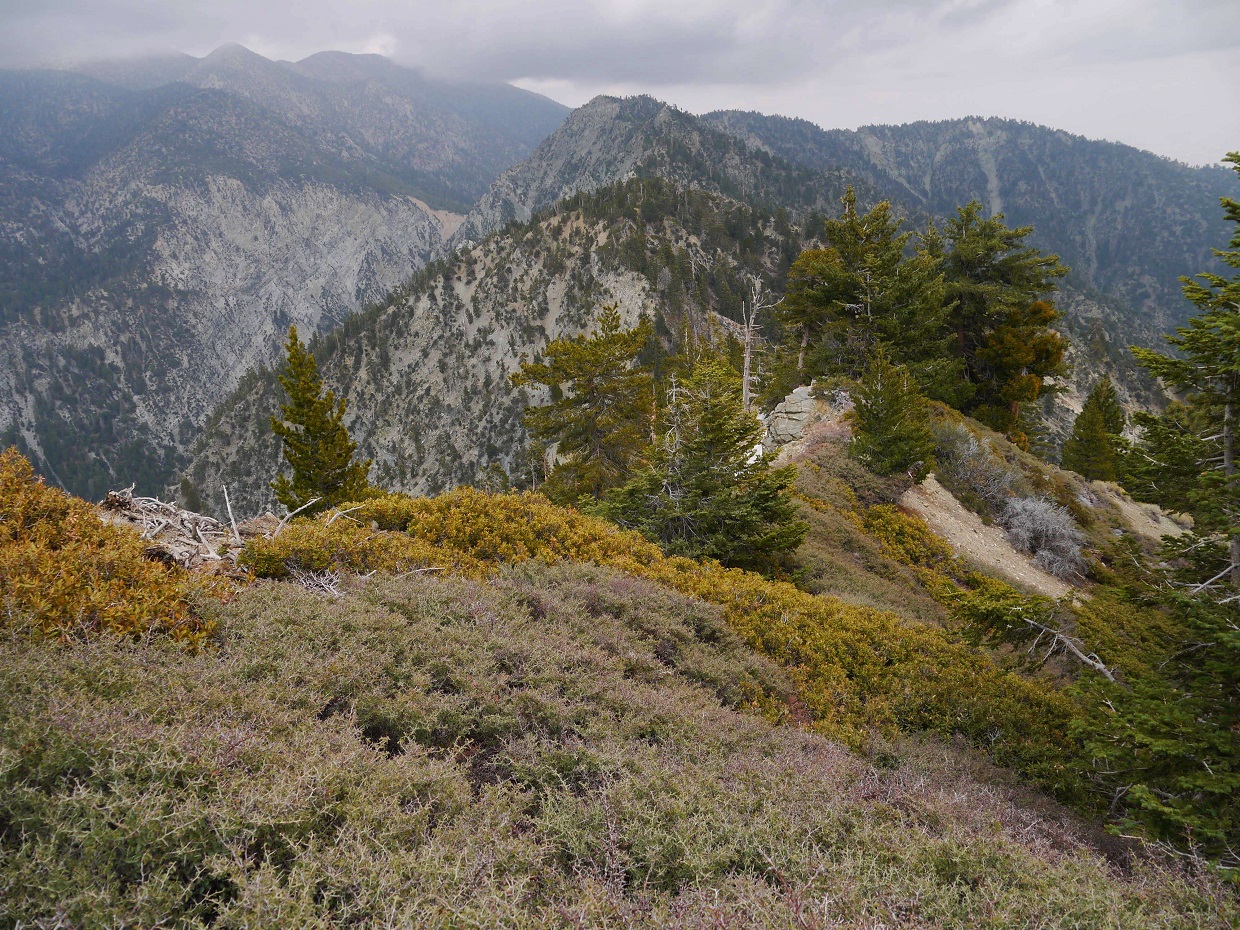
view east from the summit of Dragons Head

Back at Saddle 10,670 ft, I headed east into a large sandy flat known as Tosh's Tarn (aka. The Tarn). It seemed that at some point in history this was the bed of an alpine lake, but it has since then filled up with sediment and dried out.
Tosh's Tarn

From the east side of Tosh's tarn, I made my way up the crumbly loose rock of Bighorn Mountain's north slope. The sand and scree made for an unpleasant slog, but thankfully the climb was short and I found myself on the summit of Bighorn in less than 15 minutes after leaving the tarn.
Bighorn's north slope

views from summit


From Bighorn, the hike up to San Gorgonio Mountain was straightforward, heading up a broad ridge which started from Tosh's Tarn southeast of the summit and headed directly up to it.
view of Dragons Head while heading up Gorgonio

Bighorn

Once at the broad summit of Gorgonio, I took out the stove and began heating up water to cook breakfast with. I was running on pure glycogen, which would deplete very soon if I did not eat anything. It was a very calm morning at the summit with almost no wind and temperatures in the high 40s. Two groups which had camped at the summit the previous night were getting ready to head out.
large wind shelter on San Gorgonio Mountain

summit views


After spending about an hour at the summit heating and stuffing myself with noodles and hash browns, I packed up and headed west to a junction with the Vivian Creek Trail, at which I stayed right on the San Bernardino Peak Divide Trail. At this spot, members of Zach's 9 Peak Challenge group (which had started from Vivian Creek Trailhead earlier that morning) began trickling in, heading towards Gorgonio. I planned to quickly tag East Dobbs and Dobbs Peak, then meet up with them on Jepson.
Jepson Peak seen from a spot near the junction

From the trail junction, I took the San Bernardino Peak Divide Trail a short distance west to where it intersected a soft ridge connecting Jepson and East Dobbs. From there, it was an easy sandy descent to East Dobbs and a straightforward walk on the soft ridge between East Dobbs and Dobbs Peak.
East Dobbs and Dobbs Peak seen from the east

Yucaipa Ridge

above East Dobbs


Dobbs Peak

Yucaipa Ridge seen from the summit of East Dobbs

view east from Dobbs Peak

After bagging both peaks, I headed back up the ridge that I had descended earlier to East Dobbs, and followed it up until it terminated at the summit of Jepson.
route to Jepson seen from the summit of East Dobbs

San Gorgonio seen from Jepson

view northwest

I met up with the rest of the 9 peak group on Jepson, and we continued along the San Bernardino Ridge with 7 peaks remaining. Just to the west of Jepson was a small bump which some of them referred to as "Little Jepson" or "Jepson Jr." This bump was not part of the 9 Peaks Challenge or Mighty U Traverse, but it was there, so why not? We tagged that bump (which was not any different than Jepson) and then descended towards the saddle (10,570 ft) between Jepson and Little Charlton Peak.
heading towards Little Jepson

East Dobbs seen from Little Jepson

lingering snow on Dobbs Peak

approaching the Jepson/Little Charlton saddle (out of frame to the right)

From the saddle, we left the trail and followed the main ridge up to Little Charlton and Charlton, then descended northwest off Charlton to Dollar Lake Saddle to meet back up with the trail, slipping ocassionaly on lingering snowpatches.
heading up Little Charlton


Charlton Peak seen from Little Charlton's summit

north face of Jepson

view from Charlton's summit

sign at Dollar Lake Saddle (10,000 ft)

The next 3 peaks after Dollar Lake Saddle were pretty similar in terms of difficulty and scenery. They were each within a quarter mile of the trail and contained great views toward the mountains immediately surrounding San Gorgonio. Alto Diablo was nothing more than a small rockpile right off the trail.
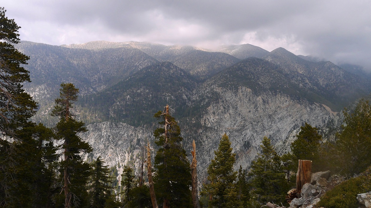
nice views towards San Gorgonio


the rockpile of Alto Diablo

view west from Alto Diablo

southeast

nice afternoon lightning

views from Shields Peak


descending a short section of talus on the west side of Shields Peak

somewhere near Anderson Peak


summit of Anderson

view west from Anderson

Shortly after Anderson Peak and just before where the trail began ascending San Bernardino East Peak was the junction with the Momyer/Alger Trail. We would keep heading west along the San Bernardino Ridge for the remaining two peaks, then head back to this junction and take the Momyer/Alger Trail to Momyer Trailhead in Forest Falls. The junction was very faint and would've been difficult to discern if it wasnt for a few cairns that marked it. I had remembered seeing a sign marking the junction a year earlier, but it had since been removed. Not needing everything in our packs for the remaining two peaks, we left our packs at this junction and continued along the ridge carrying a few small items each.
Next up was San Bernardino East Peak. This peak was very straight forward since the trail goes almost right over the summit. The highpoint was a pile of rocks south of the trail.
summit rockpile of San Bernardino East Peak

view west

southeast

The remaining distance to the last peak went fairly quickly as the highpoint was also slightly south off the trail. Once everyone had made it to San Bernardino Peak, a quick celebration ensued, after which we hustled back to the Momyer/Alger junction and down the Momyer/Alger Trail. This trail was not maintained. The top part of it was overgrown with manzanita and buckthorn, and fallen trees frequently blocked off sections of trail. There were two junctions to make note of: one at ~7,300 ft where we turned right at a well defined trail, and another at ~5,720 ft where the Momyer/Alger Trail turned a sharp left and a smaller trail branched off to the right. We reached the Momyer Trailhead (5,500 ft) sometime around 9:15 pm, feeling both exhausted and accomplished.
view southeast from San Bernardino Peak


views of Yucaipa Ridge from Momyer/Alger trail


register archive: Yucaipa Ridge

register archive: San Bernardino Ridge + remaining peaks

Final stats
40 miles
17,585 ft/14,965 ft gain/loss

Weather Forecasts
SCE hydroelectric station
4,800 ft on Yucaipa Ridge
6,500 ft on Yucaipa Ridge
8,600 ft on Yucaipa Ridge
San Gorgonio summit vicinity
San Bernardino Ridge
Momyer Trailhead
Peakbagger Pages
Mill Benchmark
Allen Peak
Birch Mountain
Cedar Mountain
Oak Glen Peak
Wilshire Peak
Wilshire Mountain
Little San Gorgonio Peak
Wanat Peak
Cuchillo Peak
Galena West
Galena Peak
Dragons Head
Bighorn Mountain
San Gorgonio Mountain
East Dobbs
Dobbs Peak
Jepson Peak
Little Charlton Peak
Charlton Peak
Alto Diablo
Shields Peak
Anderson Peak
San Bernardino East Peak
San Bernardino Peak
Summitpost Pages
Allen Peak
Little San Gorgonio Peak
Galena Peak
Dragons Head
Bighorn Mountain (note that the photo used as the main profile is Dragons Head, NOT Bighorn)
San Gorgonio Mountain
Dobbs Peak
Jepson Peak
Little Charlton Peak
Charlton Peak
Alto Diablo
Shields Peak
Anderson Peak
San Bernardino East Peak
San Bernardino Peak
Other
San Gorgonio Wilderness Association
San Gorgonio Backcountry Bulletin Board
Eric, 4-28-14 Press Enterprise just did a story on officially naming those peaks. Wanat and Cuchillo. Your TR's are always awesome to read.
ReplyDeleteThis comment has been removed by the author.
ReplyDeleteAmazing trip. Truly freak-worthy!
ReplyDelete