
January 25, 2014
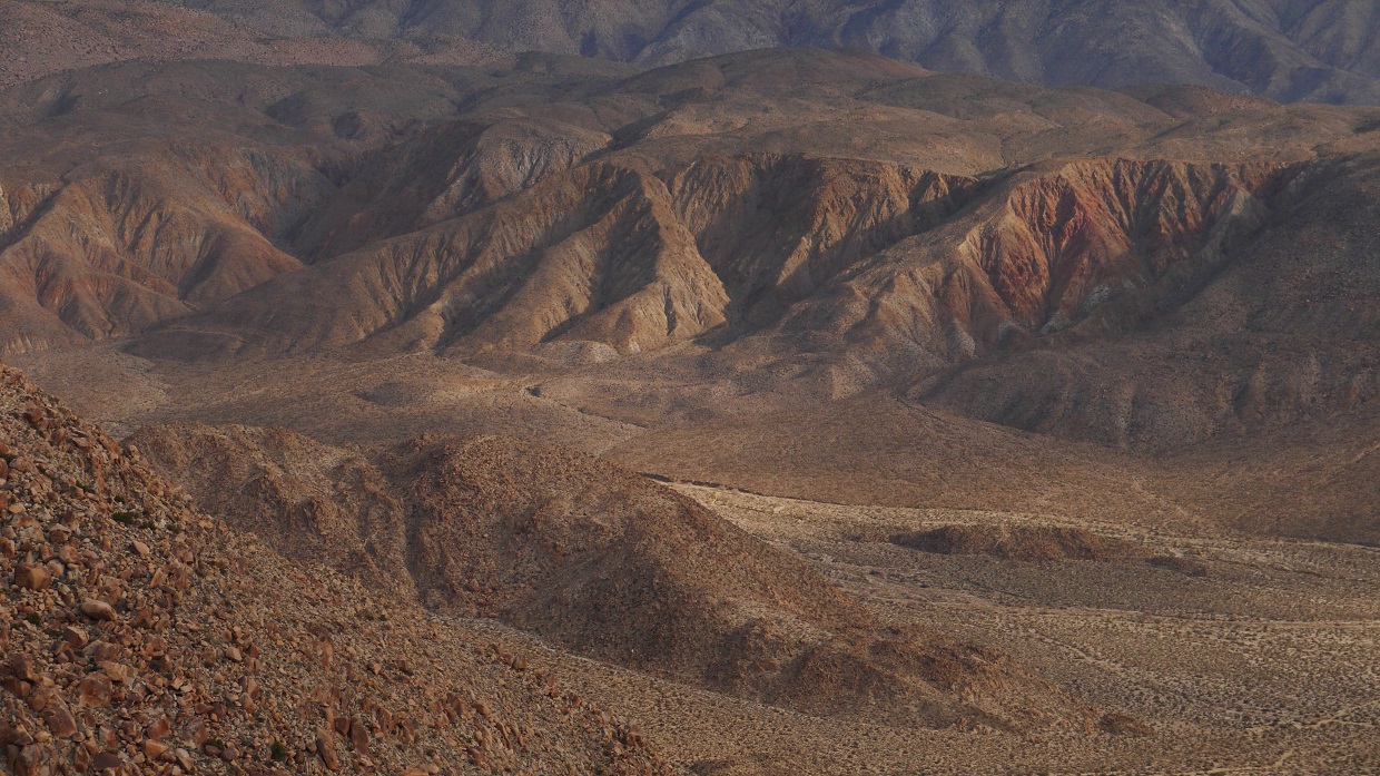
On the northwestern side of the Anza Borrego Desert is Collins Valley, an broad area of land bordered on three sides by rugged mountains. The area is relatively remote compared to the rest of Anza Borrego, and does not see much human impact. It is one of the few places in San Diego County where one can look and see nothing but an expanse of undisturbed desert floor and mountains that stretch for miles on end. To the west of Collins Valley are a jumble of peaks and benchmarks arranged in a spectacular fasion. The views from each peak are surprisingly good, and the scenery changes frequently from place to place. (see route map)
| Peak | Elevation | Topographic Prominence | Summit Coordinates (lat/lon) |
|---|---|---|---|
| Palms Benchmark | 3,121 ft | 221 ft | 33.377229, -116.48481 |
| Elder Benchmark | 3,433 ft | 53 ft | 33.386326, -116.488297 |
| Elder North | 3,482 ft | 600 ft | 33.389689, -116.489475 |
| Collins Benchmark | 4,559 ft | 299 ft | 33.389112, -116.508248 |
| Peak 4695 | 4,695 ft | 315 ft | 33.389886, -116.522069 |
| Knob Benchmark | 3,431 ft | 190 ft | 33.377138, -116.506363 |
| "Knoblet Peak" | 3,243 ft | 247 ft | 33.378401, -116.495719 |
Getting to the trailhead: Follow the waypoints on this map, which starts from Christmas Circle in Borrego Springs. Click on NexRad on the top right for best results. 4WD or high clearance 2WD is required. Expect three creek crossings even in dry years.
Trailhead coordinates (lat/lon): 33.366211, -116.482230
looking up Sheep Canyon from the trailhead

Patrick, Craig J, Craig B, and I started hiking from the trailhead (1,660 ft) at 7:20 am with our first goal in mind as Palms Benchmark. We crossed a dry wash immediately to the north, then began climbing up a slope northward towards a prominent gully. The terrain was composed of mostly solid rock, making the ascent enjoyable.
view north from trailhead

crossing the wash

fun class 2 terrain


meeting up with the prominent gully


The gully continued to ascend northward, ending at a saddle southeast of Palms Benchmark. As the saddle came into view up ahead, the rounded summit of Palms Benchmark also came into view towards the northwest (left). Before reaching the saddle, we left the gully and made a beeline for the summit.


The summit area of Palms Benchmark turned out to be an interesting little spot. The highpoint was an easy class 3 block that was pretty obvious. A few feet away to the west was a lower block which contained a few fun class 4 moves. A register was located to the north of both blocks on a large flat rock, and the benchmark was located sandwiched between two rocks west of the register rock.

summit views


Craig J on highest block

closeup of the class 4 block

register and benchmark

snack break at the summit

After spending some time on the summit of Palms Benchmark, we turned our attention towards Elder Benchmark to the north. Elder was separated from Palms by a small canyon not yet visible from the summit of Palms. We initially began descending the north ridge of Palms, but found our progress repeatedly blocked and slowed down by several very large boulders. About halfway down the ridge, we bailed off into a small canyon to the west, then continued north towards Elder. We crossed the lowpoint between Palms and Elder at around 2,750 ft.
looking towards Elder from Palms

Collins Valley


route to Elder (note that Elder is not the highest point)

big boulders on Palms north ridge

more views


Square Top looking mighty

lowpoint between Palms and Elder

climbing up Elder


Craig B and I were the first to reach Elder at around 9:30 am. From the summit, we could see the jagged profile of Elder North, the true highpoint. With 600 ft of prominence, the peak was also one of the most prominent peaks in the Collins Valley area. Feeling an urge to climb it, I dropped my pack on the summit of Elder Benchmark and headed towards Elder North. Since Craig B was only concerned with peaks on the SDC list, he had no interests in Elder North, and stayed on the summit of Elder Benchmark to wait for the others.
views from Elder Benchmark


one of two benchmarks

I descended north off the summit of Elder Benchmark, utilizing the many fun class 3 opportunities it offered. A small flat lay between Elder Benchmark and Elder North. I crossed the flat and ascended to a notch between Elder North and a lower highpoint to the south. From the notch, I ascended a short class 3 section of Elder North's south ridge, staying on the left side of the ridge.

The summit of Elder North contained two blocks which looked to be similar in elevation. The western block could be surmounted with a short class 4 friction move, and the eastern block contained around 15 ft of climbing of what looked to be in the class 5.8-5.9 range. I would probably be able to climb up onto the eastern block, but seriously doubted my ability to descend it without a rappel. It was better to be safe than sorry, so I decided to leave the eastern block unclimbed.

eastern block viewed from western block

views from summit


Craig and Craig on Elder Benchmark

massive profile of Collins Benchmark

I descended Elder North and headed back up to Elder Benchmark to retrieve my pack. By the time I got back to Elder Benchmark, the others had already left a short time ago heading towards Collins Benchmark. I grabbed my pack and headed down a class 2 gully west of Elder Benchmark, which dropped over 600 ft of elevation into a large canyon between Elder and Collins. It was only when I had descended halfway down the gully did I realize that I had forgotten to sign the register for Elder. Oh well.
last views of Elder North from Elder Benchmark

route to Collins Benchmark

I caught up with the group just as they were crossing the lowpoint between Elder and Collins at 2,740 ft. From there, the true summit of Collins was blocked from view by an eastern false summit. We ascended a loose sandy gully to a small saddle to the northeast (right) of the false summit.
looking up the gully

ascending the gully


true summit seen from false summit

views from false summit


heading up towards Collins

Even though the elevation of Collins was only 4,559 ft, it seemed like we were much higher. There were really awesome views eastward towards Collins Valley and the peaks we had climbed earlier that day. The summit block of Collins was an interesting class 2 formation. All of us could comfortably fit onto its highpoint.
views from Collins Benchmark


benchmark and register

Patrick on the summit block

Next up was Peak 4695, the highpoint of the ridge containing Collins. The four of us headed down to a saddle (4,360 ft) immediately to the west of Collins. From there, Craig J and I continued following the ridge north towards Peak 4695. Having no interests in Peak 4695, Craig B and Patrick descended south down a gully towards Knob Benchmark.
Peak 4695 seen from Collins

views from the ridge between Collins and Peak 4695

views from Peak 4695 summit


The register for Peak 4695 was quite interesting. Only the first few pages of it had been signed since Wes Shelberg and Jack Grams placed it in 1979. There was even a 16-year gap between signatures at one point.

After a few moments on Peak 4695, we headed back to Saddle 4,360 ft and descended a gully to the south, following it to the base of Knob Benchmark. The gully was comprised of much semi-compacted sand.


looking back towards Collins from the slopes of Knob Benchmark

benchmark and register

To the east of Knob Benchmark was a peak that looked similar to Knob on the Topo map. This peak had a lower elevation than Knob, but contained more prominence. I would later dub it "Knoblet Peak." From the summit of Knob, I descended towards the east, making a beeline for Knoblet Peak. Craig J was not interested in Knoblet, so he descended southeast into Sheep Canyon, following it downstream where it would eventually intersect the trailhead.
Knoblet seen from Knob

The beeline I had planned to take to Knoblet Peak ended up more like a zigzag line. On the immediate west side of Knoblet Peak was a small canyon running from north to south. As I reached the west side of the canyon, I could see that it was choked up with a large amount of very thick brush. I paralleled the canyon north and ended up locating a reasonable crossing spot at the highest grove of palm trees that resided in the canyon.
crossing spot

After crossing the canyon, the climb up to Knoblet Peak was straightforward. I simply ascended until there was no more land to ascend. The terrain was mostly composed of loose sandstone. The summit area was a small plateau with an ambiguous highpoint, so I ended up tagging all the potential candidates.
views from Knoblet Peak


To the east of Knoblet Peak is a canyon that runs from north to south, spilling out into Sheep Canyon at its southern end. From Knoblet, I descended southeast to intersect this canyon and followed it into Sheep Canyon.
view south from Knoblet Peak

As I intersected Sheep Canyon, I was surprised to bump into Craig J at that very moment. We then descended Sheep Canyon together, finding the canyon filled with moderate bushwhacking and a few waterfalls. Despite the dry year, a healthy creek could be found flowing through the canyon. Much of the rocks in the immediate vicinity of the creek were smooth and slippery from water polishing. At first there were no trails, and we made our way down the canyon making numerous creek crossings. Eventually a small use-trail began contouring along the southern side of the canyon, speeding things up. Somewhere along the line, Craig's leg was impaled by an Agave plant. After a few minutes, his leg was so stained with blood that it looked like something that was part of a Halloween costume. As we rounded the second to last bend in the canyon, the canyon opened up dramatically and the use-trail became more evident. A father and son could be seen setting up their camp in a sandy spot next to the creek. We arrived back at the trailhead just as darkness was beginning to set.
bypassing a waterfall in Sheep Canyon

Final Stats
8.7 miles
6,400 ft gain/loss

Weather Forecasts
Trailhead
all peaks
Peakbagger Pages
Palms Benchmark
Elder Benchmark
Elder North
Collins Benchmark
Peak 4695
Knob Benchmark
Knoblet Peak
Other
Anza Borrego Desert State Park
Anza Borrego Desert Forum
No comments:
Post a Comment