
day 3
August 6, 2017
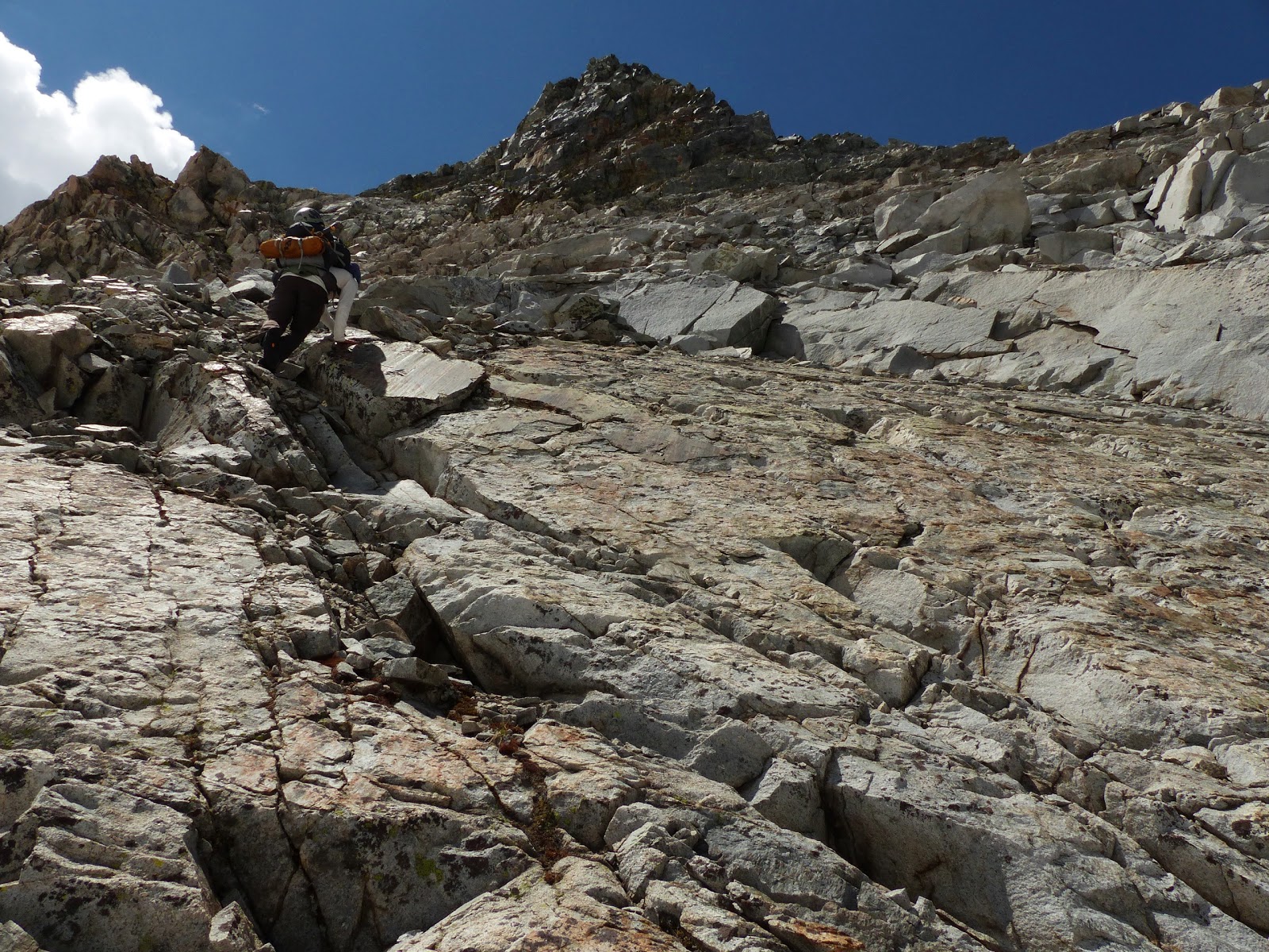
Unlike the last two days, we woke up early at first light and started climbing right at sunrise. We planned to climb Rodgers via a prominent west-to-east ascending ramp on its north face. We crossed a few low angle snowfields to get to the base of this ramp, slipping and sliding on ice as we were too lazy to put on crampons for this short stretch. The ramp itself was only class 2, but full of annoying loose slip n' slide scree, so we spread out to avoid knocking rocks on eachother, slogging up and climbing whatever bits of more solid looking class 3 which would present itself. This ramp eventually spilled us out onto Rodger's east slope/northeast ridge at 12,600 ft where it was an easy rock hop to the summit with some occasional sliding on ice covered rocks.
leaving the lake

loose cruddy ramp on north face

12,600 ft

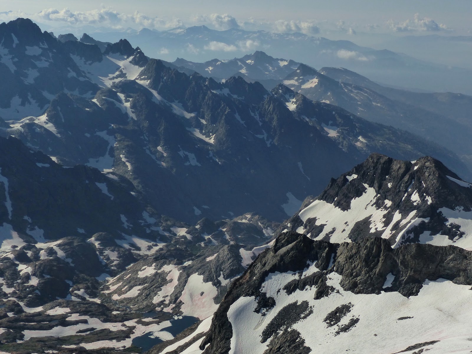
We were now at the start of the Isberg Divide, the second subrange on this traverse. It was a beautiful blue sunny day, the first clear day we had experienced on the traverse. We soaked in the awesome weather and views on Rodgers, easily remaining on its summit for over an hour as we cooked breakfast and ate. This was also the only place on the entire traverse where we had cell service, so a few minutes were also spent checking weather forecasts and notifying family and friends of our progress. During this time, small puffs of benign looking cumulus clouds were quickly building to the south, indicating that this bluebird day would not last for much longer.


After descending Rodger's southwest ridge for about 150 ft, we cliffed out at an extremely loose and dangerous drop. Doubling back about 30 ft, we set up a rappel down the west face to bypass it. I rapped down, looked around, and decided that it was too dangerous to continue. There were no viable anchors that I could see amid all the loose and flaky rock, and many drops below us were much further than what our 30m rope could reach. Plus all the rocks were coated in a thin sheet of ice on this shaded side of the mountain. I climbed back up and we dismantled the rope and anchor before climbing back up to Rodger's summit.

clouds building

We now opted to descend a few hundred feet down Rodger's class 1-2 broad southeast ridge before dropping south into a large snowy bowl between Rodgers and Hailstorm Peak, then quickly regaining Hailstorm Peak's north ridge. A steep ramp just south of the lowpoint between these two peaks looked like the most viable route to accomplish this.


Hailstorm Peak seen from the bowl

We initially predicted the ramp to be class 4, but found it to be class 3+ on remarkably fun rock. None of us took the exact same route up as there were several options to zigzag all over the place.


Once on Hailstorm Peak's north ridge, a short and scenic rock hop ensued to the summit.


A very dark cloud could now be seen to the south, having formed in seemingly no time. We decided to descend and hunker down at a lake just south of Hailstorm Peak. It wasn't even noon yet. This was gonna suck.
looking northwest from Hailstorm Peak

northeast

south

Light hail was already falling as we began setting up the tents. The terrain around this lake was mostly rocky, so we opted for an area of uneven slabs and clumpy grass. I chose the clumpy grass since it was softer and looked more comfortable, crawling inside my tent just as the first loud thunderclap sounded and hail began falling in earnest. Half an inch of hail would continue falling for the next 45 minutes, accumulating around the tents like snow. A trickle of water was soon flowing through my tent. For a few seconds, I wondered where this could be possibly be coming from, and then realized how stupid I was. The lumpy grass was part of a small marsh fed by a dry creek coming down the south side of Hailstorm Peak, except that now it was no longer dry. As the hail began melting, more water came gushing down. One side of the tent turned into a creek as I hastily moved all my stuff to the other side which was still relatively dry.
Eventually the hail turned into light rain and finally just light scattered showers. My tent creek gradually shrank as most of the hail melted away. By 3pm, it looked like most of the surrounding precipitation was merely light showers, and we decided to pack up and continue with the few hours of remaining daylight we had left.
view from my tent as the weather cleared


looking north from Electra

west

southwest


From Electra Peak, we descended into a snowy bowl to the southwest, and continued southwest paralleling Electra's southwest ridge to the saddle between Electra and Loose Ridge Peak.

Loose Ridge Peak's east ridge was a class 4 climb which still felt fun despite being, well, loose. There were two false summits in total. We went up and over the first one which could be surmounted with reasonably simple class 4. The crux came at the notch between the first and second false summits, where we dropped 10 ft south to bypass a steep slanting slab which then looked descendable after we had already bypassed it. Some looser class 4 ensued up the second false summit which we also climbed up and over. From there a short class 4 rock hop led up to the true summit.


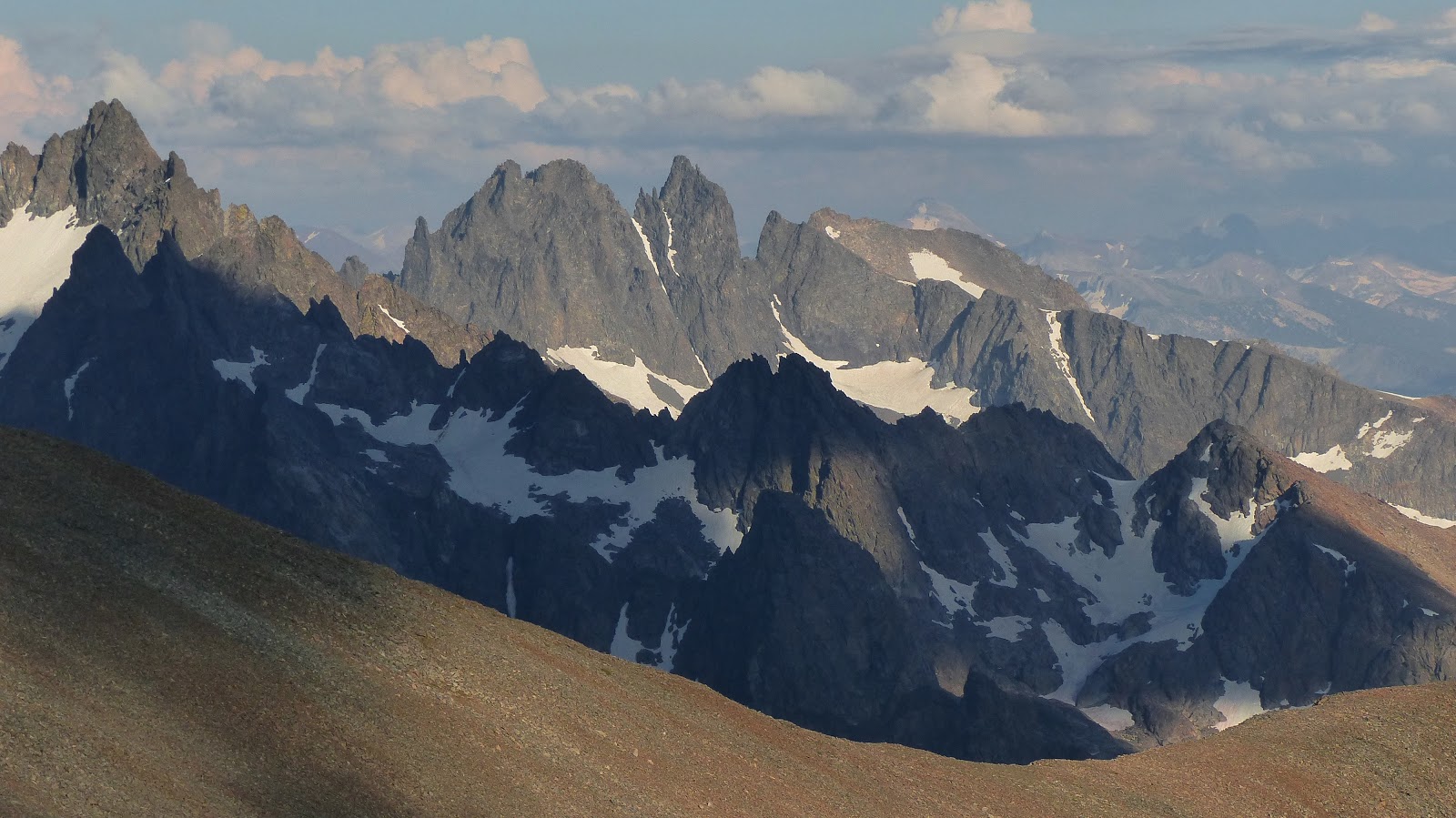

Next up was Frozen Night Peak, the tallest point between Loose Ridge Peak and Mt. Ansel Adams. An easy stroll was all that was required to surmount this one.

looking northeast from Frozen Night Peak

southwest

north

To the southwest, the large muffin-topped summit of Mt. Ansel Adams stood like a sentinel over Lyell Fork. This would be the last peak we were to climb today. It was an easy walk up to a point just east of the summit where we cliffed out. Heading south for less than a hundred feet, a class 2 ramp could be found wrapping back north to a notch just east of the highpoint. From here we scrambled easy class 2-3 west to the base of a class 3-4 face. Toshi climbed directly up this face as Sean and I took an exposed and fun class 3 ledge system to the north.


Sean topping out

register box

We sat on the summit for about 15 minutes as everything around us turned orange and a spectacular moon rose over the minarets. A warm breeze blew in from the west as a chilly one came in from the east. It had been an amazing day. Even though we were caught in storms for several hours, we had still managed to make it a third of the way across the Isberg Divide, and we knew that much of the terrain tomorrow was supposed to be faster and easier.


We left the summit right before sunset, hoping to reach a partially frozen tarn just southeast of Mt. Ansel Adams before usable light ran out. Throughout the descent, we still couldn't resist stopping and admiring the alpenglow.


20 minutes after sunset we reached the tarn with just enough light to set up tents without headlamps. It was pretty chilly on this side of the ridge, and we hastily put on more layers. A full moon illuminated everything around us beautifully. The landscape stood still and silent apart from a small brook gurgling a few hundred feet away.
go to day 5
Thank you for this write up. I plan to try this ridge line this summer and your write up help provide me with photos of the route pulse the confidents that this has been done before so it can be done again. https://www.gaiagps.com/map/?loc=14.5/-119.3405/37.6448&pubLink=iQf68FlZ9GJqmYEmbp6LpbuJ&trackId=8d2cf684-8ac5-4ad7-9683-d286d5f7683c&layer=natgeo-jmt,us-adminbounds,air-quality-today,usfs-roadless-areas,Satellite,usgs-topo,usfs-visitor,GaiaTopoRasterFeet
ReplyDeleteThank you for posting this Gaia link. I am doing Long Mountain to Ansel Adams. Any advice would really be appreciated! I am doing this solo and would really like to summit Ansel. Thank you! -Kyle 408.234.5473
DeleteI would LOVE to do these 51 peaks... anyone game to be a guide on this trip??? :-)
ReplyDelete