
January 4, 2017
Rays Ridge (aka. the main crest of San Ysidro) is one of a few prominent features visible to the west of Borrego Springs, rising from Borrego Valley at 700 ft of elevation to San Ysidro Mountain (6,147 ft), the 11th highest peak in San Diego county. In 2015, I had noticed this prominent ridge from the Borrego Traverse which was located a short ways north on the other side of Borrego Palm Canyon, realizing that it too needed to be traversed. Although the ridge itself only contained three main peaks, there were several other benchmarks and peaklets to the south which could be picked up by doing the traverse as a loop (see map).
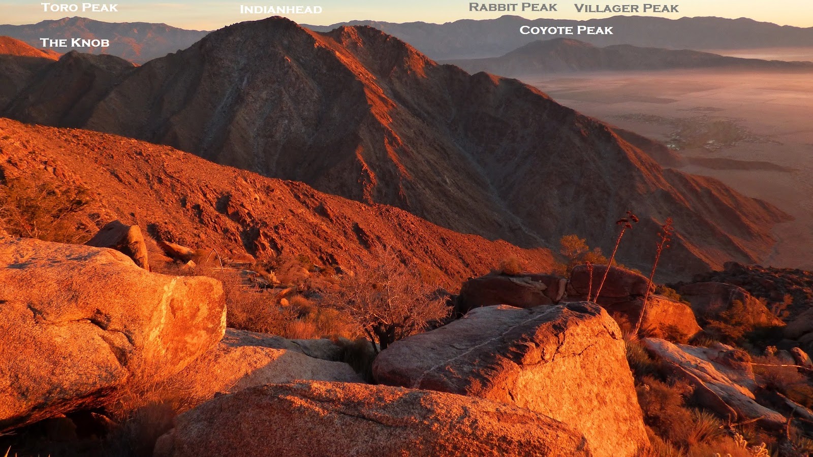
part of Rays Ridge seen from Indianhead (part of the Borrego Traverse) on December 16, 2015

| Peak | Elevation | Topographic Prominence | Summit Coordinates (lat/lon) |
|---|---|---|---|
| Panorama Outlook | 1,048 ft | 40 ft | 33.265684, -116.413029 |
| San Ysidro East Peak | 5,386 ft | 166 ft | 33.271443, -116.461483 |
| Middle Ysidro | 5,855 ft | 177 ft | 33.2671, -116.4781 |
| San Ysidro Mountain | 6,147 ft | 927 ft | 33.253933, -116.498548 |
| The Thimble | 5,779 ft | 199 ft | 33.247259, -116.497653 |
| White Benchmark | 5,326 ft | 346 ft | 33.235204, -116.489093 |
| Clyde | 4,695 ft | 25 ft | 33.2212, -116.4884 |
| Bonny Benchmark | 4,574 ft | 74 ft | 33.218441, -116.489325 |
| Hut Benchmark | 4,308 ft | 3 ft | 33.215329, -116.486976 |
| Wee Benchmark | 4,068 ft | 60 ft | 33.222246, -116.468983 |
| Lookout Point | 3,020 ft | 40 ft | 33.2312, -116.4388 |
Trailhead: Anza Borrego Visitor Center (200 Palm Canyon Drive, Borrego Springs, CA 92004-5005)
Trailhead coordinates (lat/lon): 33.2580, -116.4067
I started from the visitor center shortly after 5am under pitch black skies, walking about half a mile northwest to the toe of Rays Ridge and picking up a short trail which ended at Panorama Outlook. With the darkness, there was nothing much to see there and I simply snapped a picture of the highpoint before moving on. I was going to try to get as high as possible in the next 1.5 hours in order to capture the sunrise from an appealing angle.
summit of Panorama Outlook

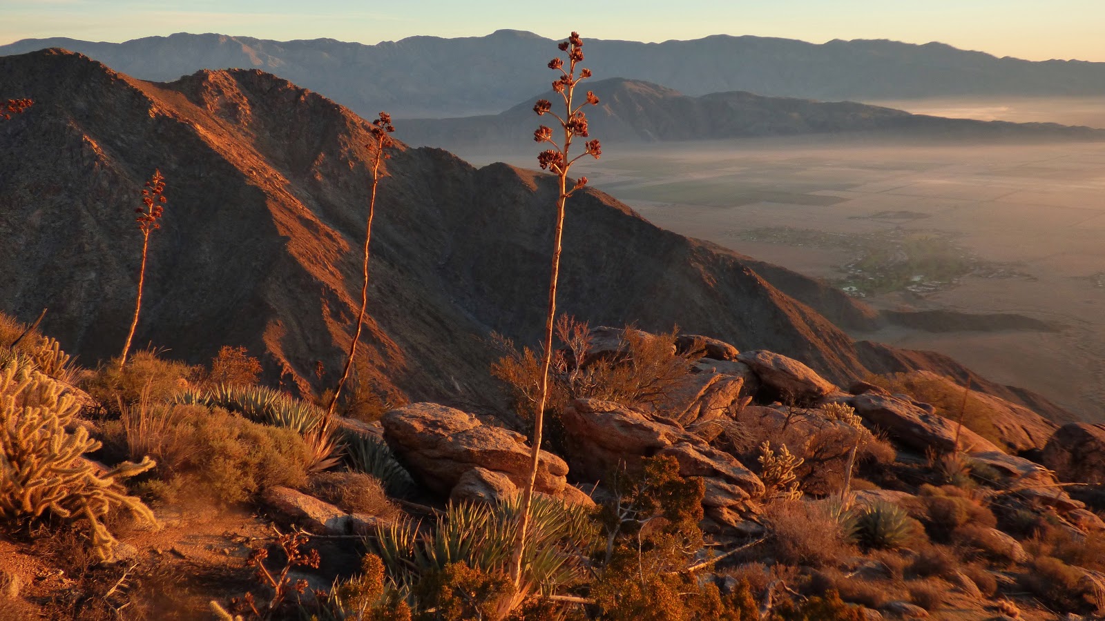
The ridge started out by gradually undulating upwards, and then began steepening above 2,000 ft. Due to the easy terrain and well defined ridge, navigation was trivial and it was pretty much one foot in front of the other as the lights of Borrego Springs gradually fell away below. By sunrise, I had almost hit 5,000 ft, feeling pretty satisfied with the sunrise results.


By now the ridge was not as smooth going as it had been at first, but still not at all horrible, with a (still very manageable) increase in rocks and agave.


Closer to San Ysidro East Peak, the terrain finally flattened out, beginning a part of the ridge which would undulate between 5-6,000 ft for several miles. It would take the next several hours and a good amount of bushwhacking to gain the next net 1,000 ft.


The summit of San Ysidro East Peak was an easy walk-up block. A register was placed under a small pile of rocks. I looked for my signature from 2012 but for some reason could not find it.
view southwest from San Ysidro East Peak

northeast

looking north towards part of the Borrego Traverse

To the west, Middle Ysidro was just over a linear mile away. It would take over 1.5 hours to reach it however due to bushwhacking. Shortly after leaving San Ysidro East Peak, the brush suddenly increased, having me crawl through thick growth and sometimes leaping from rock to rock sticking out of the brush. I stuck to both sides of the ridge with more or less the same frequency, as most of the times there was no "better" way through it. All in all, I would consider this a moderate bushwhack, especially compared to the gut wrenching brush fests found further west in the county.

Middle Ysidro marked the end of the worst bushwhacking. From here on out, much of the brush would be lower and less dense.
summit of Middle Ysidro


For the remaining distance to San Ysidro Mountain, I mainly stayed on the east (left) side of the ridge where there was significantly less brush.


As I walked the last quarter mile to San Ysidro Mountain, the wind suddenly picked up, gusting around 50-60mph and almost knocking me over whenever I would come out from behind a wind-breaking feature and get hit with a sudden gust by surprise. The summit was another easy-to-climb block with a register on top. I quickly signed it and got off due to annoying wind.

looking south from San Ysidro Mountain

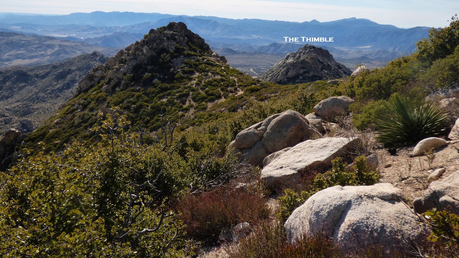
The next peak was a well known feature officially named "The Thimble." It had a distinct appearance from surrounding areas as opposed to San Ysidro Mountain which looked like a typical blob of rocks. I reached it by simply following the lightly bushwhacky ridge between San Ysidro and Thimble, moving to the west of an intermittent rocky bump.

After wrapping around to the southeast side of The Thimble, I located the standard route- a short and fun class 3 scramble which deposited me right at the summit.

looking north from The Thimble

south

From here on out, the remaining six peaks would be small and easy, with the next peak (White Benchmark) being the last one which even rose above 300 ft of prominence. From Thimble, I descended a short distance southeast, intersecting and taking an old firebreak which continued south-southeast into a series of dirt roads which I took to the northwest side of White Benchmark.
looking back at The Thimble

The summit of White Benchmark was a 10 ft class 2 block with natural "steps" seemingly cut on its side. Its register contained enough signatures to make this one of the more popular peaks in the area.

view northwest from White Benchmark

north

south

Roughly 0.7 linear miles along White Benchmark's south ridge was Chimney Rock (as labeled on the topo). Previous reports had mentioned this large 35-40 ft formation being class 5, so I did not expect to climb it as a part of this trip without a partner and rope, but still hoped to get a good look at it since it lay along the route. Some easy navigation with the map brought me to the north side of Chimney Rock, where there was a fixed rope going up a short class 3 section to the base of the climbing portion which looked to be at least 5.8-5.9.
north side of Chimney Rock (right side of photo)

southeast side

The next two peaks (Clyde and Bonny Benchmark) were both straightforward, with short and easy scrambles to the tops of each.


view south from Clyde

Bonny Benchmark

looking northwest from Bonny

north

southeast

A short distance southeast of Bonny was Hut Benchmark, located on the crest of one of several nondescript broad descending ridges. It wasn't too difficult to pinpoint exactly where it was using the map, and in less than 10 minutes I had found it.

From Hut, I descended southeast into a brushy gully which spit me out onto the California Riding And Hiking Trail. I would remain mostly on this trail for the next 7.6 miles to the finish, hitting two more very easy highpoints along the way. The first of these was Wee Benchmark, which I had last visited in 2013 starting from Culp Valley Campground. Wee was less than a minute off the trail on top of a small mound.


looking back at Rays Ridge from Wee

I continued along the gradually descending trail for a few more miles, passing by Culp Valley in the process. The last peak (Lookout Point) was a very small bump not far off the trail which looked like it might be hard to find, so I was extra careful to correlate terrain features with the map after passing Culp Valley since I don't use GPS.
views from trail


I was happy to locate the obscure little summit of Lookout Point with no trouble. The summit block stood out from its surroundings, and was a class 2 scramble much like the other summit blocks from earlier. There were no signs of human disturbance on this summit, indicating that it wasn't climbed very often. Why this was a named feature was unknown to me. The view was good, but not too different than from other points along the trail.
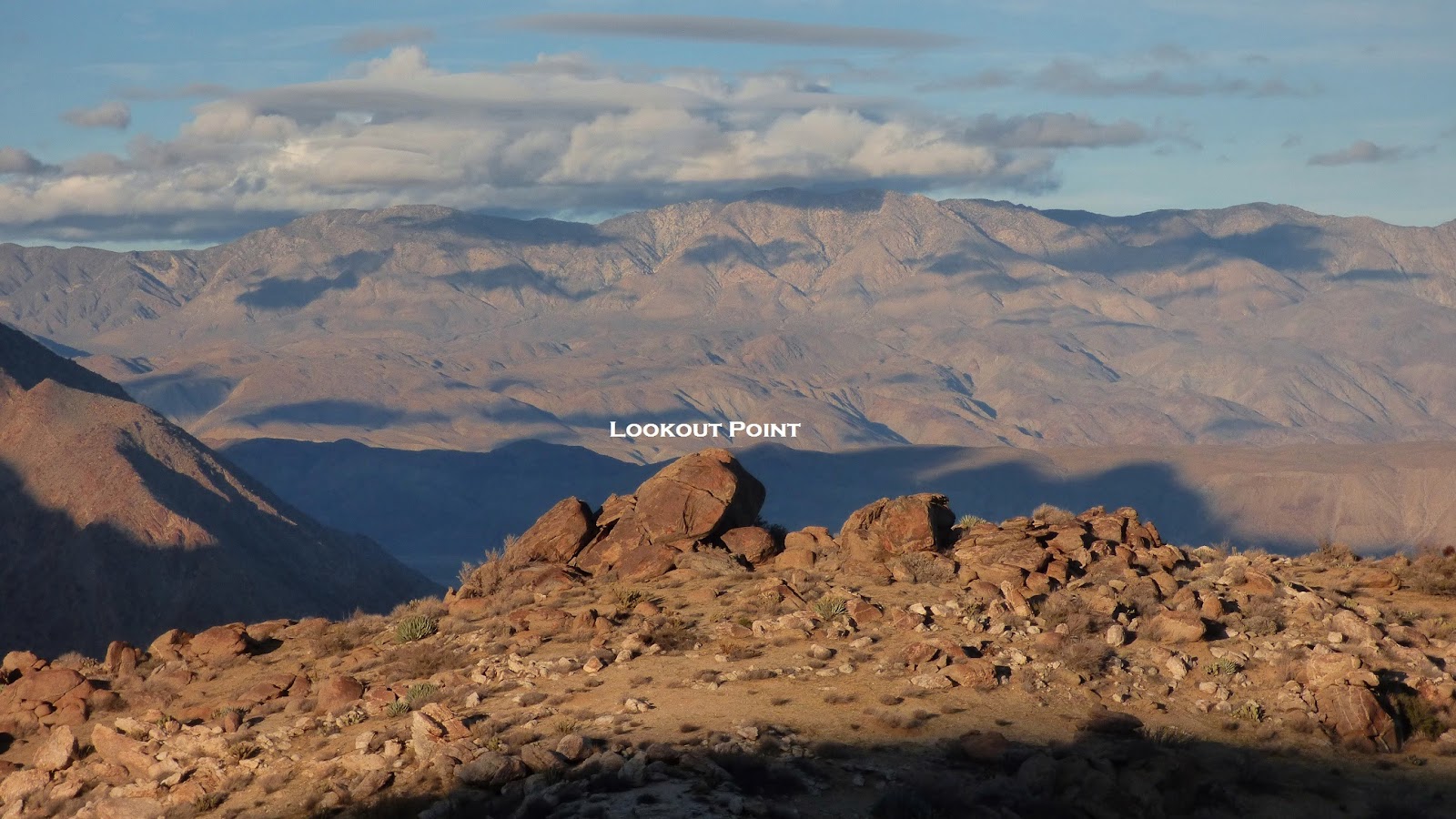

view from Lookout Point

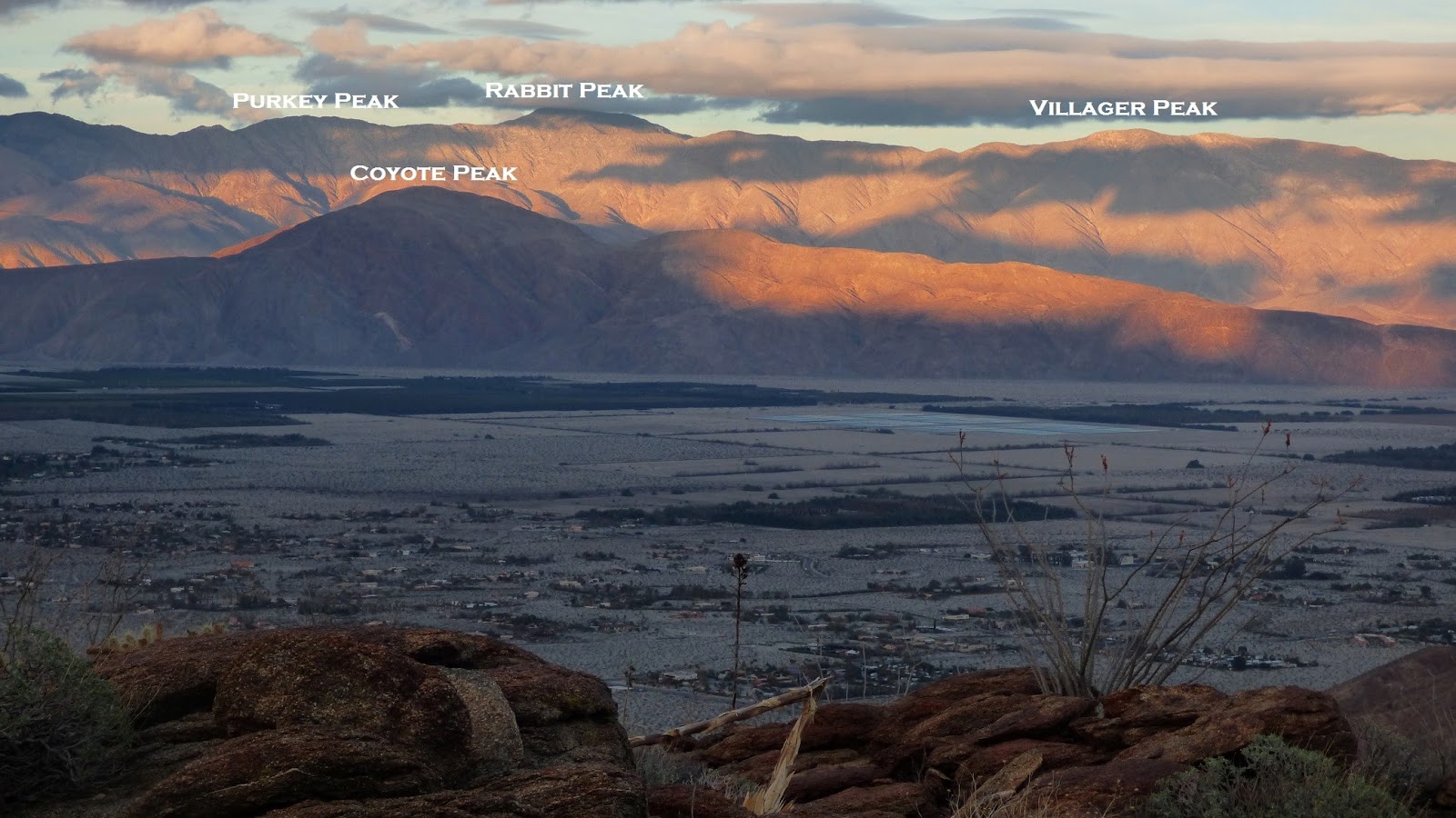
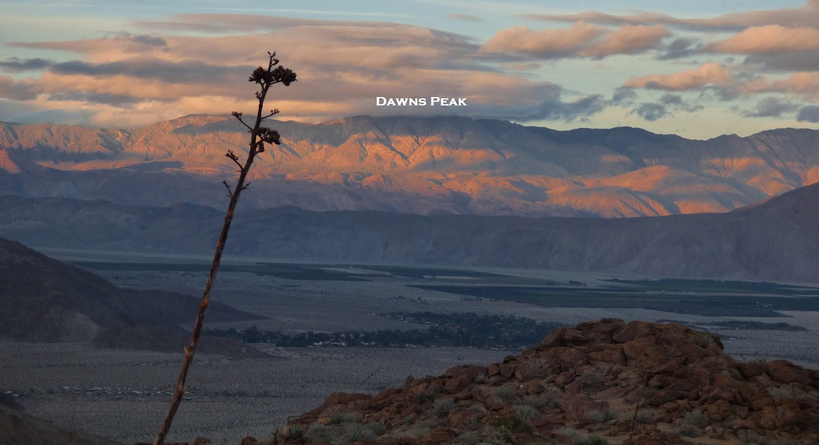
I got back onto the trail which continued its slowly undulating descent for the next few miles. Parts of the trail were slowly falling into disrepair, especially the sections which went through the beds of gullies. As I neared the desert floor, the shadows of clouds cast interesting shapes onto the Santa Rosa Mountains. A storm was due to arrive, but not for the next 12 hours.
As the trail finally hit the desert floor, I took off across it, aiming directly for the visitor center. Faint use-trails could be utilized the whole way there. I got back before 5pm, sometime after the sun had dipped behind the now gigantic shape of Rays Ridge.
Final Stats
18.4 miles
7,880 ft gain/loss
18.4 miles
7,880 ft gain/loss

Weather Forecasts
trailhead (600 ft)
3,000 ft
5,300 ft
Peakbagger Pages
Panorama Outlook
San Ysidro East Peak
Middle Ysidro
San Ysidro Mountain
The Thimble
White Benchmark
Clyde
Bonny Benchmark
Hut Benchmark
Wee Benchmark
Summitpost Pages
San Ysidro Mountain
The Thimble
White Benchmark
No comments:
Post a Comment