
June 18-19, 2016
Coyote and Angora are two relatively remote Southern Sierra peaks tucked away near the southern end of the Great Western Divide. We wanted to do these peaks as a warm up backpacking trip for the upcoming Sierra season, and ended up finding it somewhat more strenuous for a 2-day trip than what most would consider as a "warm up."
| Peak | Elevation | Topographic Prominence | Summit Coordinates (lat/lon) |
|---|---|---|---|
| "Deep Peak" | 7,588 ft | 288 ft | 36.2349, -118.4689 |
| Angora Mountain | 10,198 ft | 458 ft | 36.2643, -118.4459 |
| "Leggett Peak" | 10,064 ft | 284 ft | 36.2746, -118.4543 |
| Coyote Peaks East | 10,892 ft | 342 ft | 36.3120, -118.4472 |
| Coyote Peaks West | 10,780 ft | 240 ft | 36.3104, -118.4557 |
| "Grasshopper Peak" | 10,900 ft | 840 ft | 36.3004, -118.4564 |
| White Mountain | 8,740 ft | 520 ft | 36.2570, -118.4766 |
Getting to the trailhead: From Johnsondale, travel north on Forest Route 22S82 until it dead ends at Jerky Meadows Campground. Another option (which we used) was starting half a mile back (west) from the campground at a large pullout right by Lloyd Meadows Creek.
Trailhead coordinates (lat/lon): 36.1672, -118.4856
Bill, Sung, Hiroko, Craig, and I started up the dusty trail (trailhead = 5,850 ft) along Lloyd Meadows Creek, hiking north for 1.7 miles to a junction (6,920 ft) just north of Jerky Meadow. Not to great surprise, Lloyd Meadows Creek was bone dry even this early in the season. The previous winter's El Nino had not provided any drought relief to the Southern Sierra. From the junction, we turned right (northeast) and walked 2.7 miles to a large footbridge (5,750 ft) crossing the Little Kern River. This spot looked like a popular hub for backpackers, as there were several large groups camped along the river, likely because it was one of the only reliable water sources for several miles.


We sat down for a break, then started northeast up a broad sandy ridge, which acted as a 1.5-mile shortcut between the bridge and a lesser defined trail to the northeast.

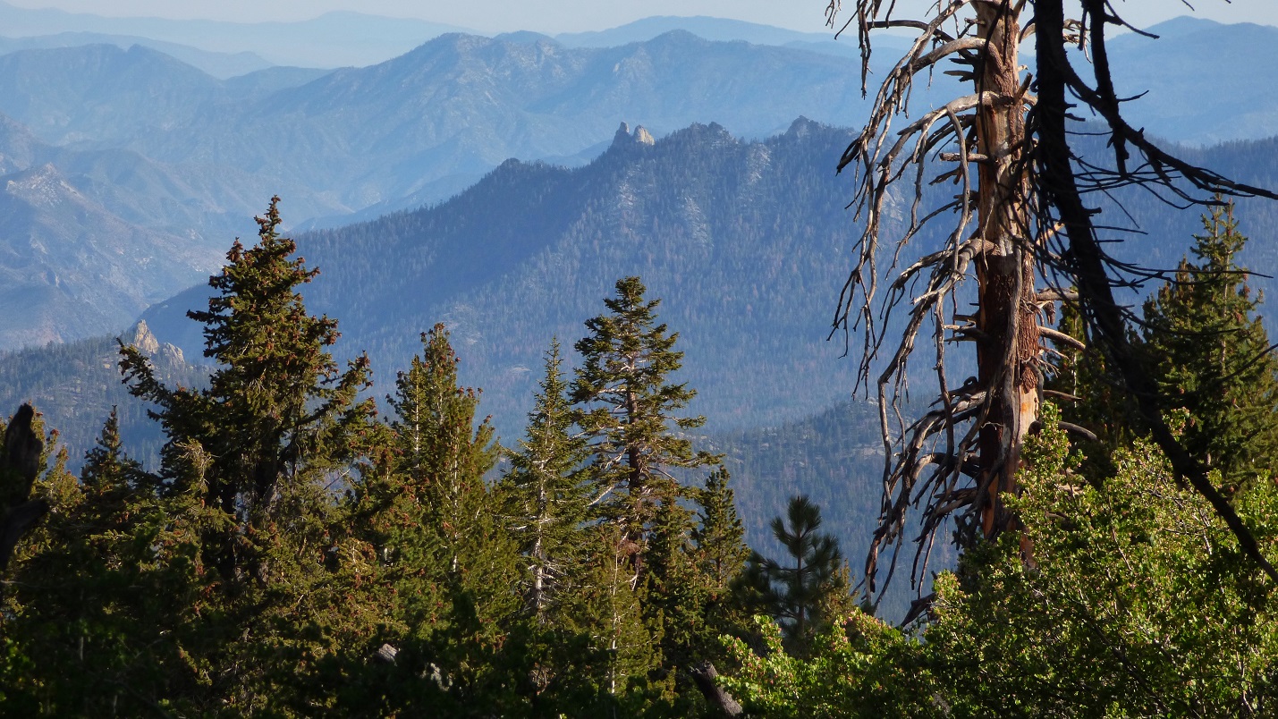
first view of Angora

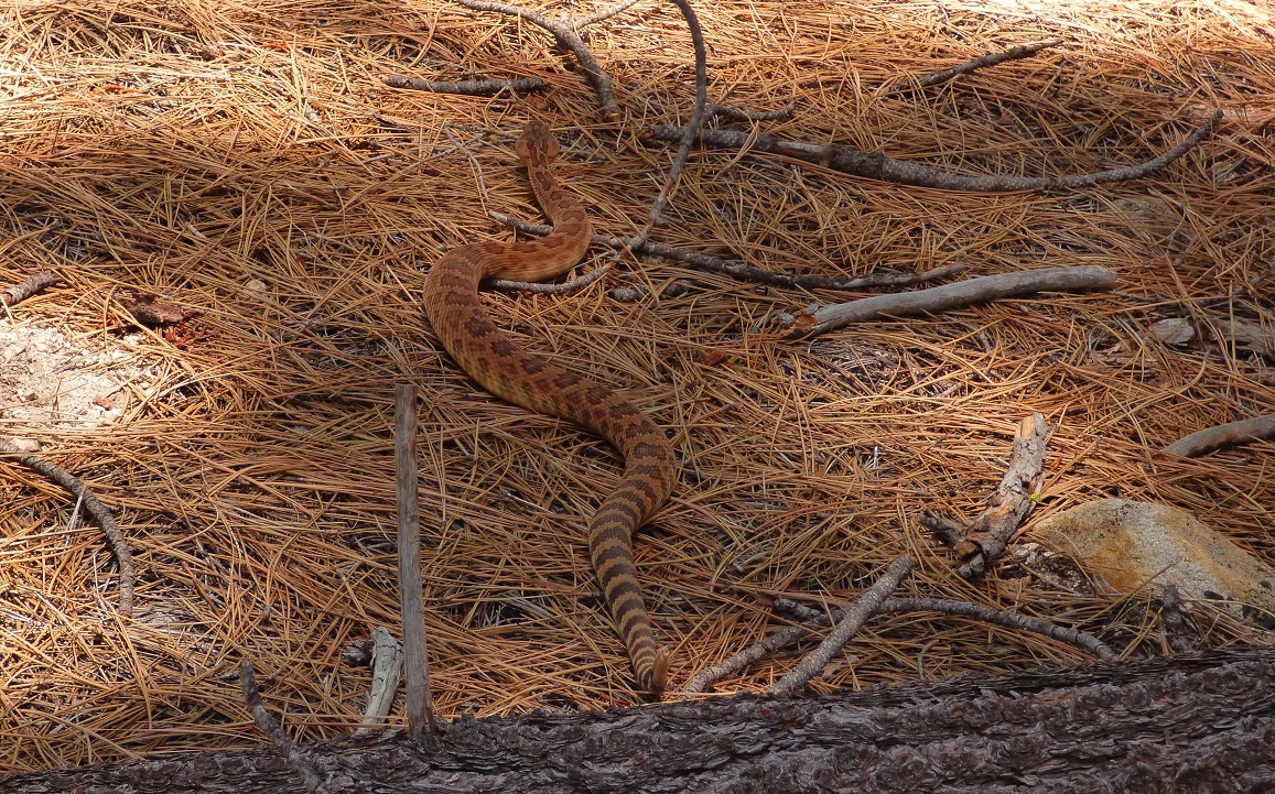
Once on the trail, we headed west, taking a water stop while crossing Deep Creek, which was really more like a trickle. Continuing a short distance further west, we took a very faint north-branching trail which would parallel Deep Creek north for 4 miles. About a mile into it, we suddenly leaped back as a rattlesnake basking in the sun suddenly jumped up and angrily slithered away.
Upon reaching the northeast side of Deep Peak, I dropped my pack and began heading straight up its forested slopes. There were endless options for ascending this side of the peak, all of them steep but with easy terrain. The ~750 ft of ascent took a total of 15 minutes.
summit views from Deep Peak


I headed back down the northeast side, this time remaining slightly north of my ascent route, and purposely overshooting (to the north of) where I dropped my pack. This way, I would know which way to turn upon hitting the trail in order to relocate the pack.
I grabbed the pack and continued up, meeting back up with the group as they were refilling on water. At 7,800 ft, the trail appeared to be heading for a large meadow, vanishing shortly before it. We easily crossed this meadow and picked up the trail again on its north side. From there, we continued a short distance to a saddle (8,220 ft) on the northeast ridge of White Mountain, then a short distance further north to a smaller saddle (8,276 ft) before splitting off on a trail heading up and east towards Angora Mountain. This trail was more defined than the last one, and we followed it 1.2 miles to an elevation of 9,360 ft before leaving it and cross countrying east towards Angora Peak. The last few hundred feet to the summit involved some easy rock hopping.
fawn just below summit

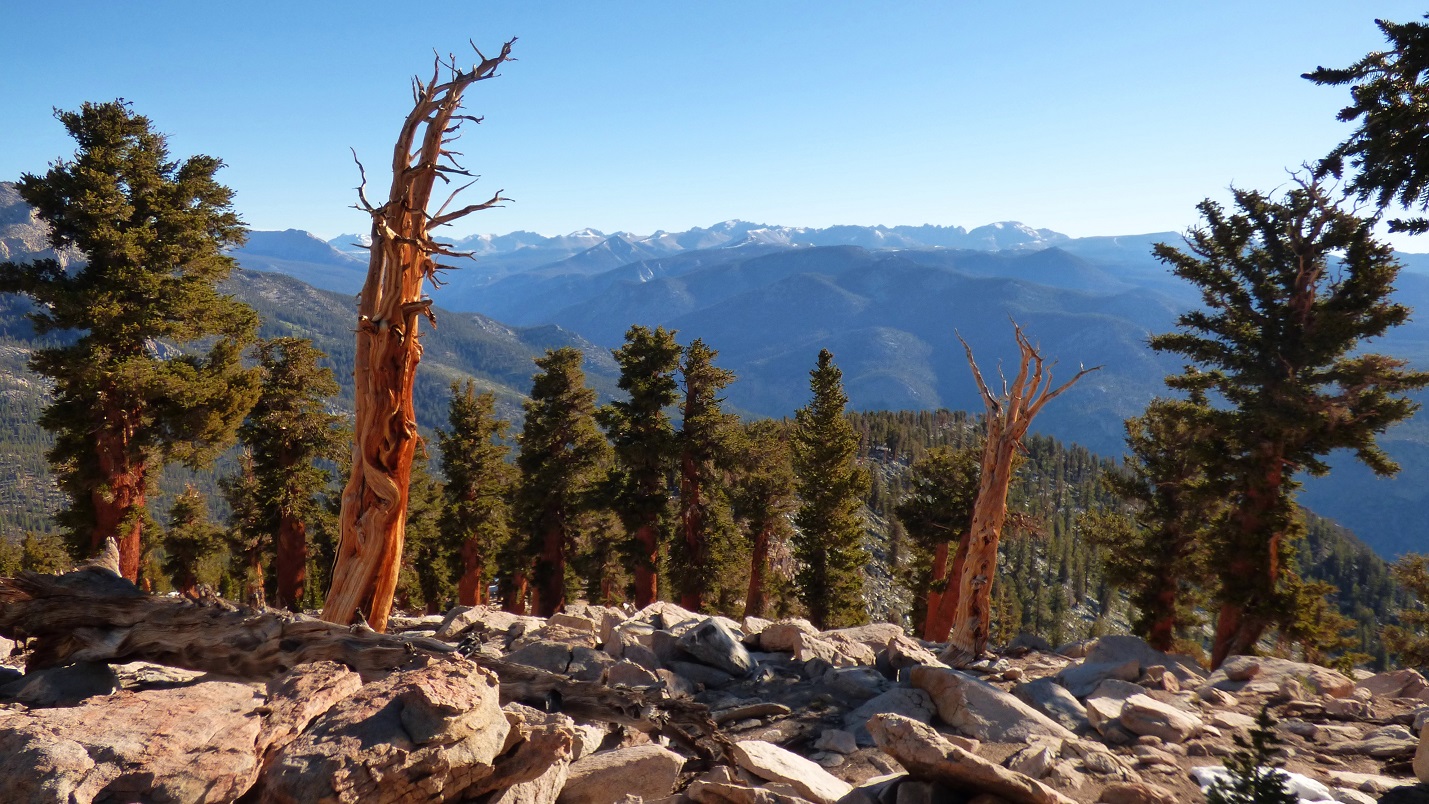
views from Angora


Angora Mountain marked our entry point onto the Great Western Divide. We continued going cross country north along the divide, soon hitting Leggett Peak, a non interesting bump hidden under trees.
summit of Leggett Peak

We descended the north ridge of Leggett to a saddle (9,740 ft), then began ascending the long south ridge of Grasshopper Peak. There were a few large rocky outcroppings on this ridge, which we easily bypassed with some light bushwhacking to the east. About two thirds the way up this ridge, we got onto a trail which came up from the east and headed north along the ridge. Eventually the trail passed within 5 minutes of Grasshopper Peak's summit, but we decided to save it for the next day (we were coming back the same way) since it was getting late an we wanted to reach Coyote Lakes for camping.


We continued north on the trail to a saddle (10,550 ft) marking a well defined junction with a trail descending east to Coyote Lakes. From there, we descended for half a mile to the northern shore of the highest lake (10,076 ft) and camped under some trees at a comfy looking spot.
north ridge of Grasshopper Peak


highest Coyote Lake

The next morning, Craig, Bill, and I woke up and packed up by sunrise, heading back up the trail towards the western saddle. We planned to bag Coyote Peaks (East and West) in the morning while Sung and Hiroko would have a more leisurely wake up and hike out.

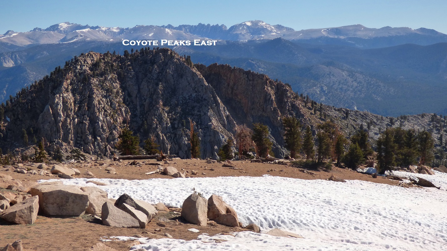
After stashing packs at the saddle, we contoured around the east side of Coyote Peaks West, then scrambled up the west ridge of Coyote Peaks East, which consisted of weaving between several large class 2 boulders. This peak contained what I thought were the best views on this trip.
Coyote Peaks East


summit of Coyote Peaks East


On the way back, we hiked up and over the summit of Coyote Peaks West. The actual highpoint was ambiguous as the summit area was a large plateau, but we narrowed it down to two rock piles on its western side.


Back at the saddle, we snacked on energy bars and were soon joined by Sung and Hiroko. We retraced our steps back up to Grasshopper Peak, and promptly tagged its highpoint.


summit of Grasshopper Peak


We descended Grasshopper's south ridge to the saddle between it and Leggett Peak, and took the trail around the west side of Leggett, eventually reaching the trail we had taken the previous day to Angora. Upon reaching the saddle northeast of White Mountain, I dropped my pack and quickly hiked up to its summit, finding two old registers among its summit blocks.

summit of White Mountain


The rest of the way back was fairly uneventful, retracing the previous day's footsteps to the trailhead. We did manage to grab the attention of a large bull, which followed 100-200 ft behind us for about a mile before disappearing.

back at Jerky Meadow

trailhead

Stats (not including Deep Peak & White Mountain)
34.8 miles
11,750 ft gain/loss
Stats (including Deep Peak & White Mountain)
37.4 miles
13,090 ft gain/loss

Weather Forecasts
trailhead/Little Kern River
White Mountain vicinity (~9,000 ft)
>10,000 ft
Peakbagger Pages
Angora Mountain
Grasshopper Peak
Coyote Peaks East
Summitpost Pages
Angora Mountain
Coyote Peaks
No comments:
Post a Comment