
August 8, 2014
Leavitt, Sonora, and Stanislaus are three prominent and easy-to-attain peaks in the Northern Sierra near Sonora Pass. The area is composed of gentle, rolling, volcanic terrain.
| Peak | Elevation | Topographic Prominence | Summit Coordinates (lat/lon) |
|---|---|---|---|
| "Latopie Peak" | 11,260 ft | 283 ft | 38.294062, -119.642358 |
| Leavitt Peak | 11,569 ft | 2,069 ft | 38.286182, -119.651249 |
| "McKay Peak" | 11,245 ft | 485 ft | 38.305935, -119.641972 |
| Stanislaus Peak | 11,233 ft | 793 ft | 38.384113, -119.667104 |
| Sonora Peak | 11,459 ft | 1,816 ft | 38.35385, -119.6355 |
Sonora Pass Trailhead (coordinates: 38.328090, -119.637183)
Saint Mary's Pass Trailhead (coordinates: 38.337307, -119.645589)
Due to thick smoke from wildfires in Yosemite, John, Craig, Jeff, and I flocked to the Northern Sierra where the air was considerably more clear (although the sky still looked murky at times). Our plan was to do Leavitt Peak from Sonora Pass Trailhead and then do Stanislaus and Sonora from Saint Mary's Pass Trailhead.
Sonora Pass Trailhead

The four of us headed south up the PCT sometime around 8:30am. Aside from a few small creeks within the first mile, there would be no running water on the trail between Sonora Pass Trailhead and Leavitt Peak.
views from PCT


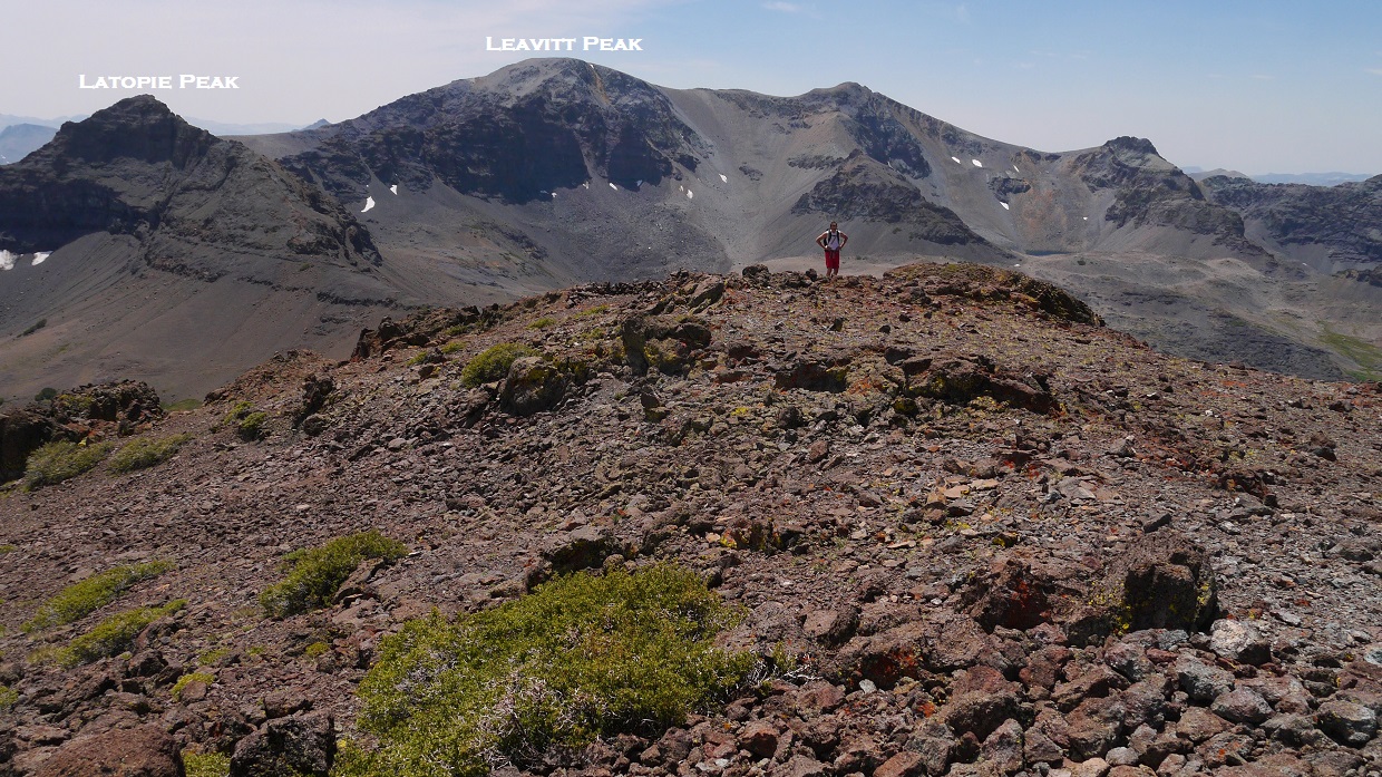
Roughly 2.1 miles after leaving the trailhead, Leavitt Peak came into view

Shortly after, an unnamed peak with 485 ft of prominence (which I later dubbed as "McKay Peak" after McKay Creek) came into view. I planned to tag it on the way back.

As the trail contoured around the west side of McKay Peak, an interesting looking peak appeared to the south (which I later dubbed as "Latopie Peak" after Latopie Lake). I decided to bag that peak first.

I left the trail at a large saddle between Latopie Peak and McKay Peak, and headed up Latopie's north ridge. By staying just below the ridge on its western side, I was able to keep the terrain to loose class 2. The last few moves before the summit involved some easy class 3.
Latopie Peak north ridge

view south from summit

southwest

I descended Latopie's south ridge and walked across a short plateau to get back onto the PCT and join back up with the group. A few switchbacks later, we left the PCT and hiked up a small use-trail which headed up Leavitt Peak's broad east ridge.
heading up Leavitt

Leavitt's summit was a large broad plateau, with a cairn marking the highpoint.
view southwest from summit

northwest

south

register

After a snack break on the summit, we headed back down the way we came.
Latopie Lake seen from PCT

Jeff

Back at the saddle between Latopie and McKay Peak, everyone decided that they would like to go for McKay Peak. McKay's south ridge was a straightforward class 1 walk up on crumbly volcanic soil.
heading up McKay


view south-southwest from summit of McKay
southwest towards Blue Canyon Lake

northwest

We descended McKay's south ridge to get back onto the trail. This class 1-2 ridge contained short sections of crumbly loose rock.
back on the trail


On the way back, we decided to shortcut the large switchback which went around the east side of Sardine Creek. The proper way to do this was to take the ridge west of the creek until it intersected the trail again lower down. We overshot the ridge, and ended up taking a series of loose canyons and gullies (not recommended) and ended up using more time than we would've saved.
Once back at Sonora Pass, we drove a few minutes down to Saint Mary's Pass Trailhead and began hiking up the trail 1.2 miles to Saint Mary's Pass.
Saint Mary's Pass Trailhead (photo by Craig Jagow)

heading up the trail


Saint Mary's Pass

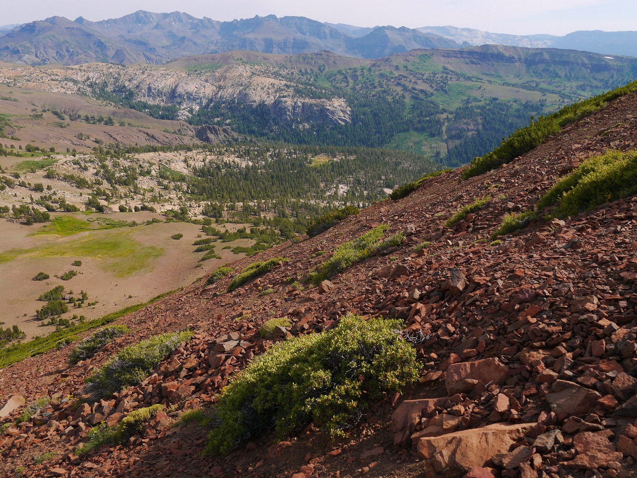
From the pass, the trail contoured along wide open grassy slopes for a few miles before ending at the base of Stanislaus Peak. We passed through several springs containing thick beds of yellow alpine flowers.


The route up Stanislaus was pretty self explanatory. We headed up the class 2 southeast slope which was a jumble of clinky volcanic talus. The last few hundred feet before the summit became steep and loose. Some of us climbed onto nearby class 3 terrain for better rock quality. The summit was marked by a large cairn but contained no register.


summit views


Sonora Peak now appeared as the large cone-shaped mound to the southeast. We descended back down to the trail and followed it to a point west of Peak 11010 which lay on the ridge between Stanislaus and Sonora. From there, we gradually headed in a general southeast direction and onto Sonora's broad northwest ridge. This ridge contained a small use trail.
more flowers

Sonora's northwest ridge


The summit was marked by a pole sticking out of a large rock shelter. The register consisted of a few scraps of paper with no writing utensil. As we made our way to the summit, the sun popped out of the clouds and bathed the surrounding landscape in amazing light. Out came the cameras. The lingering smoke provided a natural filter to create some superbly rich colors.


We stayed on the summit for nearly 30 minutes before heading back down the use-trail which deposited us on the west side of the mountain. After the trail ended, we continued west towards saint Mary's Pass, following a series of very large cairns.
sunset with Stanislaus Peak


Stats for Latopie Peak, Leavitt Peak, McKay Peak
10 miles
3,850 ft gain/loss

Stats for Stanislaus Peak, Sonora Peak
9.4 miles
3,550 ft gain/loss

Weather Forecasts
both trailheads
all peaks
Peakbagger Pages
Latopie Peak
Leavitt Peak
McKay Peak
Stanislaus Peak
Sonora Peak
Summitpost Pages
Leavitt Peak
Stanislaus Peak
Sonora Peak
Other
Emigrant Wilderness
High Sierra Topix message board
Came across your site via Facebook/California Peaks group and glad we did! We are Marcie Mills (Sam Mills). Great photos and information...Thanks for sharing. - Sam
ReplyDelete