
July 12, 2014
Standing tall on the Sierra Crest a few miles north of Paiute Pass is the gigantic craggy mass of Mt. Humphreys. This iconic peak is well known for being a few feet away from becoming a 14er and for containing over 2,000 ft of prominence. From Bishop, Humphreys is easily recognizable as the peak with the large anvil-shaped summit. There are no easy routes to the summit, with the least technical route being the class 4 Southwest Slope & Northwest Face.
| Peak | Elevation | Topographic Prominence | Summit Coordinates (lat/lon) |
|---|---|---|---|
| Mt. Humphreys | 13,986 ft | 2,563 ft | 37.27058, -118.672935 |
Getting to the trailhead
Trailhead coordinates (lat/lon): 37.230710, -118.618828
Sung, Craig, Dagmar, and I started from North Lake Trailhead (9,280 ft) at around 8 am, heading 4.7 miles up the Paiute Pass Trail to Paiute Pass (11,400 ft). As soon as we had left the shade of the trees, we had to delayer. The day was already warming up nicely.
one of the lakes en route to Paiute Pass, with Paiute Pass visible

From Paiute Pass, the craggy form of Humphreys appeared to the north. We took a short break at the pass, then began heading straight towards the mountain on expansive rolling alpine tundra dotted with alpine lakes.
Humphreys seen from Paiute Pass

As the mountain got closer, we headed directly towards the highpoint, eventually reaching a medium-sized lake at 12,035 ft situated at the base of the Southwest Slope.

Southwest Slope & Northwest Face route overview (we took the orange route up and green route down)

Lake 12,035 ft

From Lake 12,035 ft, we headed a short ways north to the base of a chute which was marked with a large and thick band of white rock to its right. The start of the chute contained mainly class 2 terrain mixed with a few short class 3 moves on loose rock. Shortly after, we found our progress blocked by a large chockstone. From here, we either had the option to either head into another loose chute to the left to bypass it, or get onto some class 3-4 ledges immediately left of the chockstone. We took the ledge option, which was short and fun. There were numerous rappel and belay stations above the chockstone, suggesting that this was a pretty well used route. Since Sung was a little uncomfortable on the terrain, we took no time to rig up a short belay for her.
From here, the chute was basically loose class 2 up till the Northwest Notch (13,500 ft). Shortly after the chockstone, the chute split in two. We took the right fork, then gradually curved over to the left as the Northwest Notch became clearly visible.
route seen from Lake 12,035 ft

looking up at the chockstone shortly after entering the chute

Craig bypassing the chockstone

Sung bypassing the chockstone

looking up shortly after the chockstone

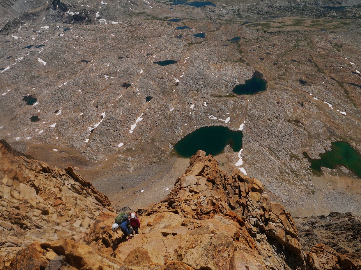
loose scrambling

views shortly before Northwest Notch


At the Northwest Notch, we took some time to eat and organize our packs for the remaining few hundred feet which contained a few short class 4 sections. We heard voices, and saw people coming down from the mountain. They turned out to be people we knew, who had just done the route that we were to do.
Northwest Notch meeting

nice view of Desolation Lake

From the Northwest Notch, the entire Northwest Face portion of the route was nicely visible. We headed up a class 3 chimney for a few hundred feet, aiming for a prominent notch to the right of the summit. Just before the notch, we walked across a ~20 ft class 4 flake. Once at the notch, a few class 4 moves brought us up to a short section of class 3 ridge to the summit.
Northwest Face viewed from Northwest Notch

class 3 chimney


class 4 above the notch


remaining class 3 to summit


The summit was very pleasant, with a slight cool breeze and incredible views of the lakes in Humphreys Basin.
view north-northwest from summit

north-northeast

northeast

southeast

west

To get down, we descended to a point just above the class 4 above the notch at a rappel station, took out the 30m rope, and rappelled down to a large ledge not far below. Across the ledge was a large, obvious rappel station. The rappel from there brought us down to a third station at the top of the initial class 3 chimney. Rappelling down this chimney was not necessary, but since we had the rope and the raps were fun, why not?
first rap


second rap station
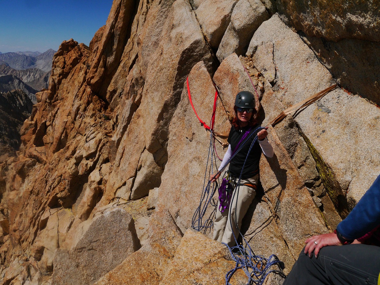
second rap

rusty piton at the third rap station

rap 3 down chimney

Basin Mountain seen from Northwest Notch

To get down from the Northwest Notch, we descended a series of gullies which lay diagonally across the Southwest Slope. These gullies were all highly loose and cruddy. I would only recommend them for descent.

views from descent


exit of our descent gully

Lake 12,035 ft

With the objective of the day finished, we took time to relax on the shores of Lake 12,035 ft, then had a leisurely hike out back to the trailhead.
views from hike out


Final Stats
16.7 miles
5,390 ft gain/loss

Weather Forecasts
Trailhead
Paiute Pass
Mt. Humphreys
Peakbagger Pages
Mt. Humphreys
Summitpost Pages
Mt. Humphreys
Other
High Sierra Topix message board
No comments:
Post a Comment