
March 9, 2014
Avawatz Peak is the highpoint of the Avawatz Mountains, a prominent range located 22 miles northwest of Baker. Although most of the hike up to this peak was not a very exciting affair, the last two miles of ridge before the highpoint provided excellent views of the surrounding desert.
| Peak | Elevation | Topographic Prominence | Summit Coordinates (lat/lon) |
|---|---|---|---|
| Avawatz Peak | 6,155 ft | 3,300 ft | 35.512756, -116.331714 |
Getting to the trailhead (Due to a recent flash flood, much of the road had been severely washed out. We were only able to make it to a spot just south of Old Mormon Spring with a 4WD Jeep Wrangler.)
Trailhead coordinates (where we started (lat/lon)): 35.513814, -116.255499
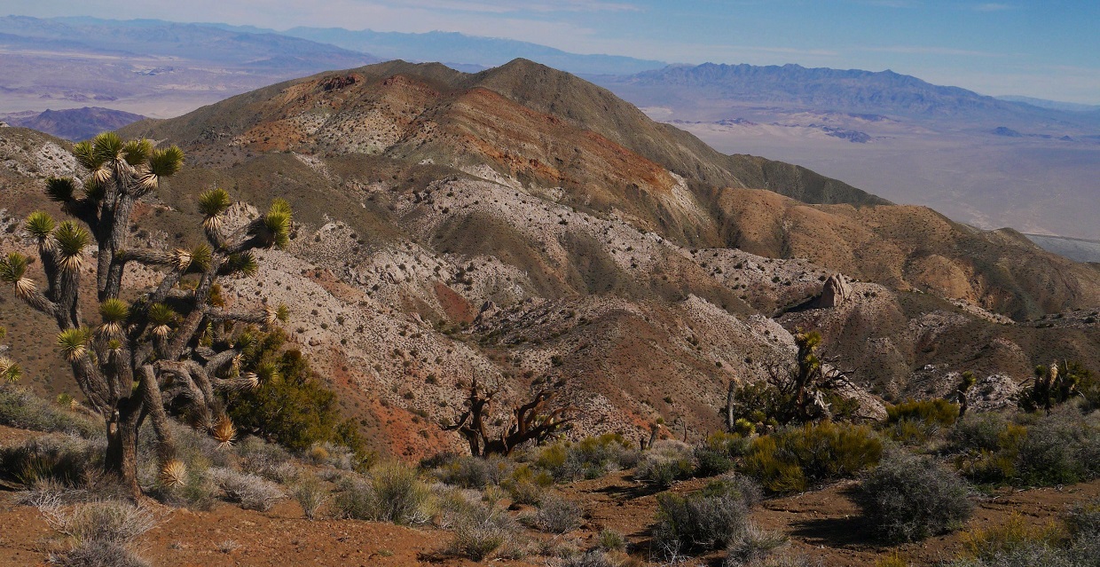
morning view from trailhead

Craig, Sung, Dagmar, Tommey, and I started hiking from the trailhead at 8:25 am, walking up the washed out road which headed southeast up a canyon for a few miles. A jumble of uprooted plants and scattered debris indicated that a flash flood had taken place recently. In most places, the road was not recognizable and resembled more of a natural wash. Small clusters of yellow flowers grew in parts of the canyon.


washed out road


A little over 3 miles after leaving the trailhead, the road left the canyon, switchbacked up a slope, and passed underneath a small hill with some solar panels on it. Shortly after the solar panels, we left the road (~3.9 miles from trailhead) and headed up a small ridge to the west, then dropped west off the ridge to a small saddle between the ridge and a white bluff.
view west from solar panels


There were several ways to get onto the white bluff, all of which involved some amount of loose class 2 rock.


The bluff itself was the tail end of a ridge that would take us to the summit of Avawatz Peak. We followed the ridge, which contained all class 1 terrain, for ~2.5 miles northwest and directly to the summit of Avawatz.
looking northwest along the ridge to Avawatz (true summit not visible).

views from ridge


We arrived at the summit of Avawatz at around 12pm, finding decent views in all directions, surrounded by the distant snow-capped peaks of Mt. San Gorgonio, Mt. Baldy, Mt. Charleston, and Telescope Peak. After a nice lunch break on the summit, we retraced our steps back to the trailhead.


oldest register entry

some deep reflective moments

descending


Final stats
13.8 miles
5,200 ft gain/loss

Weather Forecasts
Trailhead
Avawatz Peak
Peakbagger Pages
Avawatz Peak
Summitpost Pages
Avawatz Peak
Great photos and hike, thinking abt doing this soon. Any sign of water? Any wildlife?
ReplyDelete