
July 23, 2013
A thick blanket of low clouds hung over the entire Sierra Nevada range- the third straight day of 50% chance thunderstorms. Tommey and I had origionally planned a 4-day backpack to the Black Divide, but decided to scrap it because of deteriorating weather, settling on a few dayhikes instead. We had poured over maps and trip reports the previous night, deciding on two peaks- Mt. Gilbert (13,106 ft) and Mt. Johnson (12,871 ft). They were semi-remote and relatively easy climbs. They were located in an area that none of us had ever been to before, so it was nice to explore a new place.
Getting to the trailhead: From Bishop off Hwy 395, head west on West Line Street (Hwy 168). Continue 15 mi, then turn left onto South Lake Rd, which will be clearly marked with a "South Lake" sign. Continue 7 mi to the end of this road.
Trailhead coordinates (lat/lon): 37.169338, -118.565850
We departed South Lake Trailhead aka. Bishop Pass Trailhead (9,830 ft) shortly after 7am. After 0.8 miles on the Bishop Pass Trail, we turned off for Treasure Lakes.
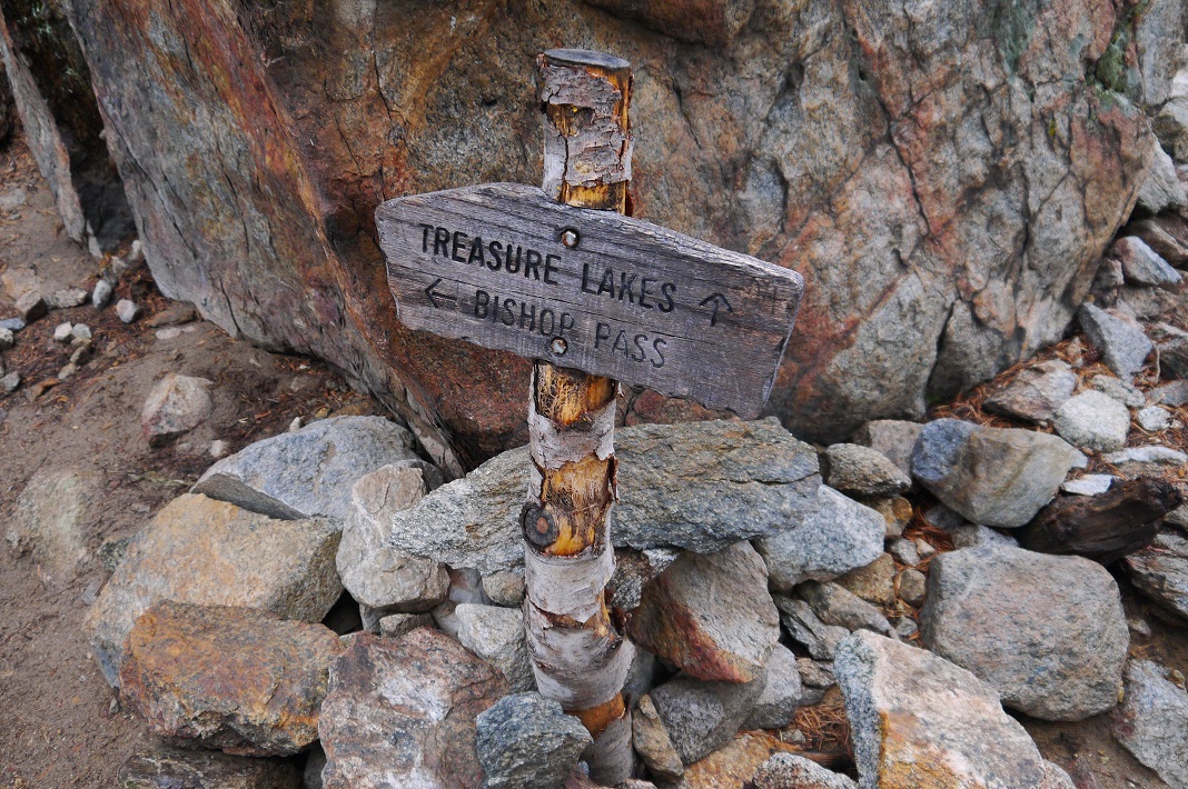
This trail continued on flat ground for a short distance, dropped down a few hundred feet, then switchbacked up to Treasure Lakes.


A steady light rain fell as we hiked up into the Treasure Lakes area. These lakes certainly did seem like treasures, nestled tightly in a small valley hidden from view from most surrounding places. Several great campsites could be found scattered throughout the area.
When the maintained trail ended at treasure lakes (2.5 mi after turnoff), the main canyon branched into two smaller canyons. We took the northern one, as a map indicated that the southern one would soon end in a bowl filled with three lakes. Our canyon seemed to head directly towards Mt. Johnson. There was a use trail for a short while at first, which soon disappeared and turned into rock hopping.

Upon reaching a small tarn at 11,320 ft, the canyon split again into north and south forks. Because we were planning to climb Mt. Gilbert first, we took the north fork (south fork would be used for descent from Johnson).
Tarn 11,320 ft with Mt. Johnson

The standard route for Mt. Gilbert climbed to the end of the canyon, then up a class 2 chute to Treasure Col. From Treasure Col, it headed north along a ridge, contoured along the western side of Peak 12640, then turned northwest up to Gilbert via its Southeast Slope.
The moment we laid our eyes on the chute up to Treasure Col, we noticed that it was free of snow. Secor had described this chute as "loose and dangerous" without snow. Even though the rain had stopped half an hour before, everything was still wet, and the chute looked muddy. Looking to the north, we saw that Peak 12640's North Face didn't look bad, and decided to climb up to Peak 12640 and traverse to Gilbert from there.

Peak 12640's North Face was nothing tricky, consisting of class 2 boulder hopping. We made it to the summit at 10:45 am, finding an old register placed by the Sierra Club. There were superb views from this little peak, particularly west towards the Black Divide.


east towards Inconsolable Range (which includes every peak labeled except Hurd Peak)

northeast towards South Lake

south

southeast

west towards Mt. Gilbert's Southeast Slope

From Peak 12640, we descended a few hundred feet down its north ridge on easy class 3 solid rock. What looked like Gilbert's highpoint from Peak 12640 was a false summit, so we turned a sharp west upon reaching Gilbert's Southeast Slope.
views from traverse


Gilbert's Southeast Slope turned out to be sandy, but not uncomfortable. It would later serve as a nice heel-plunging descent.

We ended up climbing too far west, slightly overshooting the summit. This however turned out to be a good thing. Our location resulted in awesome views towards LeConte Canyon, something that could not be seen as well from the true summit.


Gilbert's true summit

interesting clouds

Mt. Thompson


A 15 ft class 3 block jutted west off of the true summit, making for some great touristy shots. We fooled around with our cameras and this block for some minutes.


Gilbert's true summit (13,106 ft), 11:45 am

From Gilbert, the standard and most popular route to Mt. Johnson involves descending back down Gilbert's Southeast Slope, contouring across Peak 12640's west side, gaining the class 3 ridge that connects Peak 12640 and Mt. Johnson, and following it south to Johnson.
Looking south from Gilbert, I noticed a interesting peak at the end of a ridge branching southwest from Mt. Johnson. Almost immediately, my thoughts turned to climbing it. Tommey had no interest in climbing it, so he took the standard route to Johnson while I took an alternate route to check out this peak (which I found out shortly after was called "Peak 12148").
Peak 12148, viewed from Gilbert

As Tommey traversed east back across Gilbert's Southeast Slope, I descended straight down it, bringing me into a small bowl. From this bowl, I turned southwest to gain the ridge between Peak 12148 and Johnson.


class 3 transition between bowl and ridge

Upon gaining the ridge, I turned south and traversed along it, heading directly towards Peak 12148. The terrain was soft and sandy at first, allowing me to jog the steady downhill incline.

When the ridge began rising again, it became blocky, involving a few fun class 3 moves here and there.

Peak 12148's small blocky summit area was pretty interesting. It hung seemingly 3,000 ft directly over LeConte Canyon, resulting in killer views in that direction. A small register was located buried under the summit cairn, placed by two Sierra Club members in 1981. No one had signed it since then.


The traverse to Johnson from Peak 12148 was straight forward. I descended back down where I came from, and followed the gentle ridge northeast.

at the base of Johnson's rocky class 2 slope

Upon reaching the base of Johnson, I ascended up towards a saddle between Johnson and a false summit to the northwest of it. Just before reaching it, I turned right onto Johnson's North Ridge, running back into Tommey.
several patches of Hulsea Algida growing just below Johnson's North Ridge


Johnson's North Ridge contained some highly enjoyable climbing. Up we went on a solid, slightly exposed rock, marveling at the sheer dropoffs on either side. The climbing itself was pretty easy, with none of it being any harder than class 3.


summit block of Mt. Johnson (12,871 ft), 1:40 pm

view south from summit

southwest towards Peak 12148, LeConte Canyon, and Black Divide

We descended Johnson via its Southeast Face. It started off with class 3 terrain for the first 200 ft or so, then turned to easy class 2 boulder hopping. A few drops of rain started to fall. The weather was definitely going to move in later that day.
view from descent

Our descent took us into a canyon, which we followed north to intersect with the tarn back at 11,320 ft, then continued back down to Treasure Lakes and our route back.

Treasure Lakes


South Lake at very low water levels

We got back to South Lake Trailhead at around 4:30 pm, just as heavy rain started moving in.
Final Stats
12.5 miles
6,650 ft gain/loss

Weather Forecasts
Trailhead
Treasure Lakes
all peaks
Peakbagger Pages
Peak 12640
Mt. Gilbert
Peak 12148
Mt. Johnson
Summitpost Pages
Mt. Gilbert
Mt. Johnson
Other
High Sierra Topix message board
Inyo National Forest
No comments:
Post a Comment