
February 23, 2013
Rabbit & Villager peaks are Southern California classics. Most avid hikers in Southern California have heard their names and have climbed them at least once. The standard route starts at the desert floor off the S22. It climbs up a prominent ridge (Rabbit Ridge) to Villager, then continues along the main Santa Rosa Ridge up and over several bumps to Rabbit. The Santa Rosa Ridge is known for its dry and hot conditions. Most hikers will carry a minimum of 5 liters of water (assuming ideal weather conditions) and cache along the way.
This particular hike was part of an event with Southern California Adventure Hikers in which 10 attended. The mountain was surprisingly busy that day. There was a Sierra Club group of 7 starting at 4 am (2 and a half hours before us) and a few other individuals.
I had climbed Rabbit and Villager before, so my priority was Mile High Mountain, an unofficial peak named by Jerry Schad, a writer of many hiking guidebooks for the San Diego area. If there was time left after Rabbit and Villager, I was thinking of Zosel BM and Crab BM. I didn't do much prior research on these benchmarks and only knew that they were somewhere on a prominent ridge extending to the northeast of the main Santa Rosa Ridge. Luckily, Craig had GPS coordinates for Zosel and was interested in climbing it if there was time.
Getting to the trailhead: From Borrego Springs, follow Highway S-22 (Palm Canyon Drive, Pegleg Road, and Borrego Salton Seaway) generally east for about 13 miles to mile 31.8, where you'll find the Thimble Trail (dirt road) going south and a turnout for parking on the north side of Borrego Salton Seaway. (directions from Jerry Schad, in his book Afoot and Afield San Diego)
Trailhead coordinates (lat/lon): 33.302841, -116.197976
We started out at 6:30 am, our packs heavy with the weight of water. I was carrying 10 liters, which felt very heavy when I picked it up, and was a slight annoyance on my back. I was eager to start hiking and caching out the water.
Rabbit Ridge is very obvious from the trailhead. Reaching the base of it requires a 1 mile hike across the desert.
The sun rose as we hiked across the desert, making a nice glow for pictures


heading straight for the base of Rabbit Ridge

small fault line

As I remembered it from a year earlier, the ridge was unrelenting, but very gentle. A small footpath winds up past several agave and a few scattered cholla. Lots of Ocotillo are present for the first mile or so. The area would probably look really nice in mid March when Ocotillo start blooming. The ridge resembles a giant staircase. There are big stretches of plateau separated by quick bursts of steeper uphill.
terrain was much like this for the first 2 miles

nice views south towards the fault


the group's first break

a mostly easy to follow footpath

scattered cholla

I broke off from the main group at 2,500 ft with a plan to quickly climb Mile High and then catch up to them somewhere between Villager and Rabbit. At 3,000 ft, a steady 30 mph wind picked up. The wind would blow like this for the rest of the day above this point.
view from 4,400 ft


Rabbit Ridge and Mile High Mountain are on separate ridges, separated by a canyon. Getting to Mile High involved first dropping 650 ft to a saddle between Rabbit Ridge and Mile High, then climbing another 1,100 ft up a prominent west facing ridge to the summit. I cached my heavy pack at an elevation of 4,850 ft on Rabbit Ridge at a small saddle, taking only a small daypack with a liter of water and an energy bar. The descent into the canyon was fairly easy. There were a few sections of flaky rock, but they did not seem dangerous. I realized that I left Rabbit Ridge a little too early and did some sidehilling to get to the base of the west ridge. The first half of Mile High's west ridge was steep and filled with scree. It was one of those slopes where for every four steps I took, I lost a step. Fortunately, the scree section was not long. I soon found myself on a nice soft ridge that gradually wound its way up to the summit. As soon as I topped out on the flat summit, I was almost knocked over by a sudden 50 mph gust of wind. The register was located under a pile of white rocks. Once I picked it up, the wind blew it out of my hands and I had to run down the mountain chasing after it. I signed it quickly as possible (even forgetting to write the date) and got off the windy summit. Getting back onto Rabbit Ridge was straight forward. The only thing I did different was ascend to the left of my descent route from Rabbit Ridge in order to avoid sidehilling.
Total round trip stats for Mile High Mtn from the exit point on Rabbit Ridge: 2.24 mi and 1,750 ft gain/loss
route up Mile High Mountain, seen from Rabbit Ridge

ascent views


view north from Mile High Mtn summit

peaks to the northwest

comparison of descent and ascent routes from Rabbit Ridge

back at my cache

I decided to cache 3 liters of water at the spot to use on the way down. This lightened my load a little bit. I fast-walked the remaining easy mile to Villager Peak, reaching it just as the group was leaving. I cached a half liter of water on top of villager. It looked like everyone else in the group had also chosen the same place to cache.
summit of Villager with water cache


heading along the ridge to Rabbit

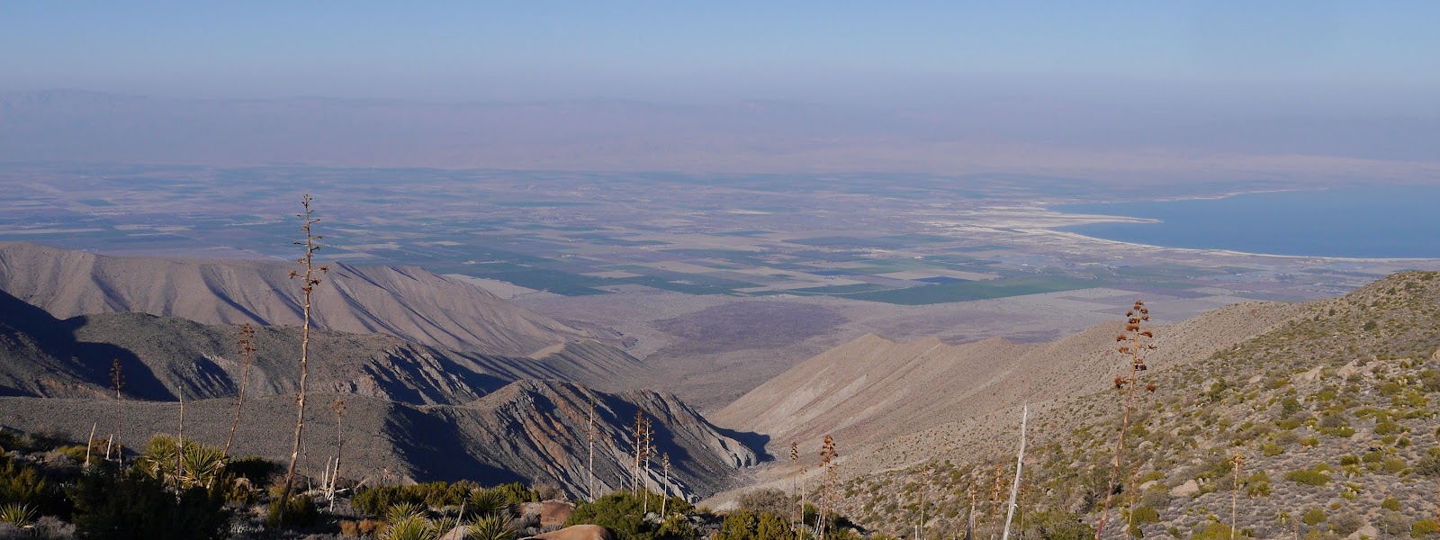
The ridge between Rabbit and Villager consists of a series of ups and downs. The good news is that its very easy to follow. Just keep hiking towards the dominant face of Rabbit. The trail seemed more defined than it was the last time I was there. It ran almost the entire length between the two peaks. There were amazingly panoramic views of the Salton Sea the whole way.


Villager and Mile High behind us

more views


Soon we were standing at the base of Rabbit Peak, 890 ft below the summit. The trail had disappeared, and by this point, judging by the clumped nature of the soil, it looked like most hikers had picked a random line of ascent to the summit. As we topped out on the summit plateau, I kept a lookout for the 15 ft summit block that seems to have been randomly dropped there on the flat expanse. After a few moments of searching and some light bushwhacking, Craig found it. The group followed without difficulty. Everyone convened below the rock and had lunch there. We spent about 45 minutes on the summit before heading down.
Note: Because the true summit of Rabbit is a plateau, the views are sort of anticlimactic. The only things to see from there are pinyon pines scattered across the flat land. One can gain nice views by hiking to the edges of the plateau. The northeast side contains some especially good views.
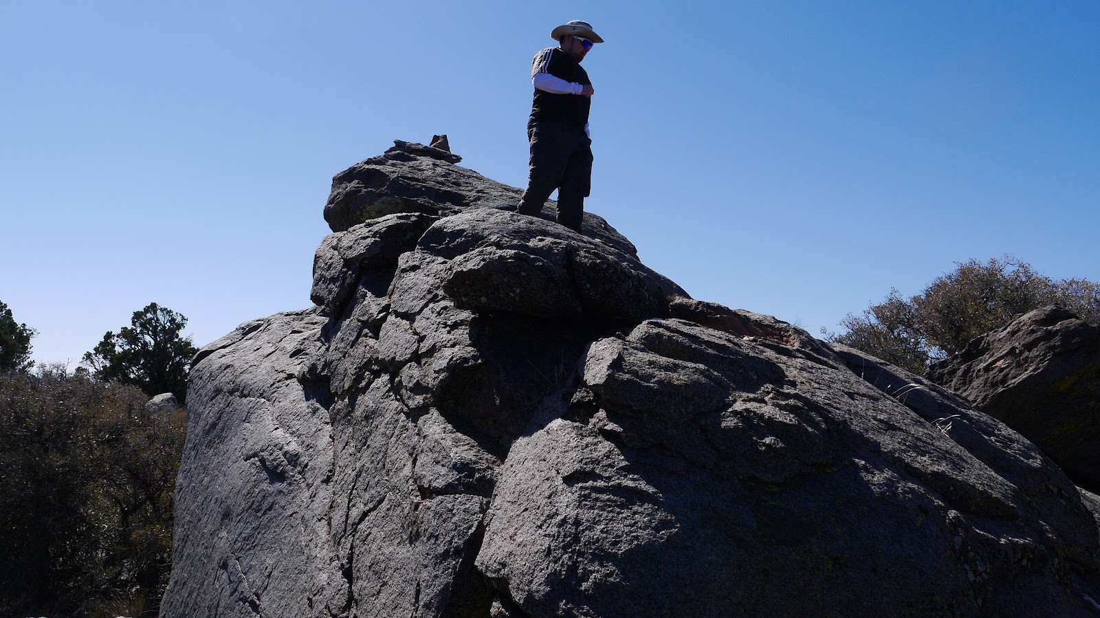
Mihai on the summit block
looking down towards Villager (right) and Mile High (left)

views while heading back along the ridge to Villager


Villager


Craig decided that he was interested in hiking to Zosel BM, so I joined him, hoping to also tag Crab BM. The benchmarks lay on a separate ridge that juts off to the northeast of the main ridge. The trick is locating the correct exit point from the main ridge. Out first exit choice was to descend off a bump that looked like it would slope down to meet the ridge. When we reached the north side of the bump, a big gully separated us from the ridge. We doubled back and tried the next bump, which worked. The correct bump was the first bump north of Villager.
correct bump seen from the north

We climbed halfway up the bump, contoured around, and met the top of the ridge. From there, we descended a few hundred feet and located Zosel BM. It was sitting on the side of a hill about 200 ft above a saddle (the only saddle between our exit point and Crab BM), NOT on a highpoint. There were several Zosel benchmarks. The main one contained a register.
view while descending the bump

Zosel BM

view down the ridge from Zosel

After signing the register I took off down the ridge towards Crab BM. Craig said that he was content with Zosel and would hang around the area and then slowly start making his way back.
The ridge turned out to be really nice and gentle. Vegetation was scattered and not persistent, allowing me to jog down the ridge.
Rabbit

Mile High

looking north
ridge terrain

I got to a point which I thought was Crab BM, so I started wandering back and forth on the mountainside looking around. After 20 minutes, nothing. I decided that I had probably overshot it, and started jogging back. It was getting late in the day. The sunlight was already vanishing from the canyons between Mile High and the ridge I was on. I decided to tag every bump on the way back just in case it was Crab.
darkening canyons with Mile High Mtn in the distance

I made it back to Zosel just as the sun dipped behind the main Santa Rosa Ridge, then hurried up to the ridge and then up to Villager. I reached Villager about 15 minutes before sunset.
Villager from the north

views while heading up Villager


summit of Villager 15 minutes before sunset


At Villager, I snapped a few pictures, collected my cache, and started jogging down, hoping to run back into Craig as soon as possible. It was all easy trail from here.
Mile High Mtn alpenglow

I ran back into Craig at a plateau at 4,300 ft. He had been chatting with a few campers for the last 30 minutes or so and periodically scanning the upper portions of the ridge to see if I was descending. We started down the ridge at a moderate jog. Flashlights were not needed as the moon brightly lit up every rock on the trail, seemingly making it glisten and shine. We reached the desert floor at about 8:15 pm. Craig called the rest of the group, which reported that they had just arrived at Carlee's in Borrego Springs. They had beaten us by about 30 minutes. The last mile across the desert floor back to the cars was nice, especially the soft sand near the end.
Later that night, I looked up the precise location of Crab BM. It turned out that I had overshot it by a half mile, climbing it along the way without knowing it.

Final Stats
27.1 miles
11,150 ft gain/loss

Weather Forecasts
Trailhead
Villager Peak (Villager Peak has an elevation of 5,755 ft. Keep in mind that this forecast is for 5,212 ft)
Rabbit Peak (Rabbit Peak has an elevation of 6,666 ft. Keep in mind that this forecast is for 5,602 ft)
Crab BM (Crab BM has an elevation of 4,485 ft. Keep in mind that this forecast is for 3,054 ft)
Peakbagger Pages
Mile High Mountain
Villager Peak
Rabbit Peak
Zosel Benchmark
Crab Benchmark
Summitpost Pages
Mile High Mountain
Villager Peak
Rabbit Peak
No comments:
Post a Comment