
Glen Alpine Traverse
April 16, 2016
As soon as dawn broke over the waters of Lake Tahoe, we were awake and packing. By 6am, we headed over to and behind Fallen Leaf Chapel where supposedly began the trail up to Angora Ridge. Due to snow coverage, we didn't expect to find it, and headed south straight up the snowy slope. For the next 10 minutes or so, we would locate bits of the trail which would disappear under snowdrifts shortly after. 15 minutes into our journey, we strapped on crampons and continued south as the slope steepened to 30 degrees.


Sunrise came as we slowly made our way up towards Angora Peak, with crampons steadily crunching against the frozen snow. It had been almost a year since I had experienced these snow conditions, and I had almost forgotten how much I enjoyed them.


Shortly before Angora Peak, the terrain grew bouldery, which prompted Mason to remove his crampons. Since I could see the snow starting again a few hundred feet away, I left mine on. We reached Angora Peak at 7:40am, finding ourselves in perfect weather: nice sunny skies, little wind, and temperatures pleasantly in the low 30s. The weekend had been forecasted with record breaking heat, and I did not expect the perfect snow conditions to last much longer before everything turned to mushy slush.
looking southwest from Angora Peak

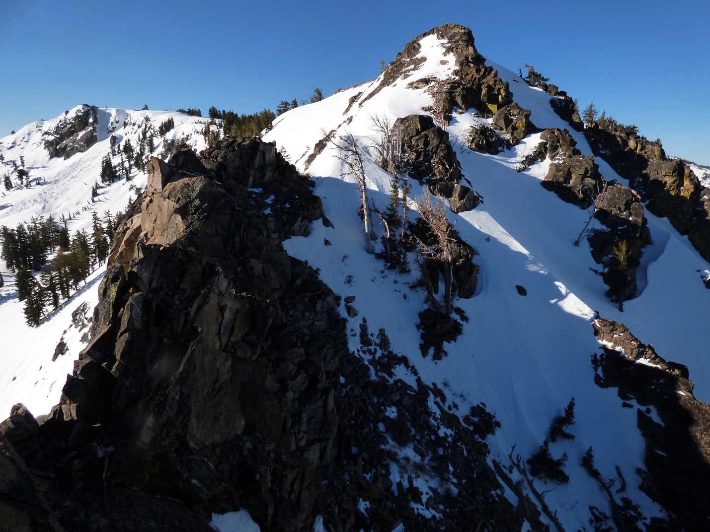
Only a few hundred feet southwest of Angora Peak was Indian Rock, a nondescript feature on the ridge between Angora and Echo peaks. I guessed that it was named due to some side of it looking impressive from below, but from here it just looked like a small bump on the ridge.
Shortly after leaving Angora Peak, Mason noted that he had lost one of his crampon straps but didn't think he lost it too long ago. Since the icy slopes ahead were steeper than 35 degrees, working crampons were a must. Mason immediately dropped his pack and went back to look for the strap while I continued towards Indian Rock and Echo Peak, planning to wait up for him on the large flat summit of Echo.
looking south from Indian Rock

northeast

A few hundred feet after passing over the summit of Indian Rock was the crux of the entire traverse- a very short stretch where the ridge suddenly thinned out and was broken roughly 10 ft across. I cautiously descended easy class 3 rock into the break, descended another 7 or so feet down a thin icy gully on the east side of the break, and proceeded to climb a class 4 mixed snow and rock crack, getting myself onto the south side of the break. Mason would later report class 3 by remaining directly on the ridge, bypassing the thin ice gully and class 4 crack.
the break

After another 100 ft of steep snow, the land suddenly eased up and I found myself standing on the giant plateau of Echo Peak. Another 10 minutes of walking brought me to Echo's summit, which I remained on for less than a minute before sheltering behind some rocks due to a somewhat chilly 25mph breeze.


summit views from Angora


Mason about to cross the break (my route in orange)

An hour later, Mason slogged up to the summit of Echo, looking dejected. He was not able to locate the crampon strap, and had to resort to a crampon on one foot and a snowshoe on the other. This imbalance resulted in two times where he completely lost traction with the ground, subsequently performing two self arrests. With most of the traverse ahead of us on much steeper terrain, Mason decided that it was not wise for him to continue.
We parted ways from Echo Peak, with me continuing the traverse solo and Mason deciding to do some lower peaks below the snowline before heading down into Reno for the rest of the day to hang out with a friend. We planned to meet back at the trailhead the next day around noon.
To the west, I could easily make out the plateau shape of Keiths Dome, which hardly looked like a dome from this angle. The easy walk over to it was fairly pleasant as I descended into the trees, and popped out above treeline once again not far below the summit.
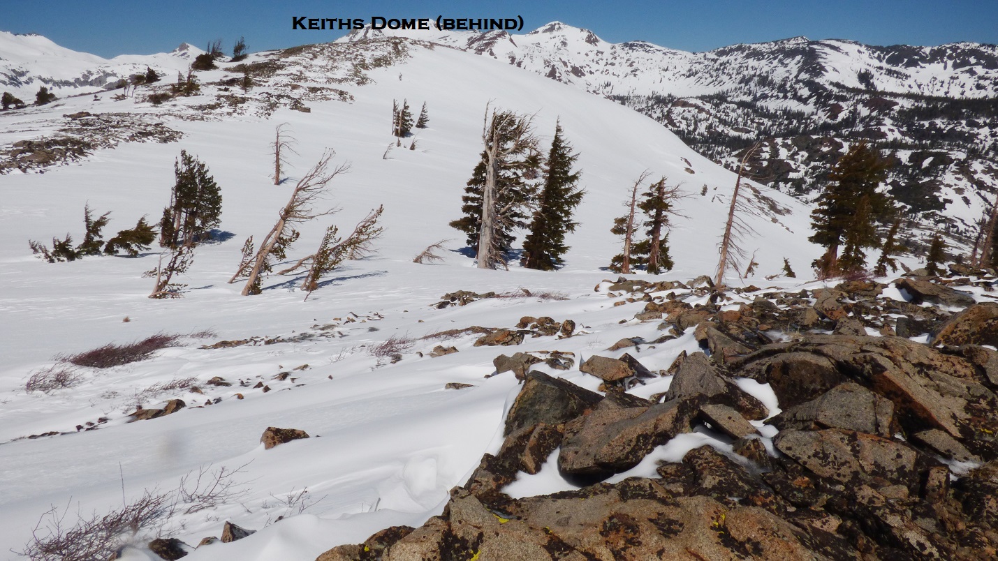
looking northwest from Keiths Dome

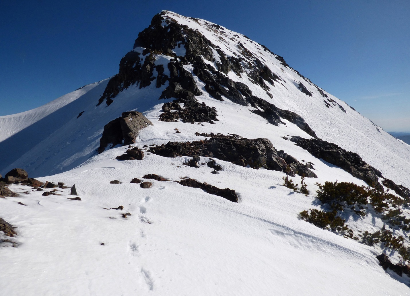
The walk between Keiths Dome and Cracked Crag was also pretty straightforward, making a beeline towards the large buttress-shaped crag. A Summitpost article had described it's southeast ridge to be class 3, but I found it to be well within the bounds of steep class 2, even with snow. Reaching the summit (which contained a giant cairn), I sat down for a longer break, enjoying views towards the main Crystal Range Crest which was almost completely blanketed in white.


summit of Cracked Crag

looking northwest

After descending the ledgy north ridge of Cracked Crag, I filled up on water at the outlet of Heather Lake, which was thankfully spewing out some fine spring melt.
descending Cracked Crag


Heather Lake

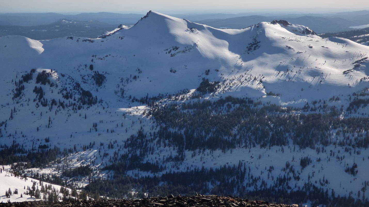
Now came the most grueling part of the traverse, a 2,000 ft slog up the southeast face of Jacks Peak in mid-afternoon snow. I heaved the now water-laden pack onto my back and began inching up the slope little by little. At first, it grew pretty hot, and I had stripped down to just a T-shirt, but as I ascended above 9,000 ft, a chilly west wind had picked up which had me digging back into the pack for the down jacket. A constant wind of 40mph was whipping along the summit ridge.
ascending Jacks


summit views from Jacks


Roughly 0.8 miles to the north was Dicks Peak, my goal for today. I began descending Jack's north ridge, finding it rather icy, and proceeding down cautiously. Near the base of the ridge, I encountered a short 30 ft section of class 3 downclimbing, which resulted in all sorts of horrible screeching sounds as crampons came into contact with rock.


Dick's south ridge was a pretty straightforward class 1-2 affair. The snow had mostly melted from the ridge itself, so most of it was a talus walk. I enjoyed looking back and watching Jacks Peak constantly change shape as I ascended higher.


summit of Dicks Peak


Although the summit of Dicks Peak would've been excellent camping, the winds were howling in excess of 60mph, which would not make for a comfortable night. I descended a few hundred feet down the north ridge, finding no flat spot but several snowdrifts that were partially out of the wind. I got to work flattening out a section of one of these snowdrifts for a tent platform, a process which took an entire two hours to complete. The end result was what looked like a giant bathtub in the snow, and I quickly got to pitching the tent inside of it before the sun went down. Quite cozy. Little did I know that later on in the night, the wind would change direction and hit this area with constant 45mph gusts, but for now, there were only small 10-20mph puffs, and I enjoyed the evening as the sun set behind the taller peaks of the Crystal Range.


go to Day 2
No comments:
Post a Comment