
Note: In 2013, a large wildfire devastated much of the Desert Divide between Palm View Peak and areas north of Red Tahquitz. Many trails in the burn zone are reportedly faint or nonexistent. The burned portion of the Desert Divide currently remains closed until further notice. View a map of the burn zone here.
August 26-28, 2011
The Desert Divide is a long ridge which forms the southern backbone of the San Jacinto Mountains. This ridge contains many interesting peaks with awesome scenery throughout its course. To the east lies the large deserty expanse of the Coachella Valley, which during the summer months constantly boils under temperatures exceeding 115°F while the Desert Divide usually remains in the mid 80s. To the west lies Garner Valley, which is full of chaparral, large groves of conifers, and occasional lakes. The contrast is stunning. The Pacific Crest Trail (PCT) runs along the entire crest of the Desert Divide, providing easy access to some of the best hiking in Southern California.
| Peak | Elevation | Topographic Prominence | Summit Coordinates (lat/lon) |
|---|---|---|---|
| Spitler Peak | 7,440 ft | 480 ft | 33.702264, -116.622447 |
| Apache Peak | 7,567 ft | 667 ft | 33.718836, -116.626709 |
| Antsell Rock | 7,679 ft | 499 ft | 33.730088, -116.641422 |
| South Peak | 7,840 ft | 280 ft | 33.743656, -116.648693 |
| Red Tahquitz | 8,720 ft | 160 ft | 33.758502, -116.652221 |
| Tahquitz Peak | 8,846 ft | 725 ft | 33.755402, -116.67709 |
Kat had gathered up five people to do a backpacking trip along the Desert Divide from Fobes Trailhead (5,230 ft) to Humber Park (6,500 ft), bagging 6 peaks along the way. On Friday, we would set up the car shuttle between the trailheads and begin making our way up the Fobes Trail towards Fobes Saddle, where we would intersect the PCT. Once on the PCT, we would follow it north, bagging peaks along the way, eventually leaving it at Saddle Junction north of Tahquitz Peak and taking the Devils Slide Trail to Humber Park. There was no schedule or set places to camp. We would simply keep moving at a pace we felt comfortable with and see where it would take us.
Getting to Fobes Trailhead (33.679416, -116.614257)
Getting to Humber Park Trailhead (33.764730, -116.685961)
Most of us in the group were fairly new to backpacking at this time. I was almost a complete novice. I dont think all of us even knew what a topo map was. Most of us had no idea where we were headed or where the peaks were, and didn't even know any of the peak's names until they were pointed out. Before the trip, I had spent hours looking up what to pack on a backpacking trip, and all the novice mistakes ensued. As I heaved the pack onto my back, I groaned under the weight, and thought that no one had ever told me that it was actually going to be heavy. I had packed a whole lot of gear that was never used, such as a full 4-day change of clothes (never mind that the trip was only 2.5 days long, but what if I fell into a river and had to change?). Other items included a camera battery charger, silverware, and a ginormous can of propane that would've been sufficient for an entire month-long expedition to the Himalayas. My tent was a cheap $30 thing that had never even come out of its box. "Ill just figure out how to set it up on the trip," I thought, and threw it into a pile with the other items.
We began hiking up the Fobes Trail on Friday right around sunset, groaning under heavy packs which included 2 days of water. We did not expect to reach running water until around Red Tahquitz. There would be plenty of water sources along the desert divide, but they would involve hiking a few extra miles off either side of the divide and back up again. We figured it was easier to just carry all our water.
It was only 1.5 miles to Fobes Saddle (6,000 ft) from the trailhead (5,230 ft), but it felt much longer because of the packs (mine was ~55 lbs). It was almost dark by the time we reached Fobes Saddle and decided to camp there. The area was large and sandy and even contained a few wooden chairs donated by PCT "trail angels." To the east and several thousand feet below us were the sparking lights from cities in Coachella Valley.

Now came the fun part. I got out my tent and began puzzling over the instructions. I manged to set up the poles properly before getting stuck on the guy lines. What the heck were guy lines? I dug around and found four yellow nylon lines which I apparently had to attach to the tent and stretch out and stake to the ground. Over the next 20 minutes, I fiddled around with them, trying to get them to work. I would set up one line and the next one would pull the first one right out. The dirt was too soft for them to hold. I could barely see. Dangit! I never thought I would be doing this in the dark. I shifted the tent around and found some harder ground, finally managing to stake in some of the lines. The end result was an odd-looking tent bent all out of shape with one side looking all sad and droopy while the other side was stretched out as far as it could go. Whatever. I quickly threw everything inside the tent and joined the rest of the group for dinner.
An hour later, everyone crawled into their tents for the night. Throughout the night, the part of my tent which was sad and droopy kept drooping even more, eventually right onto my face. I tossed and turned all night long as the condensation increased. At this time, the concept of moving outside and sleeping under the stars (it was actually quite warm out) had not yet occurred to me, and it would've been much better. By the time the eastern sky began to light up, I couldn't stand it anymore, and crawled out of the tent to see high clouds in the sky, indicating that a good sunrise was to come. It was roughly 20 minutes before sunrise. I quickly grabbed the camera, tiptoed through camp, and sprinted up the PCT to get to a spot where I could see the eastern horizon.


By the time I got back to camp, two others were up eating breakfast. 30 minutes later, we were all packed up and hitting the trail, taking the PCT northward.
chair at Fobes Saddle

on the PCT


Our first peak on the trip was Spitler Peak which was located just north of Fobes Saddle. Roughly 1.5 miles after leaving Fobes Saddle and on the northeast side of Spitler Peak, a well defined use-trail branched off to the left. A few minutes later, we found ourselves at the summit of Spitler.
heading up the use-trail

Kat and Trace near the summit

view southwest towards Lake Hemet from the summit

heading back down

Back on the PCT, we continued north towards Apache Peak. Its summit area was defined by two large soft humps. The highpoint was the left (western) hump.
a nice east-facing overlook on the PCT

Spitler Peak behind us

meadow below Apache Peak


Marge Simpson cloud


The standard route for Apache Peak is a use-trail which leaves the PCT on the south side of the peak, first heading up to a saddle between the two summit humps before heading up to the left hump. Since we did not know this, we overshot the turnoff and ended up on the north side of the peak wondering where the use-trail was. Alann, Kat, and I decided to scramble south up to the peak while the others decided to relax under some trees. The climb was short and steep up a slope with small desert shrubs. Since we did not know which hump was higher, we accidentally summited the eastern hump before realizing the western one was the higher. Laughing about our mistake, we sauntered over to the western hump in 5 minutes.
heading up Apache


The summit of Apache contained expansive views towards Garner Valley and the amazing thunderheads which were building above.


As we hit the PCT once again, low rumbles of thunder could be heard to the north. Clouds obscured the sun, bringing some much wanted shade.


Antsell Rock up ahead


Antsell Rock was my favorite peak on the trip because of its fun scramble. The PCT contoured along the northeastern face of Antsell. We left the trail (6,860 ft) at a large gully marked with cairns, roughly a tenth of a mile before the trail started switchbacking up to the saddle between Antsell Rock and South Peak. The gully was a very fun class 2 scramble with boulders and light bushwhacking at times.


Once we got to the notch, it started pouring on us and we went to the rocks for cover. After the rain stopped, I could see Jason and Kat making their ways up the mountain, and headed up after them. From the notch, we headed southwest (left) to bypass an outcropping before heading southeast (left again) to a fun jumble of rocks which led up to the summit.


The summit of Antsell Rock felt like a nicely remote and secluded place. There was a small humming sound in the air. To the south, we could see another storm headed our way. A few bolts of lightning leapt out of it. I put the camera on multiburst and managed to snap a photo of a bolt while the remainder of the group made their ways to the summit.
heavy rain falling to the south


After everyone had arrived at the summit, we were about to take a summit photo when there was suddenly a kzzzzzzzzzzzzzzzzzzz sound of static and Kat's ponytail suddenly stood up on end. All of us could suddenly feel the hairs on our arms standing up. Suddenly, Jason took off as fast as he can, and we all followed, scurrying down the rock as fast as we could and not stopping until we had reached the notch. 20 minutes after leaving the summit, a very loud and close boom sounded in the direction of the summit.
As we were descending the gully, some impressive thunderheads were bubbling up over Joshua Tree NP to the northeast


back on the PCT

Our fourth peak: South Peak (aka. Southwell Peak), appeared as a lump of brush to the north. We got to a point where we saw a gully marked by cairns, dropped our packs, and climbed up 100 ft just to meet back up with the trail. The cairns kept going. We bushwhacked up to another switchback. It turned out that the PCT contoured less than 100 ft below the summit of South Peak on its southern and eastern sides. We made it to the summit feeling a bit silly.
Alann and Kat on South Peak

Diamond Valley Lake

As we got back onto the trail, the sun came out to create some great lighting.


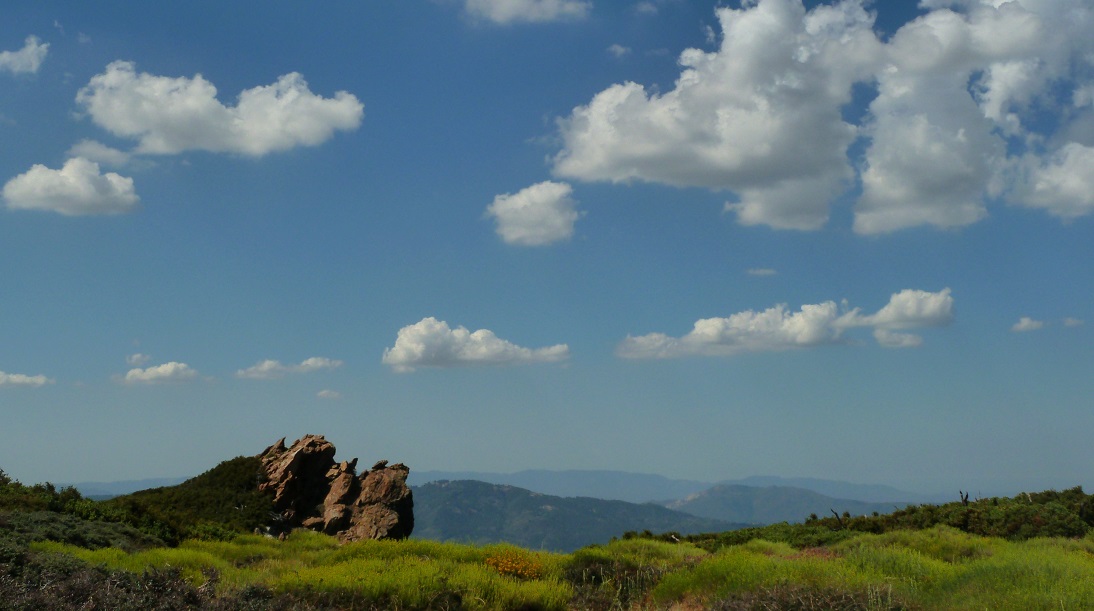
Antsell Rock

Coachella Valley


entering Mt. San Jacinto's lower plateau


We decided to stop and camp at one of several flat and sandy spots north of Red Tahquitz. A short distance to the west at Little Tahquitz Valley was a nicely flowing brook which served as our water source.
our campsite

Now came the business of once again setting up that awful tent. In 20 minutes, I had managed to tangle myself in a mess of guy lines. The end result was a very sad and very saggy mess of chords, crumpled fabric, and bent stakes which was apparently known as a tent. The diagram on "step 1" of the instruction sheet even looked much better than my setup. Oh well.
We all sat over by a large rock and had a nice and relaxing dinner, excitedly talking about the day's events. To the west was a large orange glow which we later learned was a small fire started by lightning earlier that day. After watching the starry sky for a few hours, we crawled into our tents and drifted off.
I woke up to see sunlight, and crawled out of my almost completely collapsed tent to see that it was a nice clear day.

After breaking camp, we headed towards our first peak of the day: Red Tahquitz. From a rise in the trail north of Red Tahquitz, a pretty decent use-trail branched off up to the south. We took this trail and arrived at the summit about 20 minutes later. The views from this peak were excellent.
summit of Red Tahquitz


We spent a while relaxing at the summit, then headed back down to the PCT and took it 1.2 miles west to a signed junction (8,570 ft) where the trail to Tahquitz Peak branched off to the left (south). From the junction, Tahquitz Peak was a quick 0.5 miles away. The summit contained a fancy fire lookout tower.
heading to Tahquitz Peak


Tahquitz fire lookout tower

looking towards South Peak

Overhead, the afternoon thunderclouds were already bubbling up nicely, dropping the temperature into the pleasant 70s. We headed back to the PCT, took it north for 1.2 miles to Saddle Junction, then took the Devils Slide Trail 2.5 miles to Humber Park.

Saddle Junction

mammatus clouds over Tahquitz Rock (aka. Lily Rock)

Final Stats
19.1 miles
8,220 ft/6,950 ft gain/loss

Weather Forecasts
Fobes Trailhead
Spitler Peak to Red Tahquitz
Tahquitz Peak
Humber Park
Peakbagger Pages
Spitler Peak
Apache Peak
Antsell Rock
South Peak
Red Tahquitz
Tahquitz Peak
Summitpost Pages
Spitler Peak
Apache Peak
South Peak
Red Tahquitz
Tahquitz Peak
Other
Mt. San Jacinto message board
Pacific Crest Trail Association
No comments:
Post a Comment