December 21, 2013
The Old Woman Mountains are a desert range 30 miles east of Amboy, CA. The name "Old Woman" is derived from a rock formation situated near the center of the range which resembles an old lady wearing a cloak. The area is more widely known for its rich mineral deposits. Several old mines can be found scattered throughout the range. In 1994, the Old Woman Mountains Wilderness was created, preserving the range from further development. Old Woman Mountain, the highpoint of the Old Woman Mountains and the most sought out peakbagging objective in the area, is located on the northwestern side of the range.
| Peak | Elevation | Topographic Prominence | Summit Coordinates (lat/lon) |
|---|---|---|---|
| Old Woman Mountain | 5,325 ft | 2,742 ft | 34.573365, -115.235561 |
| Willow Spring Peak | 3,585 ft | 452 ft | 34.608345, -115.215554 |
| Amboy Crater | 944 ft | 234 ft | 34.543851, -115.790726 |
Getting the the trailhead (Old Woman Mountain, Willow Spring Peak): For the 2WD trailhead (which we used), go towards the waypoint OWWBND and park before a gate marking the wilderness boundary. The last tenth of a mile before the gate may be a little rough on 2WD vehicles.
Getting to the trailhead (Amboy Crater)
Craig and I started hiking from the gate at around 9am, walking along the road for over a mile, then branching off to the south (right) into a prominent canyon containing Florence Mine (see map). For the remaining distance from Florence Mine to the summit, we would find a plethora of Cholla cactus and Cat's Claw.
Florence Mine canyon seen from the trailhead
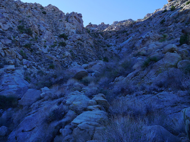
From Florence Mine, we aimed for a prominent gully to the south, which I will refer to as "Gully 1." Gully 1 ended at a saddle at 4,100 ft.
looking up Gully 1
About a fourth of the way up the gully, we encountered a short and fun class 3 dry waterfall.
nearing Saddle 4,100 ft
views from Saddle 4,100 ft
From Saddle 4,100 ft, we headed south, dropping into another gully, which I will refer to as "Gully 2." We followed Gully 2 until it ended at a saddle at 4,720 ft.
dropping into Gully 2 on loose class 2 terrain
The initial few hundred feet of Gully 2 contained some bushwhacking through desert shrubs and a few yuccas. Thankfully there were few Cholla and Cat's Claws in the gully.
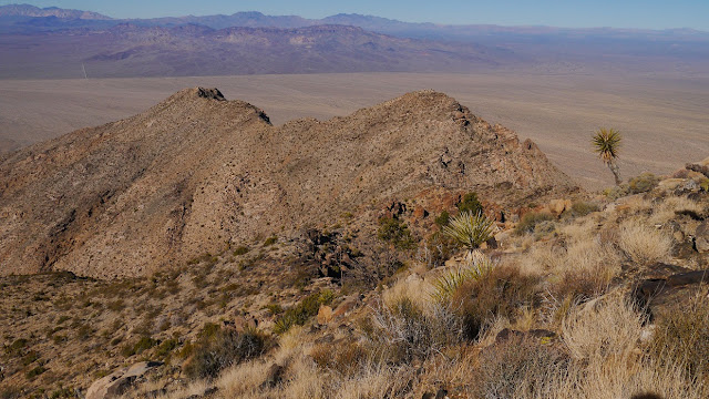
looking southwest from Saddle 4,720 ft
From Saddle 4,720 ft, we turned left and followed the ridge up to the summit of Old Woman Mountain.
summit
A decrepit old shack sat a few feet below the summit. Inside were several batteries and maybe a generator or two. We located two benchmarks slightly below the actual highpoint.
Because of the copious amount of valuable equipment inside, the shack was equipped with some top notch burglar-proof settings.
...including a door that was locked 24/7.
view southeast
south
southwest
northwest
one of several trains
oldest register entries
From Old Woman Mountain, we could see a pointy peak to the northeast which we first thought was Mercury Mountain. After consulting the map, we realized that Mercury was the darker one behind it. Since there was still some time left before dark, we decided to climb it, later dubbing it "Willow Spring Peak."
looking northeast from Old Woman Mountain
From Old Woman Mountain, we descended back to Saddle 4,720 ft, then continued down Gully 2. When Gully 2 ended, we continued northeast, aiming directly for Willow Spring Peak's Southwest Face.
views from descent
There were many possible routes on Willow Spring Peak's Southwest Face, most of them class 2.
views from summit
We ended up placing a register on the summit just for kicks.
From Willow Spring peak, we headed about 2 miles west to the trailhead.
some fun looking buttes west of Willow Spring Peak
Clipper Mountains (front) and Providence Mountains (back)
We got back to the trailhead at 3:20 pm, then began driving over to Amboy Crater. Amboy Crater is a small pile of volcanic rock formed by a series of eruptions, the most recent one about 10,000 years ago.
Old Woman Mountains seen from Route 66
Amboy Crater entrance sign
trailhead sign
We arrived at the trailhead at 4:15 pm with a few minutes of sunlight to spare, and began jogging on the trail heading towards the crater. The trail was definitely built for tourists. There were several trail markers along the way. The one thing that stood out was the copious amount of ashtrays placed throughout the trail- about one ashtray every tenth of a mile. Was Amboy Crater flammable?
Bristol Mountains
Amboy Crater
sunset on the Bristol and Marble mountains
As the sun set, we became a little impatient with the windy trail, and climbed directly up the crater's slopes. The highpoint of the crater was located on its southern side.
Once at the summit, we searched around for 10 minutes and located a battered benchmark a few feet north below the crater rim.
views from summit
Without any more peakbagging objectives for the day, we walked back to the trailhead via the trail, arriving back at around 5:30 pm.
Stats for Old Woman Mountain and Willow Spring Peak
9.8 miles
3,750 ft gain/loss
Stats for Amboy Crater
3 miles
400 ft gain/loss
Weather Forecasts
Old Woman trailhead
Old Woman Mountain
Willow Spring Peak
Amboy Crater
Peakbagger Pages
Old Woman Mountain
Willow Spring Peak
Amboy Crater
Other
Old Woman Mountains Wilderness (Recreation.gov)
Old Woman Mountains Wilderness (Wilderness.net)
Amboy Crater (Bureau of Land Management)


Excellent write up, Eric.
ReplyDelete